Geospatial & Mapping
Satellite imagery, aerial mapping, land use analysis & geospatial AI
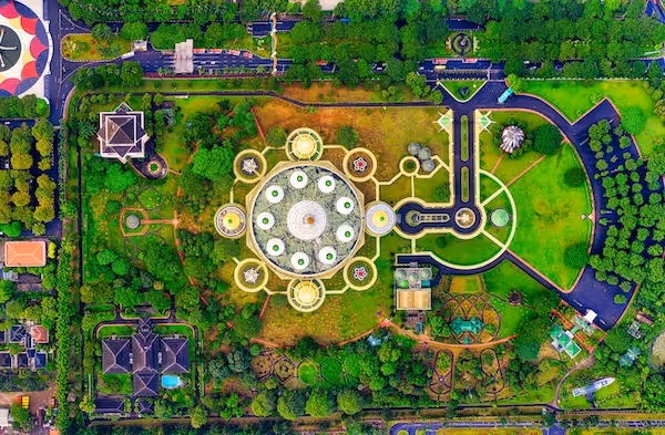
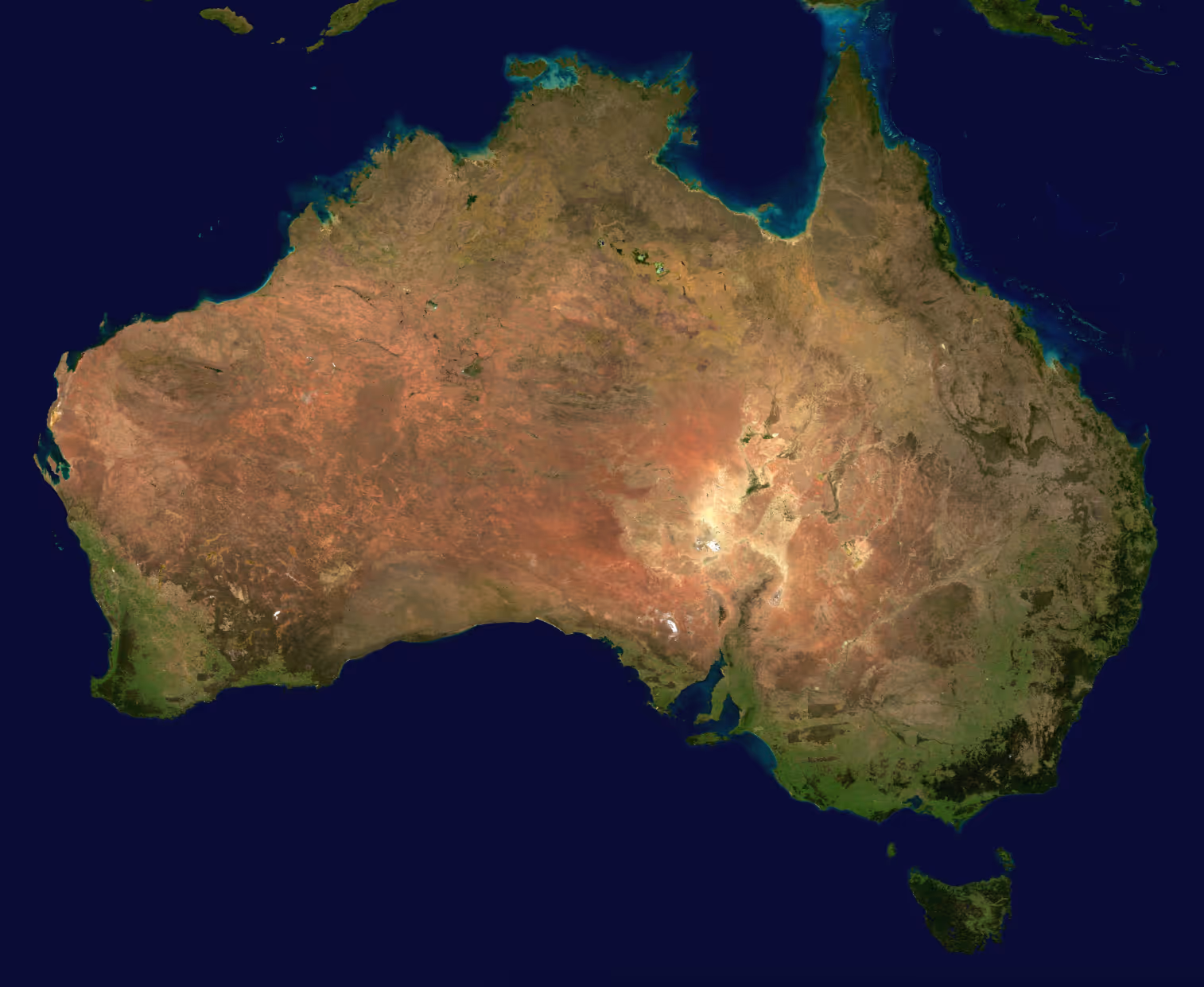
AI and Computer Vision for Geospatial Intelligence and Mapping
Geospatial AI is transforming the way organizations map terrain, monitor land use, analyze environmental changes, and create large scale datasets from satellite and aerial imagery. These applications require detailed and consistent annotations that capture terrain features, infrastructure, agricultural patterns, and environmental conditions across diverse geographies.
DataVLab provides high quality labeling for geospatial and mapping projects, including segmentation of land cover types, object detection in satellite images, road and boundary extraction, building footprint annotation, and environmental event analysis. Our workflows support optical, multispectral, and drone imagery and are designed to maintain precision across large volumes of data.
Whether you are building large geospatial datasets, training models for agricultural monitoring, or developing urban planning tools, our team ensures accuracy, scalability, and consistent class definitions that align with geographic information standards.
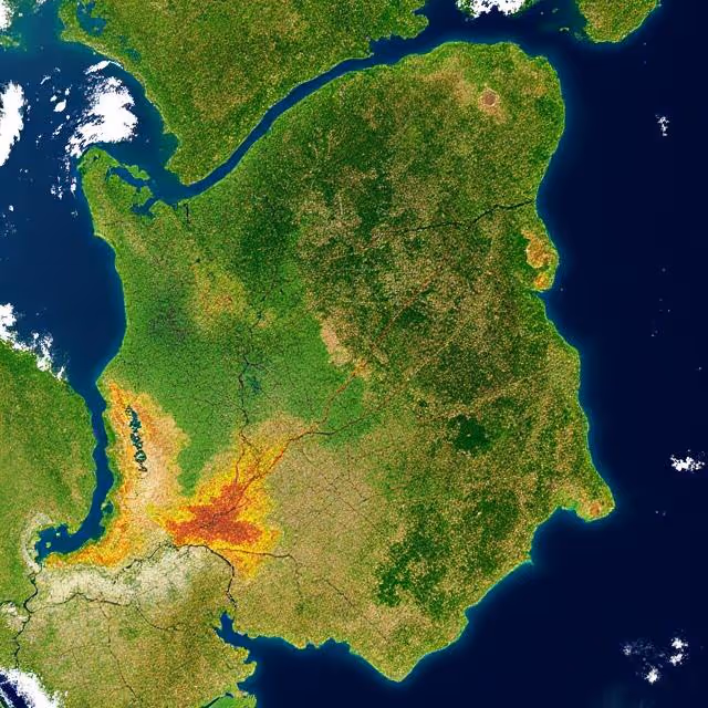
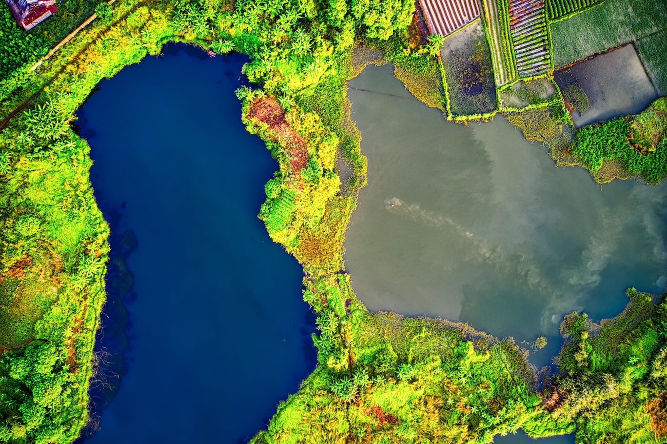
Land Cover and Land Use Segmentation
Pixel level segmentation of vegetation, water, soil, urban zones, and agricultural areas for geospatial and environmental modeling
Building Footprint Extraction
Annotation of rooftops, structures, and building outlines to support urban planning, mapping, and change detection
Road and Boundary Mapping
Detection and tracing of roads, paths, parcel boundaries, and transportation networks in satellite or aerial imagery
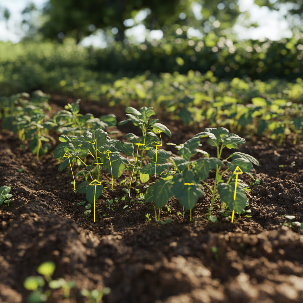
Agricultural Field and Crop Mapping
Annotation of plots, crop boundaries, and seasonal changes to support precision agriculture and yield estimation
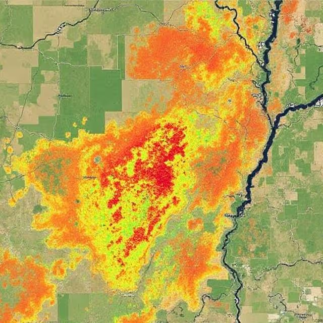
Environmental Event Analysis
Labeling of flood zones, wildfire regions, erosion areas, and other environmental changes for large scale geospatial monitoring
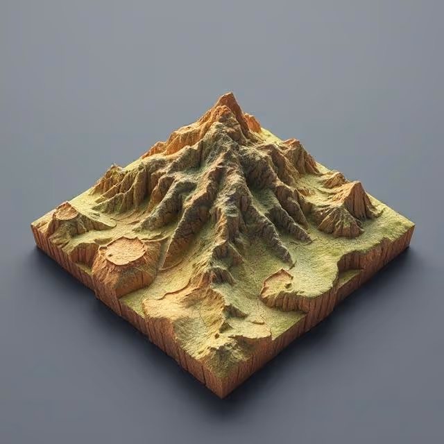
Drone Based Mapping and Terrain Classification
Annotation of drone imagery for terrain segmentation, elevation features, site analysis, and geospatial reconstruction


Annotation & Labeling for AI
Unlock the full potential of your AI application with our expert data labeling tech. We ensure high-quality annotations that accelerate your project timelines.

Enhance Computer Vision
with Accurate Image Labeling
Precise labeling for computer vision models, including bounding boxes, polygons, and segmentation.
Unleashing the Potential
of Dynamic Data
Frame-by-frame tracking and object recognition for dynamic AI applications.

Building the Next
Dimension of AI
Advanced point cloud and LiDAR annotation for autonomous systems and spatial AI.

Tailored Solutions for Unique Challenges
Tailor-made annotation workflows for unique AI challenges across industries.
NLP & Text Annotation
Get your data labeled in record time.
GenAI & LLM Solutions
Our team is here to assist you anytime.
3D Annotation Services
3D annotation services for LiDAR, point clouds, depth maps, and multimodal sensor fusion data. DataVLab delivers 3D cuboids, point cloud segmentation, drivable area labels, and object tracking for robotics, autonomous mobility, geospatial, and industrial AI.
3D Cuboid Annotation Services
High precision 3D cuboid annotation for LiDAR, depth sensors, stereo vision, and multimodal perception systems.
3D Point Cloud Annotation Services
High accuracy point level labeling, segmentation, and object annotation for LiDAR and 3D perception datasets.
Aerial Image Annotation
High quality annotation of aerial photography for mapping, inspection, agriculture, construction, and environmental analysis.
Autonomous Flight Data Annotation Services
High accuracy annotation for autonomous flight systems, including drone navigation, airborne perception, obstacle detection, geospatial mapping, and multi sensor fusion.
Drone Data Labeling
Multi modality drone data labeling for video, telemetry, LiDAR, and sequence based AI models.
Drone Image Annotation
High accuracy annotation of drone captured images for inspection, construction, agriculture, security, and environmental applications.
Geospatial Data Annotation Services
High quality annotation for satellite imagery, aerial imagery, multispectral data, LiDAR surfaces, and GIS datasets used in geospatial and environmental AI.
LiDAR Annotation Services
High accuracy LiDAR annotation for 3D perception, autonomous driving, mapping, and sensor fusion applications.
Satellite Image Annotation Services
High accuracy annotation for satellite imagery across land cover mapping, object detection, agricultural monitoring, and environmental change analysis.
We provide high-quality data annotation services and improve your AI's performances

Custom service offering
Up to 10x Faster
Accelerate your AI training with high-speed annotation workflows that outperform traditional processes.
AI-Assisted
Seamless integration of manual expertise and automated precision for superior annotation quality.
Advanced QA
Tailor-made quality control protocols to ensure error-free annotations on a per-project basis.
Highly-specialized
Work with industry-trained annotators who bring domain-specific knowledge to every dataset.
Ethical Outsourcing
Fair working conditions and transparent processes to ensure responsible and high-quality data labeling.
Proven Expertise
A track record of success across multiple industries, delivering reliable and effective AI training data.
Scalable Solutions
Tailored workflows designed to scale with your project’s needs, from small datasets to enterprise-level AI models.
Global Team
A worldwide network of skilled annotators and AI specialists dedicated to precision and excellence.
Potential Today
FAQs
Here are some common questions we receive from our clients to assist you.

What is geospatial and mapping AI annotation and what does it include?
Geospatial and mapping AI annotation labels satellite imagery, aerial photography, drone imagery, LiDAR point clouds, and other remotely sensed data so that AI models can learn to interpret Earth observation data for mapping, environmental monitoring, urban planning, infrastructure management, and intelligence applications. It includes land cover classification, building footprint extraction, road network mapping, object detection in overhead imagery, change detection between multi-temporal captures, and 3D surface modeling. Geospatial annotation requires understanding of remote sensing data characteristics, geographic coordinate systems, and the specific visual properties of each sensor type.
Why does geospatial annotation require geographic accuracy beyond visual accuracy?
Geospatial annotation must preserve geographic accuracy that standard image annotation ignores. Building footprint polygons must match the actual building boundary at real-world coordinates, not just look visually correct in the image. Road centerline extraction must align with actual road geometry to support navigation applications. Land cover boundaries must be spatially precise enough to support area calculations and environmental reporting. This requires annotation tools that maintain geographic coordinate reference systems throughout the annotation process, and annotators who understand that spatial accuracy in real-world coordinates is as important as visual accuracy in the image frame.
What formats do you use for geospatial annotation datasets?
GeoJSON is the standard format for vector annotation of geographic features with coordinate reference systems, covering points, lines, and polygons. GeoTIFF with associated label rasters is standard for semantic segmentation of aerial and satellite scenes. COCO JSON adapted for satellite imagery is used for object detection benchmarks. Shapefile (SHP) is common in GIS workflows. For change detection, temporally paired GeoTIFF images with change masks are standard. For 3D geospatial data, GeoLAS and LAS/LAZ formats are used for LiDAR point clouds. DataVLab delivers in any of these formats with validated coordinate reference systems and projection information.
What is defense and intelligence geospatial annotation?
Defense and intelligence geospatial annotation classifies military and dual-use objects in satellite and aerial imagery: military vehicles, naval vessels, facilities (production, storage, launch infrastructure), and activity patterns. This requires annotators with intelligence analysis training and, for classified programs, appropriate security clearances and controlled processing environments. European defense intelligence programs increasingly specify EU-sovereign annotation as a requirement, because geospatial intelligence data processed on non-EU infrastructure creates sovereignty and classification risk. DataVLab works with European defense geospatial programs under the appropriate sovereignty and security requirements.
What is change detection annotation and when is it used?
Change detection annotation identifies differences between multi-temporal images of the same area: building construction or demolition, deforestation, flooding, wildfire burn scars, agricultural field changes, and facility modifications. For environmental applications, change detection datasets require annotation of pre-change and post-change imagery with clear labels indicating what changed, where, and when. For intelligence applications, change detection requires identifying facility modifications that may indicate activity changes. The annotation challenge is maintaining consistency between time periods despite differences in imaging conditions, seasonal vegetation changes, and atmospheric effects between captures.
What geospatial annotation services does DataVLab provide for the mapping industry?
DataVLab provides geospatial annotation for satellite imagery, aerial photography, drone imagery, LiDAR, and multispectral sensor data. We serve defense and intelligence programs, environmental agencies, government mapping organizations, commercial satellite operators, urban planning authorities, precision agriculture platforms, and infrastructure management organizations. EU-based annotation teams are available for European programs with sovereignty, GDPR, or defense classification requirements. We support all standard geospatial annotation formats with validated coordinate reference systems.
We provide high-quality data annotation services and improve your AI's performances
Blog & Resources
Explore our latest articles and insights on Data Annotation