
LiDAR Annotation Services for Autonomous Driving, Robotics, and 3D Perception Models
LiDAR Annotation Services
Built for teams shipping autonomous systems AI who need reliable labeled documents. You get segmentation masks, keypoints, and tracking, stable label guidelines, and QA you can audit, without slowing your roadmap. LiDAR Annotation Services is delivered with secure workflows and consistent reporting from pilot to production.
High accuracy 3D annotation using cuboids, segmentation, and geometric labeling.
Support for autonomous driving, mapping, robotics, and multi sensor datasets.
Structured review processes for spatial accuracy and temporal consistency.
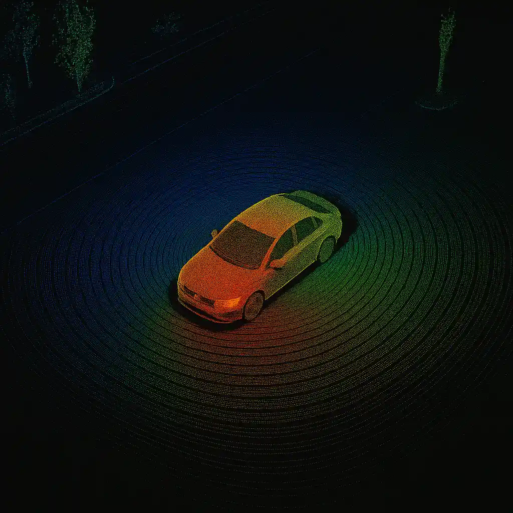
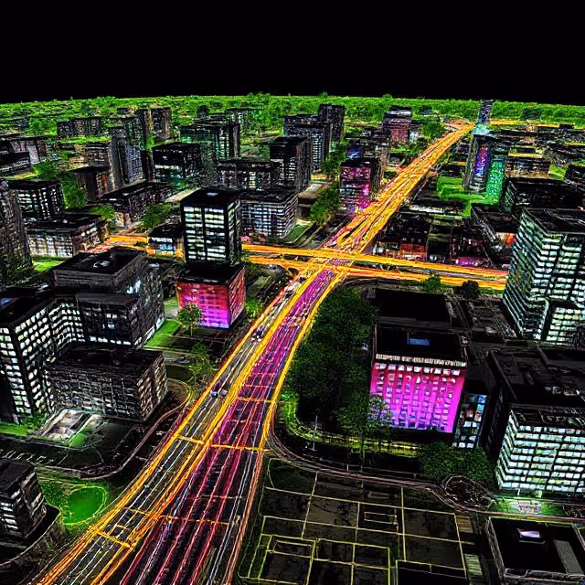
LiDAR is a core sensor in autonomous driving and robotics. It provides high resolution 3D structure, depth information, and environmental geometry that cannot be captured with cameras alone.
Building reliable perception models requires precise annotation of objects, road structures, infrastructure, and dynamic elements across large point cloud datasets. DataVLab provides LiDAR annotation services for leading ADAS and robotics teams.
Our annotators follow detailed guidelines to label objects consistently across frames and sequences using 3D cuboids, segmentation masks, keypoints, and class hierarchies tailored to your dataset.
We also support multi return LiDAR, rotating LiDAR, solid state LiDAR, and fused LiDAR datasets. Our annotation tasks include object detection, instance segmentation, road boundary labeling, traffic element annotation, lane geometry extraction, region classification, and cross sensor alignment. We also support temporal tracking across large sequences, which helps perception models interpret motion and behavior. Quality control includes multi level review, spatial alignment checks, 3D geometry validation, and consistency inspection across long time windows.
For regulated or sensitive projects, we provide GDPR aligned workflows with optional EU only annotation. Our LiDAR annotation workflows help AI teams train robust 3D perception models that understand real world structure and support autonomous navigation.
How DataVLab Supports 3D Perception and LiDAR Based AI
We annotate LiDAR point clouds at scale with workflows tailored to autonomous driving and robotics applications.

3D Cuboid Annotation for Vehicles and Pedestrians
Accurate 3D bounding boxes with class specific rules
We annotate cars, trucks, buses, cyclists, pedestrians, and traffic elements using stable 3D cuboids that follow your geometry conventions and class definitions.
LiDAR Segmentation
Point level labeling for objects and environmental structures
We perform instance and semantic segmentation of point clouds to label roads, sidewalks, buildings, vegetation, poles, vehicles, and other structural elements.
Road and Infrastructure Annotation
Labeling static structures and navigational features
We annotate curbs, barriers, traffic poles, signs, lane dividers, and environment boundaries to support localization and navigation models.
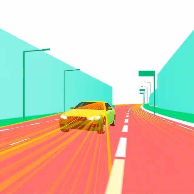
Temporal Tracking Across Point Cloud Sequences
Consistent object identities over time
We track vehicles, pedestrians, and dynamic elements across consecutive LiDAR scans to support motion prediction, trajectory analysis, and behavior modeling.
LiDAR and Camera Sensor Fusion Annotation
Cross modality alignment for multimodal perception
We align 3D LiDAR labels with camera frames, radar outputs, or map data to support fused perception and multi sensor AI pipelines.
LiDAR Dataset Quality Review
Spatial and temporal verification of 3D annotations
Reviewers check cuboid alignment, segmentation precision, class correctness, and continuity across long sequences to maintain high dataset reliability.
Discover How Our Process Works

Defining Project
Sampling & Calibration
Annotation
Review & Assurance
Delivery
Explore Industry Applications


We provide solutions to different industries, ensuring high-quality annotations tailored to your specific needs.
We provide high-quality annotation services to improve your AI's performances

Annotation & Labeling for AI
Unlock the full potential of your AI application with our expert data labeling tech. We ensure high-quality annotations that accelerate your project timelines.
3D Annotation Services
3D annotation services for LiDAR, point clouds, depth maps, and multimodal sensor fusion data. DataVLab delivers 3D cuboids, point cloud segmentation, drivable area labels, and object tracking for robotics, autonomous mobility, geospatial, and industrial AI.
3D Cuboid Annotation Services
High precision 3D cuboid annotation for LiDAR, depth sensors, stereo vision, and multimodal perception systems.
Sensor Fusion Annotation Services
Accurate annotation across LiDAR, camera, radar, and multimodal sensor streams to support fused perception and holistic scene understanding.
Map Annotation Services
Accurate annotation for digital maps, GIS layers, boundaries, POIs, road networks, and 2D cartographic datasets.
FAQs
Here are some common questions we receive from our clients to assist you.
What is LiDAR annotation and why is it needed?
LiDAR annotation labels three-dimensional point clouds generated by laser scanning sensors. A LiDAR sensor emits laser pulses and measures the time for each pulse to return, producing a dense spatial map of the environment as a cloud of points, each with x, y, z coordinates and typically an intensity value. Annotation adds semantic information to this point cloud: 3D bounding cuboids around objects (vehicles, pedestrians, cyclists, road furniture), point-level semantic labels (road surface, building, vegetation, unknown), and track IDs for sequential data. LiDAR annotation is foundational for autonomous driving perception stacks.
What is the difference between LiDAR annotation and camera image annotation?
Camera-only annotation works in 2D image space. LiDAR annotation works in 3D physical space. Camera annotation is faster, cheaper, and captures rich color and texture information but cannot provide precise metric distance measurements or function reliably in low-light conditions. LiDAR annotation is slower, more expensive, and produces sparse representations without color, but provides accurate metric geometry, works in darkness and rain, and gives downstream systems real-world object dimensions and distances. Most production autonomous driving systems use sensor fusion: cameras for visual classification and LiDAR for precise 3D localization, requiring both annotation types in synchronized datasets.
What tools are used for LiDAR annotation?
LiDAR annotation tools significantly affect throughput and quality. Professional annotation platforms provide synchronized bird's-eye, front, and side views with 3D cuboid manipulation, ground plane detection to assist with object height placement, auto-fit algorithms that snap cuboids to the point cluster boundaries, and copy-propagation for tracking across sequential frames. Without these tools, annotating LiDAR data by manually specifying cuboid parameters is extremely slow and error-prone. DataVLab works with industry-standard LiDAR annotation platforms including Scale AI, CVAT, Segments.ai, and client-specified tooling.
What LiDAR annotation formats do you support?
KITTI format stores 3D annotations as text files with object type, truncation and occlusion flags, 2D bounding box, 3D dimensions, and 3D location and rotation angle. It is the standard format for autonomous driving research benchmarks. nuScenes JSON provides a richer schema including sensor calibration, scene metadata, and multi-sensor synchronization for complex multi-camera, multi-LiDAR setups. ROS bag files are common for robotics applications. WAYMO Open Dataset format is used for Google's autonomous driving data. DataVLab delivers LiDAR datasets in KITTI, nuScenes, or custom formats, with validated coordinate systems and calibration files.
What are the main applications of LiDAR annotation?
LiDAR annotation is primarily used in autonomous driving (L2 to L4 vehicle perception), mobile robotics and AGV navigation (warehouse, logistics, last-mile delivery), HD map creation (road geometry, lane markings, traffic signs in 3D), construction and mining site monitoring (equipment tracking, safety zone enforcement), precision agriculture (crop structure analysis, yield estimation), and industrial metrology (dimensional inspection of manufactured parts). Any application requiring metric spatial understanding in outdoor or indoor environments is a candidate for LiDAR annotation.
What are the main challenges in LiDAR annotation campaigns?
LiDAR annotation campaigns face several challenges that require explicit planning. Sparse point clouds at long range make distant objects difficult to annotate precisely, requiring range-dependent annotation standards. Sequential data requires consistent tracking that must survive occlusions, sensor dropouts, and object re-entry into the sensor field of view. Multi-sensor fusion projects require tight temporal synchronization between LiDAR and camera data. Large outdoor scenes with hundreds of objects per frame require efficient batch annotation workflows. DataVLab manages these challenges through experienced LiDAR annotators, specialized quality control for 3D data, and annotation workflow design adapted to each project's sensor configuration.


Custom service offering
Up to 10x Faster
Accelerate your AI training with high-speed annotation workflows that outperform traditional processes.
AI-Assisted
Seamless integration of manual expertise and automated precision for superior annotation quality.
Advanced QA
Tailor-made quality control protocols to ensure error-free annotations on a per-project basis.
Highly-specialized
Work with industry-trained annotators who bring domain-specific knowledge to every dataset.
Ethical Outsourcing
Fair working conditions and transparent processes to ensure responsible and high-quality data labeling.
Proven Expertise
A track record of success across multiple industries, delivering reliable and effective AI training data.
Scalable Solutions
Tailored workflows designed to scale with your project’s needs, from small datasets to enterprise-level AI models.
Global Team
A worldwide network of skilled annotators and AI specialists dedicated to precision and excellence.
Potential Today
Blog & Resources
Explore our latest articles and insights on Data Annotation
We are here to assist in providing high-quality data annotation services and improve your AI's performances