Why This Fusion Matters 🌍
The integration of GIS data with manual annotation isn’t just a process improvement—it’s a foundational evolution in how satellite AI systems are trained and validated. When geospatial intelligence is merged with human-curated insight, the resulting datasets become significantly more powerful, actionable, and generalizable.
The Limitations of Using Either Alone
- GIS data alone can be accurate but outdated or incomplete—especially in fast-changing environments like urban fringes or disaster zones.
- Manual annotation alone is flexible and precise but time-consuming and prone to human error without spatial context.
By uniting the two, annotation pipelines gain the scalability of GIS automation and the contextual richness of human judgment.
Real-World Benefits of the Fusion
🧩 Improved Semantic Consistency
When GIS data is used to guide human annotations, it ensures that objects like road networks, land parcels, and water bodies are labeled consistently across images and time frames. This consistency is crucial for multi-temporal analysis, like tracking urban sprawl or seasonal crop cycles.
📍 Spatially-Aware Decision Making
GIS data helps define relationships between features. For example, a floodplain annotation isn’t just a visual segment—it can be connected to upstream rainfall data, terrain slope, or nearby infrastructure. Human annotators can use these relationships to apply domain logic when assigning labels.
📊 Boosted AI Explainability
AI models trained with geospatially aligned annotations produce outputs that are easier to interpret by analysts. For instance, if an AI flags a region as deforested, having linked GIS boundaries (e.g., protected area zones or logging permits) allows you to understand the regulatory or ecological context behind the prediction.
🌱 Sustainability and Environmental Monitoring
When monitoring environmental change—like desertification or biodiversity loss—GIS provides long-term spatial trends, while manual annotation helps capture recent or small-scale events that satellites alone may not distinguish clearly (e.g., illegal mining activity, invasive species encroachment).
🔄 Iterative Model Improvement
Annotations can improve GIS databases too. Annotators may spot roads, construction, or land use patterns not yet updated in public maps like OpenStreetMap, contributing to a feedback loop where data and AI continuously evolve together.
Cross-Sector Impact
This integration unlocks transformative potential across multiple industries:
- Agriculture: Combining soil maps and satellite imagery with manual crop boundary annotation enables more accurate yield prediction models.
- Disaster Management: Pairing GIS flood zones with real-time Image Annotation improves impact assessment and recovery planning.
- Smart Cities: Annotating urban infrastructure using GIS road networks accelerates AI-based traffic monitoring, zoning enforcement, and public works tracking.
- Climate Science: Integrated datasets enable accurate land cover classification, which feeds into carbon stock estimation models used by environmental agencies and researchers.
The Role of GIS Data in Satellite AI Pipelines
GIS data isn’t just about maps—it’s about structured geospatial intelligence. From road networks and land boundaries to hydrological systems and land cover classification, GIS datasets provide the scaffolding upon which AI can reason spatially.
Key types of GIS data leveraged in satellite AI projects:
- Shapefiles and GeoJSONs: Define precise polygons or boundaries of interest.
- Raster and vector data: Encode land surface information, elevation, or infrastructure.
- OpenStreetMap (OSM): Frequently used as a public, semi-structured source of roads, buildings, and POIs.
- Remote sensing layers: NDVI, elevation, slope, LST (Land Surface Temperature), and more.
By embedding these datasets into training workflows, teams can:
- Pre-filter and align imagery by geolocation.
- Automatically suggest or auto-fill annotation boundaries.
- Enable spatially-aware augmentation techniques.
- Enrich semantic segmentation with topological context.
Platforms like QGIS and ArcGIS allow seamless overlay and manipulation of GIS datasets, supporting annotation processes across diverse AI use cases.
Why Manual Annotation Still Matters ✍️
Even with sophisticated GIS layers, automated labeling still falls short in many real-world contexts. Manual annotation is essential when:
- Satellite data contains visual ambiguities (e.g., cloud cover, low resolution).
- Temporal dynamics (e.g., seasonal crop rotation or disaster impact) create rapidly changing scenes.
- Domain knowledge is required to distinguish functionally different objects with similar appearance (e.g., flooded vs. irrigated fields).
- Pre-trained models have low generalizability across new regions.
Skilled annotators, especially when guided by GIS overlays, bring valuable insight. For example:
- Annotating urban informal settlements often requires identifying patterns not well-defined in GIS databases.
- Environmental changes like deforestation or shoreline retreat need human validation to ensure accuracy.
- In military or conflict zones, geospatial intelligence needs to be corroborated with human judgment.
This synergy between manual precision and geospatial alignment is what elevates annotation quality from functional to exceptional.
Best Practices for Combining GIS and Manual Annotation 🧭
Bridging structured GIS data with human annotation workflows requires thoughtful coordination. Below are proven strategies to integrate both layers effectively:
Use GIS Data as Annotation Guides, Not Replacements
Rather than treating GIS layers as "truth," use them to guide annotators. For instance:
- Overlay shapefiles onto satellite images to provide reference boundaries.
- Use elevation or land cover layers to validate class selection.
- Snap annotations to GIS-derived grids for geometric consistency.
This ensures spatial coherence while preserving human insight.
Integrate GIS Preprocessing in Annotation Pipelines
Before annotating, process GIS data to:
- Filter regions of interest (ROI)—e.g., only annotate images within urban zones.
- Generate class masks—pre-fill annotation canvases with approximate regions from land use data.
- Align imagery spatially—reproject satellite tiles to match GIS layers using the same CRS (Coordinate Reference System).
This preprocessing step saves time and avoids errors.
Create a Feedback Loop Between Annotators and GIS Engineers
Annotation should not be a one-way task. Annotators often identify missing or outdated GIS data during labeling. Establish feedback loops where:
- Annotators can flag GIS mismatches.
- GIS engineers can update datasets based on annotation insights.
- The pipeline evolves iteratively, leading to more robust training data.
This collaboration is especially useful in dynamic environments, such as disaster zones or newly urbanized regions.
Real-World Examples: Where Integration Makes a Difference 🌐
Let’s explore how this integration is transforming various satellite AI projects.
Urban Mapping and Infrastructure Monitoring 🏙️
Projects like Microsoft’s AI for Earth or Google’s Open Buildings Dataset rely on a combination of manual polygon annotations and GIS inputs such as cadastral maps and road networks.
Manual annotations capture fine building details or roof outlines, while GIS data validates alignment with actual urban planning records.
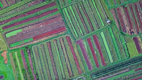
Agricultural Parcel Delineation 🌾
In precision agriculture, integrating GIS data like irrigation networks, soil type layers, and land registry boundaries allows annotators to better identify crop types, boundaries, and field usage.
For instance, platforms like Radiant Earth Foundation leverage such combined data sources for accurate agricultural classification and yield prediction.
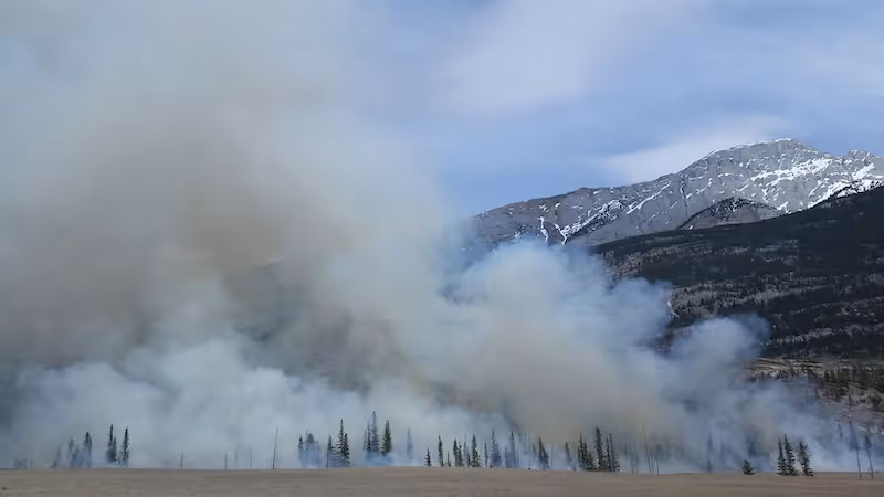
Disaster Response and Climate Monitoring 🌪️
When mapping flood zones, wildfire scars, or hurricane impact areas, GIS data (e.g., FEMA flood zones or fire perimeters) can be used as coarse references. Manual annotation helps refine these datasets, capturing edge cases or correcting outdated polygons.
This integration is crucial in time-sensitive deployments like NASA’s Disasters Program or Copernicus Emergency Management Services.
Challenges You Might Face (And How to Solve Them) ⚠️
While the integration of GIS and manual annotation is powerful, it comes with its own set of challenges.
Data Format and CRS Incompatibilities
- Problem: GIS datasets and satellite tiles often come in different coordinate reference systems.
- Solution: Use tools like GDAL or QGIS to reproject and align data consistently before importing into annotation platforms.
Incomplete or Outdated GIS Layers
- Problem: GIS layers may not reflect current conditions—e.g., newly constructed roads or deforested areas.
- Solution: Combine time-stamped satellite images with real-time feedback from annotators to flag outdated entries.
Cognitive Load on Annotators
- Problem: Overloading annotators with too many GIS overlays can cause confusion or errors.
- Solution: Only display the most relevant GIS layers for each task and allow toggling visibility for better usability.
Maximizing Model Performance with Hybrid Data Strategies 🧠
Training machine learning models on satellite imagery requires more than just pixels and labels. The context in which these images were captured—elevation, climate, urban density, infrastructure proximity—often determines the quality and reliability of the model.
This is where hybrid strategies shine: by embedding both GIS features and manually curated annotations, we enable a multi-dimensional learning environment for AI.
Key Advantages of Hybrid Annotation Workflows
🔍 Precision in Edge Cases
Geospatially informed models excel at spotting edge cases. For example, distinguishing between a flooded field and a lake expansion becomes more reliable when elevation, watershed layers, and annotated boundaries are jointly considered.
🧠 Contextual Feature Enrichment
Traditional computer vision models rely on image textures and shapes. But when models also ingest GIS-derived metadata—such as vegetation index (NDVI), distance to urban centers, or land use classifications—they gain contextual awareness. This enables more accurate predictions in ambiguous or low-resolution images.
⚡ Faster Training and Reduced Data Needs
Enriched labels from GIS-enhanced annotations help models converge more quickly during training. The quality-over-quantity effect allows teams to reduce the volume of annotated samples needed, lowering cost and annotation time while still maintaining high accuracy.
🌍 Regional Generalization
Hybrid-trained models generalize better across different geographies. A model trained on Indian agricultural parcels using GIS-aligned annotations is more likely to adapt well to fields in Africa or Southeast Asia—especially if the GIS features used (like soil layers, rainfall zones) are region-agnostic.
Unlocking Multimodal Learning
When manual annotations are enriched with GIS layers, you unlock multimodal AI capabilities:
- Input channels: Combine RGB imagery with terrain, land use, and weather layers.
- Label complexity: Move beyond binary segmentation to include probabilistic or fuzzy boundaries informed by terrain gradients or land cover overlaps.
- Predictive tasks: Train models to not just classify or segment, but also forecast—e.g., how an area will urbanize over 5 years based on labeled patterns and spatial data.
Platforms like Google Earth Engine and Sentinel Hub already support this type of integrated analysis, and the next generation of AI models will increasingly demand these hybrid pipelines.
From Annotation to Deployment: A Smarter Feedback Loop 🔁
The benefits don’t stop at training. When deployed in production:
- Real-time AI detections can be overlaid on GIS dashboards.
- Annotators can validate or correct predictions based on map-based UI.
- Feedback from prediction errors can be used to improve both the annotations and the underlying GIS layers.
This continuous improvement loop ensures long-term accuracy and model robustness.
Thinking Ahead: The Future of Geospatial Annotation 🚀
With increasing access to open satellite datasets and geospatial APIs, the fusion of GIS and manual annotation is poised to become the standard in satellite AI workflows.
What we might see next:
- Auto-generated annotation proposals from GIS databases with real-time human validation.
- Cross-region annotation transfer where models fine-tuned on GIS-guided labels are adapted globally.
- Blockchain-verified geospatial datasets to track annotation lineage and versioning.
- Integration with smart sensors on the ground for hybrid ground truthing in agriculture and environmental monitoring.
As satellite imagery resolution increases and AI demand grows, annotation strategies will need to scale intelligently. GIS + human annotation is how that scale becomes reliable.
Let’s Put This Into Practice 🚧
If you’re building a satellite AI pipeline and want to move beyond raw image labeling, now’s the time to integrate GIS into your annotation strategy.
Start by:
- Identifying which GIS datasets align with your objectives.
- Choosing annotation platforms that support geospatial overlays.
- Training annotators to interpret spatial context alongside visual cues.
- Creating feedback loops for continuous refinement.
The synergy between spatial intelligence and human judgment is where AI thrives. 🌐✨
🚀 Want Help Annotating Geospatial Data Accurately?
At DataVLab, we specialize in complex, high-precision annotation for geospatial AI projects. Whether you need urban feature detection, flood zone mapping, or agricultural boundary delineation, we’ve got the expertise to blend GIS and manual annotation seamlessly.
👉 Reach out to our team to discuss your project or request a free consultation.