Why Drone Mapping Needs Precision Annotations ✨
Drone mapping produces vast amounts of aerial imagery, which, when properly annotated, can be used for AI-driven insights like terrain classification, object identification, structural analysis, and change detection over time.
Whether you're using photogrammetry, LiDAR, or a hybrid workflow, the success of any downstream AI or modeling process depends on one foundational input: annotated data that is both spatially accurate and semantically rich.
High-quality annotations empower models to:
- Understand scale and depth in reconstructed scenes
- Recognize and differentiate between roads, buildings, vegetation, and water bodies
- Detect micro-changes in infrastructure or land use
- Create training datasets for autonomous drones or navigation systems
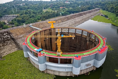
The High-Stakes World of 3D Reconstruction
3D reconstruction from drone footage is more than just making models look pretty — it enables critical decision-making in environments like:
- Disaster response: Mapping collapsed buildings or landslide zones
- Agriculture: Assessing field topography for irrigation optimization
- Mining and quarrying: Calculating excavation volumes
- Smart cities: Building high-resolution urban digital twins
But behind the impressive 3D outputs lies a grueling pipeline where annotation plays a pivotal role — often invisible, yet vital.
Annotation Techniques Tailored to 3D Data 📐
Polygon & Polyline Annotations
These are frequently used to delineate rooftops, roads, fences, and canopy boundaries in orthophotos or digital surface models (DSMs). Because of their geometric complexity, polygon annotations must be pixel-perfect — even minor deviations can cause major distortions in volumetric analyses.
Semantic Segmentation for Terrain Understanding
Unlike bounding boxes, segmentation masks give AI a complete understanding of object shapes and sizes in a pixel-wise fashion. This is especially useful for differentiating:
- Water vs. shadows
- Grass vs. crops
- Bare soil vs. construction material
Segmentation annotations often feed into Digital Elevation Models (DEMs) and Classified Point Clouds, enhancing their semantic value.
Keypoint and Landmark Annotations
For photogrammetry workflows, keypoint annotations on overlapping images help improve image matching and camera calibration. In construction monitoring, landmarking specific control points aids in verifying geospatial accuracy over time.
3D Annotation on Reconstructed Models
In post-processing stages, annotators may work directly on 3D meshes or point clouds using platforms like Supervisely or Scale AI. These annotations can include:
- Tagging structural elements (walls, beams, pillars)
- Drawing 3D bounding volumes
- Defining walkable vs. non-walkable areas
Challenges Unique to Drone-Captured Data 🧩
While drone imagery offers unprecedented access to aerial perspectives, annotating this data is far from simple. Each frame carries not just visual complexity but geospatial significance, which magnifies the risk of error. Below are the most pressing and often underestimated challenges.
Perspective Distortion and Lens Calibration
Drone cameras, especially fisheye or wide-angle lenses, introduce optical distortions that warp real-world geometry. Straight roads might appear curved, or building corners misaligned. Without proper lens calibration or distortion correction, annotations based on these raw images can lead to misleading spatial insights in 3D models.
Solution: Apply pre-processing steps like lens undistortion and camera calibration using software such as Agisoft Metashape or Pix4D Mapper.
Altitude Variance and Scaling Dilemmas
Drone flight plans don’t always maintain a fixed altitude, especially in hilly or uneven terrain. This results in scale inconsistencies — a vehicle in one image may appear twice the size of the same vehicle in another. Annotators must remain constantly aware of altitude metadata, or risk training a model that misjudges size and elevation.
Complication: A single label across multiple images could have different real-world dimensions — which breaks 3D consistency.
Occlusion from Structures or Natural Features
Buildings, trees, or topographical variation often hide key features in aerial imagery. Unlike street-level views, drones can’t always move closer or reposition freely due to flight regulations or terrain hazards. Annotators working on single images may label partial objects or overlook important features altogether.
Workaround: Annotate across time-synced image sequences or use image pairs from overlapping flight paths.
Lighting Conditions and Atmospheric Interference
Shadows cast by buildings or vegetation can mimic water bodies, holes, or terrain changes. Fog, haze, or glare — especially during golden hour — can create misleading color tones and false texture gradients, confusing both human annotators and AI models.
Reality Check: Even high-resolution drones can capture ambiguous zones that need cross-referencing with elevation data or field validation.
Stitched Orthomosaics vs. Raw Imagery
Many drone mapping workflows involve image stitching to create large orthophotos. However, the stitching process can introduce ghosting artifacts, misaligned textures, or duplicated features — especially at overlapping seams.
Annotation Risk: Mistakenly labeling duplicated trees or structures in overlapping frames can lead to false positives in object detection tasks.
GPS Drift and Inaccurate Geotags
Although modern drones are equipped with GPS, the location metadata isn’t always perfect. Even a 1–2 meter drift can significantly affect precise mapping applications like cadastral surveys, infrastructure audits, or land boundary disputes.
Implication: Annotations may appear accurate in the visual domain but are spatially misaligned with real-world coordinates.
Domain Expertise Required
Not all terrain or man-made structures are easily distinguishable without context. For example, an untrained annotator may confuse a gravel path with a dried-out streambed or mislabel solar panels as glass rooftops. Without domain-specific training, annotation efforts can introduce semantic noise into your dataset.
What Quality Annotation Enables in 3D Mapping Projects 🚀
High-quality annotations aren’t just a checkbox — they’re the foundation for dependable AI applications in geospatial analysis. Let’s explore the concrete, high-impact outcomes made possible by well-labeled drone data.
Precision Mapping for Smart Infrastructure
Detailed annotations of roads, utility poles, rooftop edges, drainage systems, and pedestrian paths allow municipalities to digitize infrastructure at scale. When layered onto 3D reconstructions, this data enables:
- Automated detection of illegal construction
- Maintenance alerts for degrading infrastructure
- Enhanced urban planning and zoning regulation
📌 Example: Annotating cracks or spalling on bridges helps AI models flag early signs of structural degradation.
High-Accuracy Topography for Engineering
Engineering-grade annotations feed into digital elevation models (DEMs) and digital surface models (DSMs), allowing civil engineers to:
- Calculate precise cut/fill volumes
- Simulate water flow and runoff
- Determine buildability for new structures
This is especially critical in hilly or flood-prone areas, where terrain accuracy directly affects project safety and cost.
Agriculture and Land Use Classification 🌾
Well-labeled aerial imagery enables classification of:
- Crop types and growth stages
- Irrigation patterns
- Soil moisture stress zones
- Tree canopy health
This supports precision agriculture, helps governments monitor land use, and guides climate change mitigation strategies.
📌 Example: Annotating differences between dry and irrigated zones helps build AI models for smart irrigation recommendations.
Autonomous Navigation and Simulation
Drones annotated with roads, trees, power lines, and fences train AI agents for:
- Obstacle avoidance
- Path planning
- Delivery route optimization
In simulation environments, annotated 3D reconstructions become virtual worlds where autonomous vehicles, robots, or drones are trained — without the risks of real-world testing.
Volume and Surface Measurement at Scale
By combining polygon annotations with altitude data, AI models can:
- Estimate pile volumes in mining sites
- Calculate material stock in construction zones
- Analyze erosion or land displacement
Environmental Monitoring and Conservation
Annotations help AI models track:
- Deforestation or afforestation trends
- Erosion of coastlines and riverbanks
- Changes in glacier or snowpack coverage
Conservationists rely on these outputs to plan mitigation strategies, enforce protected zones, or validate environmental restoration efforts.
Disaster Response and Recovery
Post-disaster drone surveys are a lifeline for first responders. Annotated 3D maps assist in:
- Identifying collapsed buildings
- Navigating blocked roads
- Estimating damage to infrastructure
📌 Real use case: In the aftermath of the Turkey-Syria earthquakes, drones captured orthomosaics and annotated collapse zones to help NGOs prioritize aid delivery.
🧠 Training Simulation AI
Realistic drone-mapped 3D environments are used in training AI for autonomous navigation, military reconnaissance, and robotics. Annotated elements guide object avoidance and mission planning.
Real-World Applications that Depend on These Annotations 🌐
Here are a few domains actively integrating drone-based 3D annotation into their core workflows:
- Agritech companies monitoring field geometry for yield predictions
- Geospatial firms training AI for terrain classification
- Construction giants automating project audits
- Environmental agencies tracking deforestation, erosion, or wetland expansion
- Defense contractors building battlefield simulations with geo-tagged 3D maps
One striking example is Pix4D, which allows annotation overlays on dense point clouds and mesh models, integrating AI to recognize and track changes in infrastructure.
Best Practices for High-Quality Drone Annotations ✍️
- ✅ Use Ground Control Points (GCPs) as visual anchors during annotation
- ✅ Annotate from orthomosaic layers whenever possible for stability
- ✅ Leverage temporal overlap to resolve occlusions or ambiguous views
- ✅ Normalize image input before labeling to remove tilt/skew
- ✅ Establish annotation protocols by altitude range to maintain consistency
- ✅ Always include elevation metadata alongside visual annotations for 3D alignment
Annotation teams must also undergo domain-specific training. Labeling a rural agricultural field is vastly different from annotating a high-rise construction site in urban Tokyo.
Let’s Talk About What Happens When It Goes Wrong 😬
Even small annotation errors can cascade into major AI inaccuracies:
- Misclassified slopes could result in faulty flood risk modeling
- Incorrect building outlines may distort zoning or permit calculations
- Under-segmented vegetation masks can skew biodiversity models
- Overlapping annotations on stitched images may double count structures
For mission-critical use cases like infrastructure monitoring, disaster relief, or military operations, poor annotation can be more than inconvenient — it can be dangerous.
How the Industry is Evolving 🔄
Several exciting innovations are shaping the future of drone annotation in 3D environments:
- Auto-annotation models that pre-label structures based on historical training data
- AI-assisted segmentation where models suggest polygon boundaries that human annotators refine
- 3D mesh-aware tools allowing annotation directly on photogrammetric reconstructions
- Crowdsourced validation layers, especially for public or open datasets like OpenAerialMap
As models improve, human annotators are shifting from manual labeling to validation and refinement roles, ensuring AI outputs align with real-world needs.
Smart Annotation = Smarter AI Outcomes
Drone mapping and 3D reconstruction are revolutionizing how we see and measure the world. But these revolutions rely on data precision at every pixel and coordinate.
From flood modeling to agricultural optimization, annotated drone imagery empowers AI to understand — and act on — the physical world with confidence.
Whether you’re building your own aerial dataset or scaling annotation teams across continents, the lesson is clear: Invest in quality annotation. Your models (and your stakeholders) will thank you.
Ready to Elevate Your Aerial AI Pipeline? 🚁
Looking to build an annotation pipeline that’s scalable, accurate, and customized for drone mapping and 3D reconstruction? At DataVLab, we specialize in geospatial image annotation with expert teams trained across terrain, structure, and volumetric workflows. Reach out to explore how we can help you create the next generation of intelligent, aerial-aware AI.
Let’s take your drones — and your data — to the next level. 🌍📊