Agriculture & Environment
Crop analysis, Weed detection, livestock monitoring & field mapping

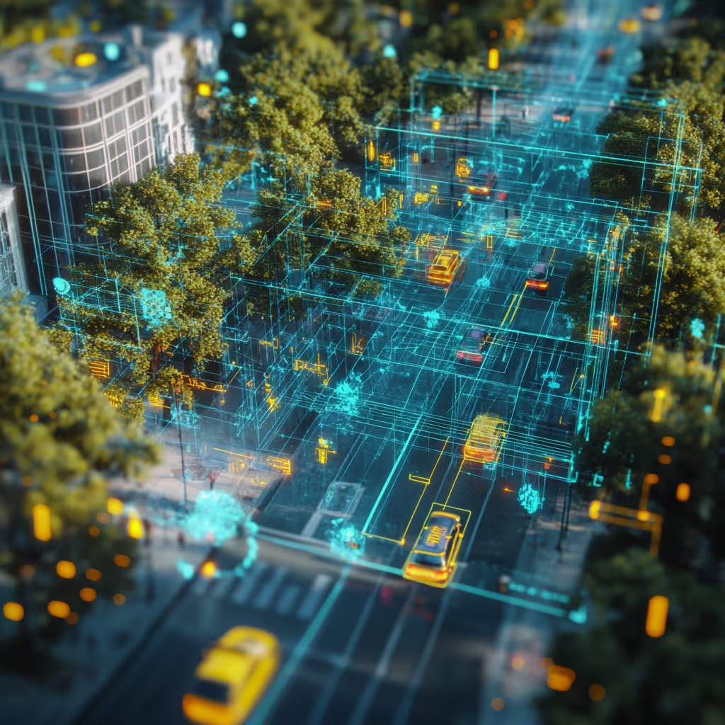
AI and Computer Vision for Agriculture and Environmental Intelligence
Agriculture and environmental monitoring are increasingly supported by AI models that analyze fields, crops, livestock, and natural habitats. These systems rely on large volumes of accurately annotated data collected from drones, satellites, ground cameras, and IoT devices. High quality labeling is essential for tasks such as crop health assessment, yield estimation, field boundary detection, livestock tracking, and environmental monitoring.
DataVLab provides specialized annotation services for both agriculture technology companies and environmental research groups. Our teams label crops, plants, soil types, field zones, animals, equipment, water features, and environmental indicators across complex visual datasets. We support segmentation, classification, bounding boxes, and long sequence tracking based on client specific taxonomy requirements.
With consistent and scalable workflows, we help organizations improve crop management, reduce environmental risk, detect early signs of stress or disease, and build more sustainable monitoring systems.

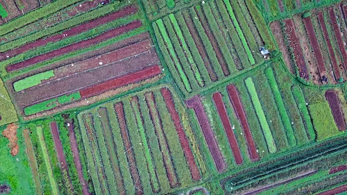
Field Boundary and Crop Type Mapping
Segmentation and classification of field zones and crop varieties to support precision agriculture and land use analysis
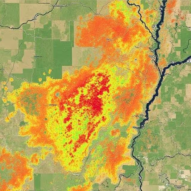
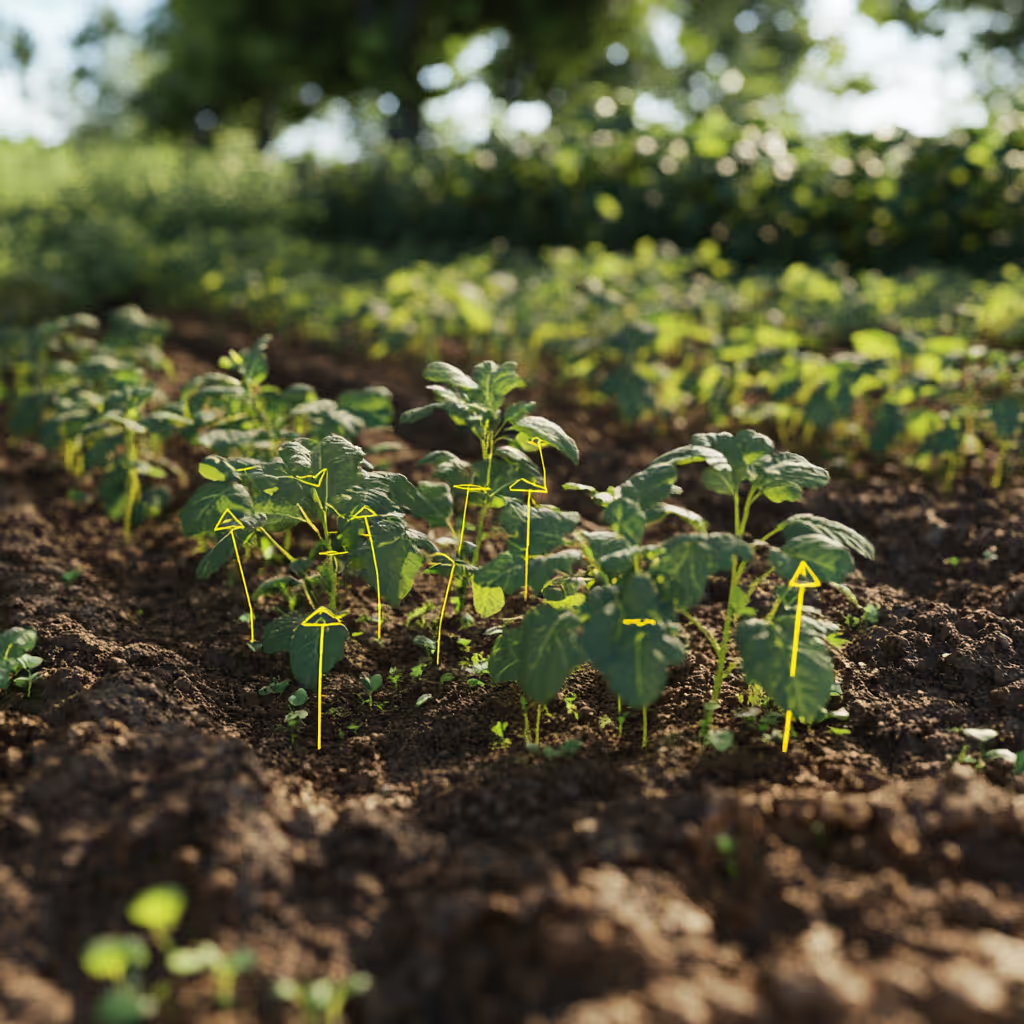
Crop Health and Stress Detection
Annotation of signs of disease, nutrient deficiency, dry zones, and canopy variations for early intervention
Livestock Detection and Tracking
Bounding boxes and tracking for cattle, sheep, and other animals to support monitoring and behavior analysis
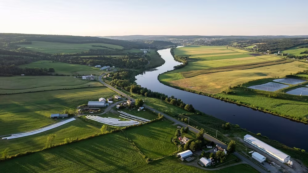
Drone Based Field Surveys
Labeling of aerial images from UAV flights, including plants, irrigation lines, equipment, and terrain features
Environmental Change Monitoring
Segmentation of vegetation, water, soil types, and landscape changes to track environmental shifts at scale
Soil and Land Surface Classification
Detailed labeling of soil textures, surface conditions, and land types to support agronomic and environmental modeling


Annotation & Labeling for AI
Unlock the full potential of your AI application with our expert data labeling tech. We ensure high-quality annotations that accelerate your project timelines.
Enhance Computer Vision
with Accurate Image Labeling
Precise labeling for computer vision models, including bounding boxes, polygons, and segmentation.
Unleashing the Potential
of Dynamic Data
Frame-by-frame tracking and object recognition for dynamic AI applications.
Building the Next
Dimension of AI
Advanced point cloud and LiDAR annotation for autonomous systems and spatial AI.
Tailored Solutions for Unique Challenges
Tailor-made annotation workflows for unique AI challenges across industries.
NLP & Text Annotation
Get your data labeled in record time.
GenAI & LLM Solutions
Our team is here to assist you anytime.
Agriculture Data Annotation Services
High accuracy annotation for farming images, drone and satellite data, crop monitoring, livestock analysis, and precision agriculture workflows.
Agritech Data Annotation Services
High accuracy annotation for agritech applications including precision farming, field robotics, multispectral analytics, yield prediction, and environmental monitoring.
Plant Annotation Services
High precision plant level annotation for leaf segmentation, disease detection, phenotyping, growth analysis, and scientific agriculture datasets.
Drone Image Annotation
High accuracy annotation of drone captured images for inspection, construction, agriculture, security, and environmental applications.
Satellite Image Annotation Services
High accuracy annotation for satellite imagery across land cover mapping, object detection, agricultural monitoring, and environmental change analysis.
Geospatial Data Annotation Services
High quality annotation for satellite imagery, aerial imagery, multispectral data, LiDAR surfaces, and GIS datasets used in geospatial and environmental AI.
Aerial Image Annotation
High quality annotation of aerial photography for mapping, inspection, agriculture, construction, and environmental analysis.
Semantic Segmentation Services
High quality semantic segmentation services that provide pixel level masks for medical imaging, robotics, smart cities, agriculture, geospatial AI, and industrial inspection.
We provide high-quality data annotation services and improve your AI's performances

Custom service offering
Up to 10x Faster
Accelerate your AI training with high-speed annotation workflows that outperform traditional processes.
AI-Assisted
Seamless integration of manual expertise and automated precision for superior annotation quality.
Advanced QA
Tailor-made quality control protocols to ensure error-free annotations on a per-project basis.
Highly-specialized
Work with industry-trained annotators who bring domain-specific knowledge to every dataset.
Ethical Outsourcing
Fair working conditions and transparent processes to ensure responsible and high-quality data labeling.
Proven Expertise
A track record of success across multiple industries, delivering reliable and effective AI training data.
Scalable Solutions
Tailored workflows designed to scale with your project’s needs, from small datasets to enterprise-level AI models.
Global Team
A worldwide network of skilled annotators and AI specialists dedicated to precision and excellence.
Potential Today
FAQs
Here are some common questions we receive from our clients to assist you.

What is agriculture and environmental AI annotation and what does it cover?
Agriculture and environmental AI annotation labels visual and sensor data from agricultural and ecological environments so that AI models can support crop monitoring, yield estimation, pest and disease detection, precision irrigation, autonomous farming equipment, biodiversity research, and environmental change monitoring. It covers RGB drone imagery, multispectral and hyperspectral data, satellite imagery, ground-level cameras, LiDAR point clouds, and IoT sensor data. Agriculture annotation requires annotators with agronomic and ecological domain knowledge because the relevant classes require genuine expertise to identify correctly from visual data.
What is multispectral and hyperspectral annotation for agricultural AI?
Multispectral annotation requires understanding of spectral indices and reflectance properties beyond RGB color. NDVI (Normalized Difference Vegetation Index) annotation identifies vegetation health from near-infrared and red band combinations. NDWI (Normalized Difference Water Index) identifies water stress. Thermal imagery annotation identifies irrigation efficiency and plant stress that is invisible to standard cameras. SAR (Synthetic Aperture Radar) annotation enables monitoring through cloud cover for large-scale environmental applications. Each spectral modality requires annotators trained to interpret the specific visual characteristics of that sensor type, which differ substantially from RGB interpretation.
What are the unique challenges of drone and satellite imagery annotation for agriculture?
Drone and satellite imagery present unique annotation challenges absent from ground-level cameras. Variable altitude means the same crop or species class appears at dramatically different scales depending on flight height or orbital altitude. Seasonal variation means land cover classes change appearance across the growing season, requiring annotators to understand phenological cycles. Cloud cover and atmospheric effects partially obscure satellite scenes, requiring inference about occluded areas. Geographic coordinate systems require annotations to be spatially accurate in real-world coordinates, not just visually accurate within the image frame.
What is precision agriculture annotation and what does it require?
Precision agriculture AI annotation covers the specific workflows that enable variable rate application of inputs (water, fertilizer, pesticide) based on within-field variation. This requires field boundary delineation (identifying individual field parcels from aerial or satellite imagery), crop type classification (identifying what is grown in each field), crop health zoning (identifying which parts of a field show stress, disease, or deficiency), and yield estimation annotation (labeling fruit counts, canopy density, and maturity indicators). Each of these tasks requires agronomic expertise that general annotators cannot provide.
What is wildlife and ecology annotation?
Wildlife and ecology annotation labels animal species, behaviors, and habitats from camera trap footage, drone imagery, and satellite data. Species identification in complex natural environments requires zoological expertise: distinguishing similar species from partial views, in variable lighting, at different life stages, and in cluttered habitats requires the kind of knowledge that field biologists and ecologists possess. Camera trap annotation is particularly challenging because most triggers capture empty frames (wind-moved vegetation) that must be quickly identified, and animal subjects may be partially visible, in motion blur, or in unusual postures.
What agriculture and environment annotation services does DataVLab provide?
DataVLab provides agriculture and environment annotation for drone imagery, satellite imagery, ground-level cameras, multispectral sensors, and LiDAR data. We work with precision agriculture platforms, agtech startups, environmental agencies, conservation organizations, research institutions, and government mapping programs. Our annotation network includes agronomists, ecologists, and environmental scientists for tasks requiring domain expertise. EU-based annotation is available for European agricultural and environmental AI programs with data residency requirements.
We provide high-quality data annotation services and improve your AI's performances
Blog & Resources
Explore our latest articles and insights on Data Annotation