🛰️ Understanding the Role of Satellite Imagery in AI
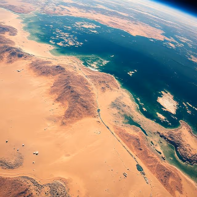
Satellite imagery is not just another input source for AI—it’s a gateway to global-scale, real-time, and multi-dimensional insights. Unlike traditional image datasets used in machine learning, satellite data presents a set of distinct characteristics that demand both technical and domain-specific expertise to annotate and analyze effectively.
What Makes Satellite Imagery Unique?
- Massive Geographic Coverage
One satellite image can span hundreds or even thousands of square kilometers. This allows for macro-level insights into land usage, deforestation, or urban growth, enabling AI models to function at continental or even planetary scales. - Spectral Richness Beyond the Visible
Many satellite sensors collect data in non-visible wavelengths—infrared, near-infrared (NIR), short-wave infrared (SWIR), and even thermal bands. These allow AI models to detect vegetation health, soil moisture, heat signatures, and pollution levels—insights invisible to the naked eye but critical for applications like Agriculture, environmental science, and disaster management. - Temporal Dynamics
With daily or weekly revisits, satellites offer a powerful stream of time-series data. When properly annotated, this temporal dimension allows AI to detect changes over time—urban expansion, glacier melting, flood progression—making satellite AI a potent tool for monitoring and forecasting. - Multi-Resolution Input Sources
Satellite imagery varies dramatically in resolution—from ultra-high-res (30 cm per pixel) to low-res (10–100 m per pixel). Annotating such varied data types teaches AI to adapt across scales, which is especially useful in models designed for generalization across diverse terrains. - Global Availability and Accessibility
Thanks to open data programs like Copernicus (Sentinel) and Landsat, high-quality satellite imagery is widely accessible, democratizing the development of AI applications in agriculture, urban planning, climate research, and more—even for low-resource regions.
Why Annotation is Crucial for Satellite-Based AI
Raw satellite imagery alone doesn't provide actionable insights. AI models must be trained on vast amounts of labeled examples to understand:
- What constitutes a building, a road, or a forest from space.
- How to differentiate seasonal snow from permanent glaciers.
- How floodwater differs from a river at various resolutions.
Without structured annotation—typically pixel-level masks, bounding boxes, or polygon overlays—these distinctions are lost in the visual noise. Human-guided annotation ensures that models not only learn “what” is visible in the imagery but also “why” it matters in the given geospatial context.
Bridging Remote Sensing and AI
For AI to effectively interpret satellite imagery, it must be coupled with the principles of remote sensing—an interdisciplinary field rooted in physics, geography, and environmental science. Annotators working in this space often require a solid understanding of:
- Sensor characteristics and spectral signatures.
- Geographical context (e.g., vegetation types in different regions).
- Seasonal variations and their impact on land cover.
This is why satellite annotation is more than a Data Labeling task—it’s the intersection of Earth science, geospatial analytics, and machine learning.
🏙️ Urban Planning and Smart Infrastructure Development
Cities are expanding at unprecedented rates. To manage urbanization sustainably, governments and private developers rely on satellite imagery to track land use, identify infrastructure gaps, and plan future developments.
Common Use Cases:
- Building footprint detection for housing density and expansion.
- Road network mapping to update outdated public maps or monitor illegal construction.
- Urban sprawl monitoring using time-series annotations to evaluate growth trends.
- Zoning classification to enforce urban regulations.
These annotations serve as the training ground for AI models that automate urban mapping. In places with limited on-the-ground data, satellite-based models are often the only scalable solution for infrastructure monitoring.
🔗 Learn how platforms like UP42 and Planet Labs provide access to annotated satellite data for urban analytics.
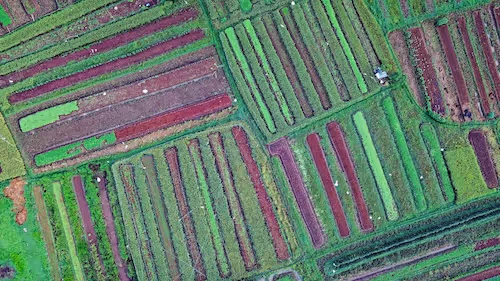
🌾 Precision Agriculture and Crop Monitoring
Satellite imagery is revolutionizing how we grow food. With AI-assisted interpretation of annotated fields, farmers and agritech firms can monitor crop health, predict yields, and reduce resource waste.
Real-World Applications:
- Field boundary delineation for detecting crop zones and ownership mapping.
- Crop type classification based on multi-temporal satellite images.
- Growth stage monitoring using vegetation indices like NDVI or EVI.
- Pest and disease spread analysis via thermal and hyperspectral signatures.
By annotating features such as plant coverage, irrigation patterns, and canopy gaps, agronomists enable supervised learning algorithms to detect anomalies and optimize inputs.
🔗 Check out how the European Space Agency’s Sentinel Hub supports crop analytics with annotated satellite imagery.
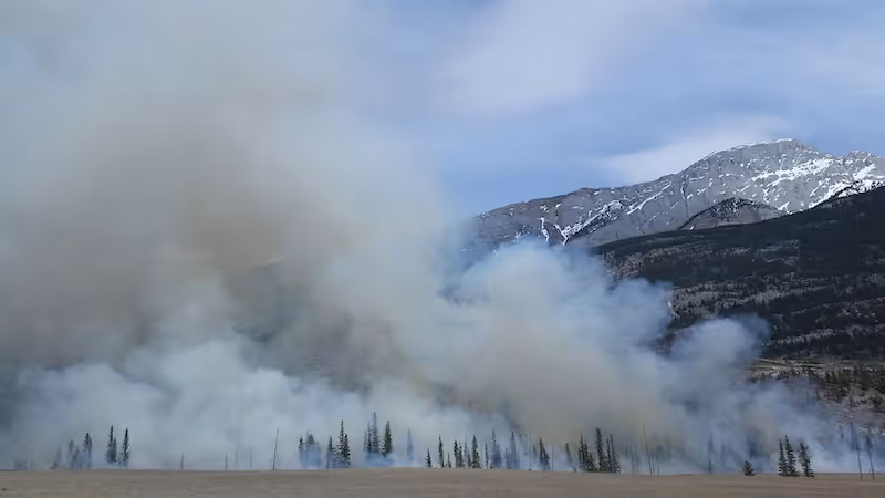
🌋 Disaster Management and Emergency Response
When natural disasters strike—wildfires, hurricanes, floods—AI needs accurate, up-to-date imagery to assess the situation and deploy resources effectively. Satellite annotations help emergency agencies rapidly identify damage and plan recovery operations.
Key Annotation Tasks:
- Flood extent mapping to assess submerged areas in real-time.
- Fire perimeter and burn scar labeling from thermal imagery.
- Landslide detection through change analysis of topography.
- Damage assessment of buildings, roads, and utilities post-disaster.
By training AI models on annotated crisis datasets, humanitarian organizations like the UNOSAT Rapid Mapping Service or Copernicus Emergency Management Service can generate response maps within hours.
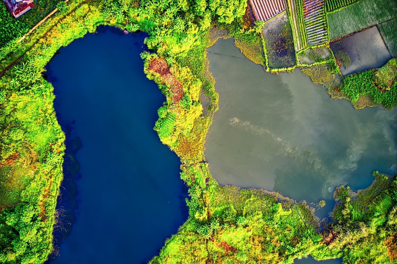
🌳 Environmental Monitoring and Climate Research
Tracking long-term changes to the Earth’s surface is impossible without annotated satellite datasets. From glacial retreat to coral bleaching, the precision of annotation allows AI to detect gradual shifts invisible to the naked eye.
Strategic Use Cases:
- Deforestation and afforestation mapping for rainforest conservation.
- Glacier and snow cover tracking in polar and mountainous regions.
- Wetland and coastal erosion mapping for ecosystem protection.
- Air pollution plume detection using satellite-based spectroscopy.
Researchers often combine spectral band annotations with environmental datasets to monitor climate indicators over time, making AI an indispensable ally in ecological modeling.
🔗 See the work of NASA’s Earth Observatory for annotated environmental changes across decades.
🛡️ National Security, Surveillance, and Border Control
Governments and defense organizations use annotated satellite data to monitor sensitive areas, detect suspicious patterns, and strengthen border surveillance. AI models trained on such data offer unmatched coverage and persistence compared to drones or patrols.
Core Applications:
- Object detection of vehicles, ships, or aircraft in restricted areas.
- Change detection of military installations or unauthorized activities.
- Border anomaly detection to spot fence breaches or tunnel construction.
- Illicit mining or deforestation tracking in protected zones.
To enhance model performance, annotations must account for camouflage, cloud occlusion, and cross-domain variation (e.g., urban vs rural). Many of these projects remain classified, but the underlying annotation principles apply across all remote sensing domains.
🛢️ Energy and Resource Exploration
In oil, gas, and mineral exploration, satellite imagery—annotated for geological patterns or infrastructure—is critical for site selection, operations, and environmental compliance.
Energy Sector Use Cases:
- Pipeline route mapping and monitoring for potential leaks or encroachments.
- Mining site detection and production assessment.
- Solar and wind farm suitability analysis using annotated terrain and weather layers.
- Environmental impact monitoring around drilling and extraction sites.
Here, annotations often combine spectral interpretation with auxiliary data (e.g., geological surveys, land ownership maps), helping ML models identify patterns invisible to human analysts.
🔗 Explore how Descartes Labs uses annotated geospatial data for energy intelligence.
🐘 Biodiversity and Wildlife Conservation
AI models trained on annotated satellite imagery are also being used to support biodiversity initiatives—from tracking animal migration paths to preventing illegal poaching or habitat destruction.
Important Use Cases:
- Habitat mapping for endangered species.
- Water hole and migration corridor detection in arid regions.
- Illegal encampment or vehicle detection in nature reserves.
- Forest fragmentation analysis to assess species connectivity.
Organizations like Global Forest Watch and WWF rely on satellite annotations to maintain up-to-date ecological models and prioritize interventions.
🧠 Combining Satellite Imagery with Other Data Sources
To extract actionable insight, satellite annotations are increasingly combined with:
- Ground-truth data (e.g., field surveys, sensors)
- Weather records (temperature, precipitation, humidity)
- Economic indicators (urban GDP, transport data)
- Temporal analytics (change over time)
This fusion of spatial and contextual data allows AI models to go beyond visual analysis and into prediction and forecasting, especially when trained on longitudinal annotations across diverse geographies.
🚧 Challenges in Satellite Image Annotation
Working with satellite images presents unique annotation hurdles that require domain-specific strategies:
- High class imbalance (e.g., urban vs. rural pixels)
- Occlusions from clouds, shadows, or seasonal snow
- Varying resolutions across sensors and scenes
- Limited availability of high-quality ground truth
- Multi-temporal drift in annotations over time
Overcoming these challenges requires annotation workflows grounded in geospatial intelligence, frequent validation, and well-structured datasets.
🌟 The Future of Satellite Image Annotation in AI
As satellite technology evolves, so does the nature of data annotation. The next frontier in Earth observation lies in scaling human insight through intelligent, adaptive, and collaborative annotation pipelines. Here's where the industry is heading:
🔁 Active Learning and Semi-Automated Annotation
One of the most transformative trends in satellite annotation is active learning. In this approach:
- AI models identify which parts of the satellite image are uncertain or underrepresented.
- Human annotators are then prompted to label only those areas, rather than the entire image.
This feedback loop allows annotation efforts to be concentrated where they’ll have the highest impact—improving data efficiency and reducing human effort.
Platforms like Labelbox and Encord are already integrating such workflows to accelerate geospatial AI development. Future annotation frameworks will likely be hybrid—combining automated pre-labeling with human validation.
🌐 3D Annotation and Multi-Angle Satellite Analysis
With the rise of stereoscopic satellites and LiDAR-equipped satellites, 2D annotations will soon evolve into 3D geospatial annotations. This allows AI to not just detect objects in flat space but measure height, depth, and volume.
This is particularly game-changing for applications like:
- Estimating building heights and solar potential in urban planning.
- Analyzing elevation changes in glacier studies or landslide prediction.
- Monitoring mining site activity in near-real time.
As spatial analytics become more volumetric, the demand for 3D ground truth data will push annotation frameworks to accommodate new dimensions and formats like point clouds and 3D meshes.
🔐 Privacy-Aware and Ethical Annotation
With increased access to high-resolution imagery, ethical concerns around surveillance, privacy, and militarization of AI are becoming central. Future annotation platforms must integrate:
- Redaction protocols to exclude sensitive locations.
- Access controls for restricted annotation projects.
- Bias monitoring in training datasets (e.g., overrepresentation of certain regions or seasons).
Responsible annotation will involve clear consent models and auditability—especially in humanitarian, conflict zone, and environmental justice applications.
🔗 Learn more from the Partnership on AI’s work on responsible AI data development.
🧠 Domain-Specific Fine-Tuning with Foundation Models
With the introduction of foundation models trained on planetary-scale data (like Microsoft’s Z-Code for Earth), the way satellite annotation contributes to AI is changing.
Instead of building small custom models from scratch, organizations will increasingly fine-tune general-purpose geospatial models using small but high-quality annotated datasets tailored to specific regions or tasks.
This shift makes annotation even more strategic: a few thousand precise labels can recalibrate massive models for niche applications like:
- Desertification in the Sahel
- Coral reef monitoring in the Pacific
- Infrastructure detection in post-conflict zones
🤝 Crowdsourcing Meets Expert Validation
Citizen science has long played a role in satellite imagery interpretation (e.g., NASA’s Zooniverse). The future lies in platforms that combine the scale of crowdsourcing with the reliability of expert review.
Expect to see more tiered annotation models where:
- Volunteers create rough labels on massive datasets.
- Remote sensing experts validate and refine those labels.
- AI models are updated continuously using this human-AI collaboration loop.
This hybrid workflow reduces costs and accelerates annotation without compromising accuracy.
📊 Integration with Real-Time Monitoring Dashboards
Annotated satellite data is no longer used solely for offline model training. Increasingly, it's fed directly into real-time dashboards that help cities, governments, and researchers monitor environmental or infrastructural shifts live.
- Construction companies use annotated imagery to track project progress.
- Municipalities integrate it into urban heat maps for public health.
- Conservationists receive alerts based on deforestation detected by annotated AI.
In this context, annotation becomes part of a living pipeline—updated, validated, and refined as new imagery becomes available.
🌎 Democratization of Satellite AI
Finally, as open-source models, no-code geospatial tools, and affordable imagery access continue to grow, the barriers to entry for satellite-based AI projects are falling fast.
- Students in remote areas can now train models on their local environment.
- NGOs in disaster zones can deploy detection systems without deep tech stacks.
- Governments can regulate environmental compliance with fewer field inspections.
Annotation remains the key layer that bridges raw pixels and policy decisions—empowering a more inclusive, globally distributed AI ecosystem.
🚀 Ready to Launch Your Satellite AI Project?
Whether you're mapping forest loss, monitoring borders, or analyzing urban heat islands, high-quality satellite image annotation is the cornerstone of successful geospatial AI.
🔍 At DataVLab, we specialize in satellite image annotation that blends accuracy, geospatial expertise, and AI-readiness. Want to explore how annotated imagery can accelerate your AI goals?
Let’s start mapping your vision—together.
📩 Contact our annotation experts today →