AI and Computer Vision for Maritime Safety and Operations
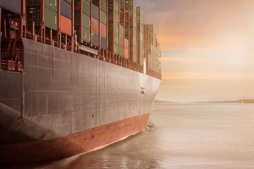
Maritime operations require accurate situational awareness across open water, coastal regions, ports, and offshore facilities. AI powered systems now assist in vessel detection, route monitoring, environmental surveillance, cargo handling, and marine safety. These applications depend on high quality annotated datasets that account for reflections, waves, varied weather, changing water conditions, and complex fleet movements.
DataVLab provides detailed annotation services for maritime use cases. We label vessels, buoys, docks, cranes, containers, waves, coastlines, and operational zones across aerial, satellite, drone, and port level imagery. Our workflows support object detection, segmentation, tracking, behavior analysis, and environmental monitoring. Teams follow strict protocols to ensure consistency across dense maritime scenes and long video sequences.
Whether you are developing port automation tools, vessel tracking platforms, marine environment monitoring, or navigation support systems, we deliver training data that improves accuracy, reliability, and operational safety.
Vessel Detection and Classification
Bounding boxes and segmentation for ships, boats, tankers, ferries, and small craft across open sea and coastal regions
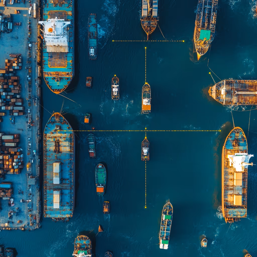
Port and Harbor Activity Monitoring
Annotation of cranes, trucks, containers, loading areas, and vessel movements for port automation and logistics AI
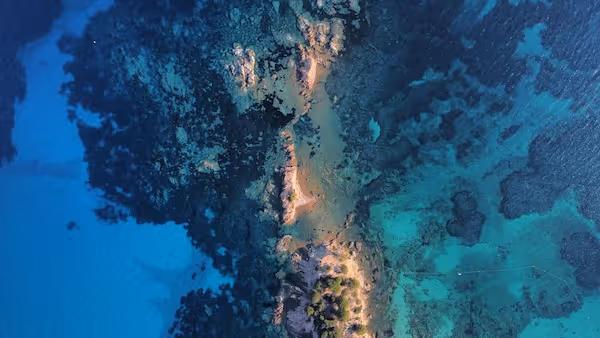
Marine Environment Segmentation
Segmentation of water, waves, coastlines, sand, docks, and rocks to support environment analysis and navigation modeling
Offshore Infrastructure Inspection
Labeling of rigs, turbines, platforms, and marine structures to support inspection and maintenance workflows
Vessel Route and Behavior Tracking
Multi frame tracking of vessel trajectories to support collision avoidance and traffic analysis
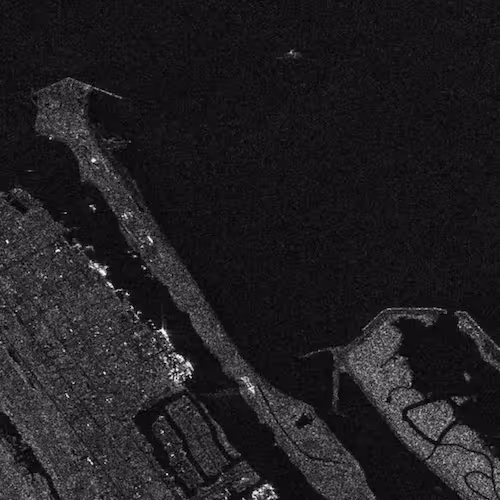
Satellite and Aerial Maritime Surveillance
Annotation of vessels, shoreline features, environmental conditions, and maritime infrastructure across wide area imagery


Annotation & Labeling for AI
Unlock the full potential of your AI application with our expert data labeling tech. We ensure high-quality annotations that accelerate your project timelines.
Enhance Computer Vision
with Accurate Image Labeling
Precise labeling for computer vision models, including bounding boxes, polygons, and segmentation.

Unleashing the Potential
of Dynamic Data
Frame-by-frame tracking and object recognition for dynamic AI applications.

Building the Next
Dimension of AI
Advanced point cloud and LiDAR annotation for autonomous systems and spatial AI.

Tailored Solutions for Unique Challenges
Tailor-made annotation workflows for unique AI challenges across industries.
NLP & Text Annotation
Get your data labeled in record time.
GenAI & LLM Solutions
Our team is here to assist you anytime.
Maritime Data Annotation Services
High accuracy annotation for maritime computer vision, including vessel detection, port monitoring, EO and IR imagery labeling, route analysis, and maritime safety systems.
Satellite Image Annotation Services
High accuracy annotation for satellite imagery across land cover mapping, object detection, agricultural monitoring, and environmental change analysis.
Geospatial Data Annotation Services
High quality annotation for satellite imagery, aerial imagery, multispectral data, LiDAR surfaces, and GIS datasets used in geospatial and environmental AI.
Aerial Image Annotation
High quality annotation of aerial photography for mapping, inspection, agriculture, construction, and environmental analysis.
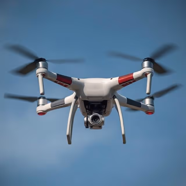
Drone Image Annotation
High accuracy annotation of drone captured images for inspection, construction, agriculture, security, and environmental applications.
Object Detection Annotation Services
High quality annotation for object detection models including bounding boxes, labels, attributes, and temporal tracking for images and videos.
We provide high-quality data annotation services and improve your AI's performances

Custom service offering
Up to 10x Faster
Accelerate your AI training with high-speed annotation workflows that outperform traditional processes.
AI-Assisted
Seamless integration of manual expertise and automated precision for superior annotation quality.
Advanced QA
Tailor-made quality control protocols to ensure error-free annotations on a per-project basis.
Highly-specialized
Work with industry-trained annotators who bring domain-specific knowledge to every dataset.
Ethical Outsourcing
Fair working conditions and transparent processes to ensure responsible and high-quality data labeling.
Proven Expertise
A track record of success across multiple industries, delivering reliable and effective AI training data.
Scalable Solutions
Tailored workflows designed to scale with your project’s needs, from small datasets to enterprise-level AI models.
Global Team
A worldwide network of skilled annotators and AI specialists dedicated to precision and excellence.
Potential Today
FAQs
Here are some common questions we receive from our clients to assist you.

What is maritime AI annotation and what does it cover?
Maritime AI annotation labels imagery and sensor data from marine environments so that AI systems can support vessel detection and tracking, port automation, coastal surveillance, environmental monitoring, and maritime safety. It covers annotation of vessels (ships, boats, tankers, ferries, small craft) across satellite, aerial, and port camera imagery, port and harbor activity annotation (cranes, containers, trucks, loading zones, vessel berths), offshore infrastructure inspection (oil rigs, wind turbines, platforms), marine environment segmentation (water, waves, coastlines, docks), and vessel route and behavior tracking. Maritime annotation must handle challenging visual conditions: reflective water surfaces, wave clutter, spray, fog, and the full scale range from small fishing boats to large tankers.
What makes vessel detection from satellite imagery challenging?
Vessel detection from satellite imagery is technically demanding because vessels appear at dramatically different sizes depending on satellite resolution, vessel type, and distance from the imaging system. A supertanker may occupy hundreds of pixels in high-resolution commercial satellite imagery but only a few pixels in medium-resolution imagery. Small vessels (fishing boats, recreational craft, rigid inflatables) may be smaller than the resolution limit of many satellite systems. Dark vessel detection (vessels that disable their AIS transponders) requires annotation of vessels that may be partially obscured by sea state, viewed at unfavorable aspects, or exhibiting unusual thermal signatures in EO/IR imagery. These challenges require annotators with maritime remote sensing knowledge.
What is port and harbor automation annotation?
Port and harbor automation annotation labels the physical elements and activities that port AI systems must understand to support vessel traffic management, equipment automation, and logistics coordination. This includes vessel berth occupancy (which berths are occupied and by what vessel type), crane and equipment status (working, idle, maintenance), container and cargo unit detection and classification, truck and vehicle movement in port landside areas, worker presence in automated equipment operating zones, and navigation channel and fairway conditions from port monitoring cameras. Port annotation must handle the specific challenges of port environments: night operations under artificial lighting, fog and weather, and the simultaneous presence of vessels, cranes, trucks, and workers at different scales.
What is maritime domain awareness annotation?
Maritime domain awareness annotation labels the full picture of maritime traffic, activity, and anomalies across a sea area from satellite, aerial, and sensor data. This includes vessel detection and classification, AIS track correlation (linking detected vessels to AIS transponder data where available), behavioral anomaly detection (vessels drifting off course, suspicious rendezvous patterns, illegal fishing behavior), and environmental monitoring (oil spills, pollution events, illegal dumping). For defense and coast guard applications, dark vessel detection (vessels without AIS) and behavioral pattern analysis are particularly important. Maritime domain awareness annotation for defense programs requires EU-sovereign workflows and appropriately vetted annotators.
What GDPR considerations apply to maritime annotation?
GDPR applies to maritime annotation that captures identifiable individuals in vessels, on port facilities, or in coastal areas. Port security imagery capturing workers, truck drivers, or vessel crew is personal data under GDPR. Satellite imagery of port facilities at sufficient resolution to identify individuals triggers GDPR obligations. For maritime AI training data, standard practice requires anonymization of identifiable individuals where feasible, documented legal basis for processing port and coastal surveillance data, and data processing agreements with annotation service providers. For defense maritime programs, sovereignty considerations go beyond GDPR.
What maritime annotation services does DataVLab provide?
DataVLab provides maritime annotation for vessel detection and classification (satellite, aerial, port camera), port and harbor activity monitoring, offshore infrastructure inspection, marine environment segmentation, vessel route and behavior tracking, and maritime domain awareness. We work with port operators, maritime logistics companies, coast guard and naval programs, offshore energy operators, and maritime AI technology providers. EU-based annotation is available for European maritime programs with GDPR compliance or sovereignty requirements, including defense maritime applications.
We provide high-quality data annotation services and improve your AI's performances
Blog & Resources
Explore our latest articles and insights on Data Annotation