Why This Distinction Matters 🛰️🚁
From a data annotation perspective, satellite and UAV imagery come with fundamentally different challenges and opportunities:
- Resolution: Satellite images typically have lower resolution but broader coverage.
- Angle and Perspective: UAVs capture oblique angles; satellites deliver top-down orthographic views.
- Temporal Access: UAVs can be deployed on-demand; satellites depend on orbital cycles.
- Regulatory and Cost Factors: Satellites may offer free data (like Sentinel), while UAVs offer flexibility but require field logistics.
Understanding these tradeoffs can prevent costly missteps in dataset planning and AI development.
The Fundamentals: Where Do These Images Come From?
Let’s briefly look at the source mechanics of both imagery types to better understand their annotation implications.
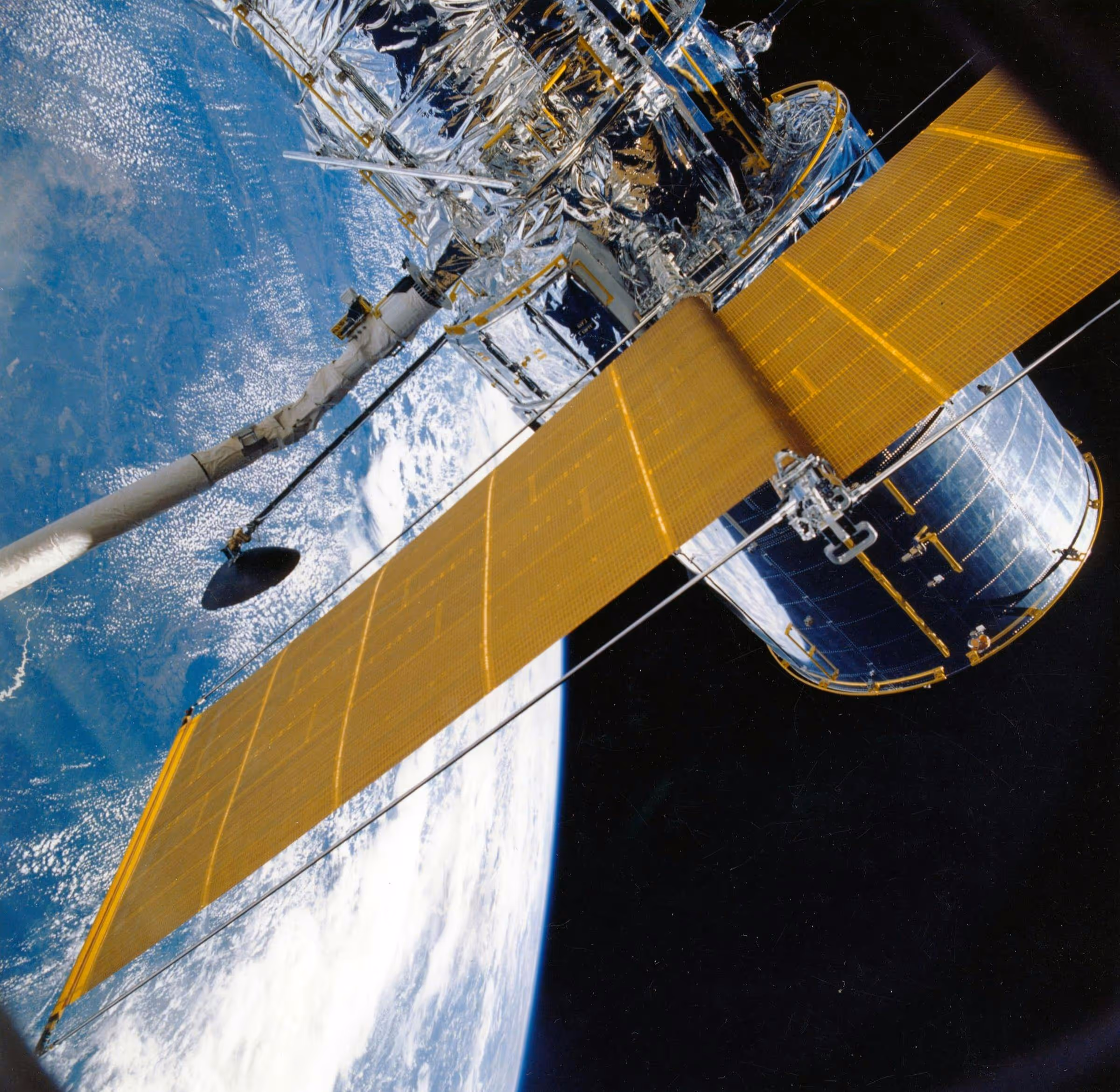
Satellite Imagery
Captured by Earth observation satellites such as:
- Sentinel-2 (by ESA): Medium-resolution, multispectral, free to access.
- WorldView series (Maxar): High-resolution commercial satellites.
- Landsat-9 (NASA/USGS): Long-running free dataset with 30m–15m resolution.
These systems orbit at altitudes of 500–700 km, offering broad regional or even global coverage with each pass.
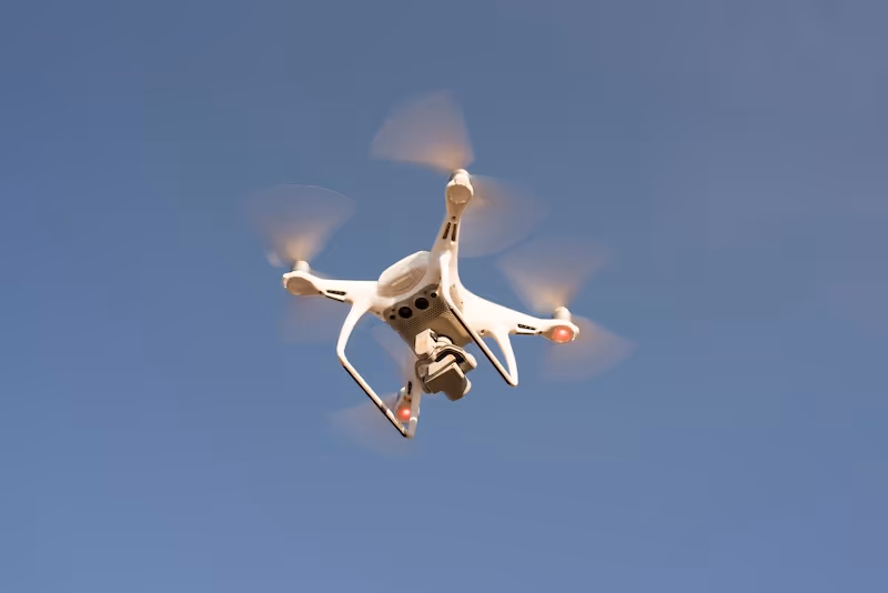
UAV Imagery
Captured using drones equipped with cameras and sensors, often at altitudes between 50–400 meters. UAVs can be:
- Manually piloted or autonomous
- Multispectral, thermal, RGB, or LiDAR equipped
- Operated on-demand for real-time missions
This means UAV imagery is highly adaptable and granular, especially when focused on localized environments.
Resolution and Scale: The Most Visible Difference 🔍
Satellite Imagery: From Regional to Continental
- Spatial resolution can range from 30 meters/pixel (Landsat) to 0.3 meters/pixel (WorldView-4).
- Suitable for urban expansion tracking, disaster response, and land use classification.
- But fine object detection (e.g., detecting individual people, small vehicles) becomes difficult due to pixel-level blending.
UAV Imagery: From Centimeters to Millimeters
- Can reach <2 cm/pixel with high-end RGB or multispectral sensors.
- Enables ultra-precise tasks like:
- Detecting individual plants, animals, or cracks in infrastructure.
- Counting objects like solar panels, vehicles, or crop anomalies.
Annotation Implication:
In UAV images, annotators must deal with very fine-grained detail, requiring tighter bounding boxes or polygons. In contrast, satellite annotations often involve broader classes and regional segments (e.g., land cover, zoning areas).
Geographic Context and Coverage 🌐
Satellite: Wide-Area Synoptic View
- Satellites offer imagery that spans hundreds to thousands of kilometers per scene.
- Best suited for:
- Monitoring forest cover change
- Detecting urban sprawl
- Observing glacier movement or coastal erosion
UAVs: Hyper-Localized Mission Focus
- Typically used for site-specific missions: a single farm, construction site, or traffic intersection.
- Ideal for:
- Monitoring pipeline corrosion
- Surveying mine sites
- Assessing storm damage on roofs
Annotation Implication:
Satellite annotation projects often demand macro-labeling strategies, while UAV annotation tasks require pixel-level accuracy across tightly packed objects.
Frequency and Real-Time Capabilities ⏱️
Satellite Imagery: Scheduled and Periodic
- High-resolution satellites may revisit the same location every few days to weeks.
- Cloud cover can delay clear captures.
- Real-time updates are difficult without priority satellite tasking (often costly).
UAV Imagery: On-Demand and Real-Time
- Deployed instantly for emergency response, military missions, or time-sensitive Agriculture assessments.
- Can be flown multiple times per day for high-frequency monitoring.
Annotation Implication:
If your use case involves dynamic change (e.g., flooding, crowd movement), UAVs are more suitable. Satellite data is better for slow changes or trend analysis.
Sensor Diversity and Spectral Range 🌈
Satellites: Multispectral and Hyperspectral Masters
- Instruments like Sentinel-2 provide up to 13 spectral bands.
- Hyperspectral satellites like PRISMA enable deep material analysis (vegetation health, minerals, pollution).
UAVs: Flexible Sensor Mounts
- UAVs can carry:
- RGB cameras
- Thermal sensors
- LiDAR scanners
- NDVI cameras for crop health analysis
Annotation Implication:
Multispectral annotation requires channel-aware tools. For UAVs, multi-modal annotation projects often combine visual and depth data, which can be complex to align but richer for AI.
Use Cases: What Are You Annotating For?
The applications of satellite and UAV Image Annotation stretch far beyond simple object detection. Each use case demands a distinct labeling approach—dictated by image resolution, field of view, update frequency, and domain-specific needs. Let’s dive deeper into how image annotation supports real-world decision-making across sectors like agriculture, urban development, defense, insurance, and disaster relief.
Precision Agriculture 🌾
Satellite Annotation for Crop Intelligence
Satellite imagery provides regional and seasonal overviews of agricultural productivity. Annotators often classify land use, vegetation indices (NDVI), and water stress areas. The goal is to generate high-level insights into trends—like yield forecasts or regional drought conditions.
Example annotations:
- Zoning large agricultural plots by crop type
- Identifying irrigation patterns or soil moisture variations
- Monitoring pest spread over time
UAV Annotation for Field-Level Decisions
Drones add granularity. They fly low and slow, capturing the minute details needed to assess plant health, weed presence, or fruit ripeness. UAV image annotation enables AI systems to detect plant stress at the individual plant level—supporting precision spraying and harvesting.
Key annotations might include:
- Bounding boxes around diseased plants
- Polygon annotation for affected areas within a crop field
- Change tracking for plant growth across time-series UAV images
Why it matters: Farms that use drone-based AI annotation reduce pesticide use, increase yield, and adapt more quickly to climate change.
Urban Planning and Smart Cities 🏙️
Satellite Annotation for Macro Urban Analysis
Urban planners and governments rely on satellite-based labeling to track infrastructure expansion, traffic heatmaps, and zoning compliance. Annotators mark:
- Residential vs. industrial zones
- Expansion of informal settlements
- Green space vs. built-up area ratios
These annotations feed AI models that support long-term city modeling, resource allocation, and environmental sustainability metrics.
UAV Annotation for Micro-Level Maintenance
In contrast, UAV imagery supports operational use cases like:
- Roof damage inspection
- Pavement wear analysis
- 3D mapping of construction sites
Drone footage allows cities to proactively maintain assets and inspect public infrastructure without sending personnel on-site. Annotators may draw polygons around cracked roads, segment building outlines, or measure crowd density at events.
Why it matters: Combining both types of annotation enables cities to scale infrastructure while keeping it smart, efficient, and safe.
Defense, Intelligence, and Border Security 🛡️
Satellite Imagery for Strategic Monitoring
Defense applications of satellite imagery include:
- Surveillance of military installations
- Identifying changes in terrain or infrastructure
- Monitoring border zones
Annotated data enables defense AI systems to detect anomalies, unauthorized structures, or movement patterns over wide areas—often covering thousands of square kilometers.
UAV Imagery for Tactical Operations
UAVs play a crucial role in real-time battlefield awareness. Annotated UAV video is used for:
- Live object tracking (vehicles, personnel)
- Identification of enemy assets
- Damage assessment post-airstrike
Labelers need high-speed annotation tools to handle video frames and ensure models are trained on temporal sequences. These annotations enable AI models for target tracking, facial recognition, and object classification in military-grade drones.
Why it matters: Defense-grade AI relies on annotated geospatial data to enable surveillance, decision-making, and mission automation at both strategic and tactical levels.
Insurance and Risk Assessment 🏚️
Post-Disaster Satellite Annotation
After hurricanes, earthquakes, or floods, insurers and governments turn to satellite images to assess the scale of damage. Annotators mark:
- Flood extent zones
- Damaged structures and debris spread
- Burned land in wildfire zones
These annotations help prioritize aid delivery, streamline insurance payouts, and estimate total losses across regions.
UAV Annotation for Property-Level Claims
For building-level or asset-specific evaluations, drones offer the needed granularity. Annotators might:
- Highlight cracked roofs, broken solar panels, or fallen trees
- Segment water-damaged areas within a property boundary
- Track before/after differences at the parcel level
Why it matters: In both satellite and UAV annotation, speed is critical. AI models trained on labeled imagery accelerate disaster recovery, reduce fraud, and lower operational costs in insurance workflows.
Environmental and Wildlife Monitoring 🐘🌳
Satellite Annotation for Global Environmental Change
From carbon sink analysis to glacier retreat, satellites provide the big picture. Annotators label:
- Deforestation patterns in the Amazon
- Shrinking lake or glacier areas
- Coastal erosion in delta regions
This data powers sustainability analytics, UN monitoring reports, and ESG tracking tools.
UAV Annotation for Species Protection
In the field, UAVs help detect:
- Endangered animal nests or migration trails
- Illegal logging or mining in protected zones
- Coral bleaching or marine debris along coastlines
Labelers must be trained in domain-specific knowledge (e.g., identifying turtle nests vs. beach rocks). Annotation projects often involve working with conservationists and require ethical standards.
Why it matters: Annotated aerial imagery helps protect ecosystems, enforce environmental laws, and raise awareness about biodiversity loss.
Construction and Infrastructure Monitoring 🚧
Satellite-Based Infrastructure Expansion Tracking
Governments and private firms use satellite annotation to track:
- Rail and highway development
- Utility corridor expansion
- Urban land reclamation
Polygons and segmentation maps show how cities evolve—supporting public works audits and investor reporting.
UAV-Based Site Inspection
Drones offer daily or weekly insights on:
- Construction progress tracking
- Structural integrity checks
- Site safety and compliance audits
Labelers may annotate:
- Cranes, vehicles, and materials
- Worker location and PPE compliance
- Unsafe zones or spillage
Why it matters: In both cases, annotated imagery feeds dashboards and BIM (Building Information Modeling) systems to ensure timelines are met and risks are flagged early.
Search and Rescue & Humanitarian Operations 🚑
Satellite for Disaster Mapping
When disasters strike, satellite imagery provides a broad overview:
- Earthquake epicenter damage mapping
- Hurricane path and flooding extent
- Refugee camp identification
Annotation tasks help responders estimate the scale of displacement and prioritize evacuation routes.
UAV for Life-Saving Interventions
In real-time, UAVs can locate:
- Survivors on rooftops
- Collapsed buildings
- Obstructed roads or unsafe zones
Annotations here may be done in parallel with live missions. AI trained on such data can even suggest optimal drone flight paths or trigger alerts for human intervention.
Why it matters: Labeled imagery becomes a life-saving tool—combining AI inference with human-in-the-loop analysis in crisis zones.
Forestry and Land Cover Classification 🌲
Satellite-Driven Global Forestry Monitoring
Forestry AI models rely on annotated imagery to:
- Differentiate tree species
- Estimate canopy density
- Detect illegal logging
Projects like Global Forest Watch depend on satellite annotation to drive sustainability policy and international conservation efforts.
UAV for Tree Health and Plantations
In managed forests or plantations, UAVs help:
- Inspect tree rows for disease
- Measure tree height and density
- Detect dead trees or invasive species
Annotators might work from thermal or multispectral UAV imagery, labeling stress signs invisible to the naked eye.
Why it matters: Annotated forestry data supports smarter reforestation, better biomass tracking, and more resilient ecological systems.
Cost, Compliance, and Logistics 💸📋
Satellite Annotation Projects:
- Cost factors:
- Image licensing (e.g., Maxar imagery can be expensive)
- Labeling at scale (due to vast area coverage)
- Compliance:
- Easier to anonymize—low human visibility
- Public data like Sentinel and Landsat simplifies procurement
UAV Annotation Projects:
- Cost factors:
- Field operations (pilots, permits)
- Data volume (ultra-HD video and high-res images require more storage)
- Compliance:
- GDPR-sensitive (individuals often visible)
- Local airspace regulations and flight approvals needed
Annotation tip: Satellite projects suit outsourced offshore labeling, while UAV data may require nearshore or EU-based teams for privacy reasons.
Real-World Examples 🌐
- Global Forest Watch (source): Combines satellite labels with UAV validation to monitor tree loss globally.
- UNOSAT (source): Uses satellite annotation for humanitarian disaster mapping.
- PrecisionHawk (source): UAV-based analytics in agriculture, energy, and insurance—supported by detailed image labeling.
- Planet Labs: Offers daily imagery streams—annotators label change detection and crop stages for AI prediction.
These use cases demonstrate that annotation isn't just about drawing boxes—it’s about understanding your image source.
Challenges and Future Directions
Key Challenges
- Aligning resolution differences in satellite vs. UAV datasets
- Standardizing labeling protocols across sources
- Ensuring annotation consistency when scaling across teams and time
- Managing privacy and airspace regulations in UAV data collection
Looking Ahead
As AI matures, the need for cross-resolution, multi-platform annotation strategies will grow. Foundation models and vision transformers trained on mixed satellite and UAV datasets may require new hybrid labeling paradigms.
💡 Emerging annotation tools already offer features like:
- Automated suggestions based on pretrained geospatial models
- Temporal change tracking for time-series labeling
- Sensor fusion for UAV + LiDAR input streams
Let's Put This Knowledge to Work 🚀
Whether you’re annotating a wildfire zone from orbit or counting crops from 200 feet above ground, knowing how to tailor your strategy to the image source is half the battle. Satellite and UAV annotation each offer unique strengths—and smart teams leverage both.
📩 Curious how to build a scalable annotation pipeline for your geospatial AI project? We’ve helped dozens of teams go from raw pixels to robust predictions—let’s chat.
👉 Reach out to our team at DataVLab and let’s design the right strategy for your mission.