Why Drone Target Tracking Is a Core Capability
Tracking Enables Real-Time and Sequential Understanding
Object tracking goes beyond simple detection by ensuring that each moving target is consistently identified across a sequence of frames. This allows drones to follow vehicles in traffic monitoring, track wildlife for conservation, or monitor equipment movement on large industrial sites. The Visual Object Tracking community at the University of Oxford provides key insights into how tracking differs from static detection and why sequential data is essential. By interpreting temporal context, tracking models deliver richer operational insights than detection alone.
The Importance of Maintaining Identity Across Frames
Unlike detection, where each frame is processed independently, tracking must maintain object identity across time despite scale variation, partial occlusion, or deformation. A vehicle turning behind a building, a person walking under tree cover, or machinery briefly obstructed by equipment stacks can all break the tracking link if the system is not designed for real aerial complexity. Strong tracking algorithms use motion predictions, appearance features, and contextual cues to maintain identity even when visibility becomes inconsistent.
Where Organizations Use Drone Tracking
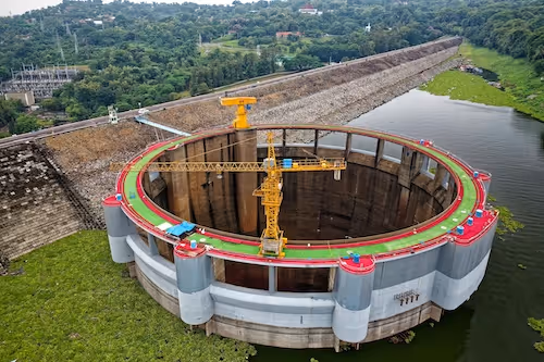
Industries rely on drone tracking for a wide range of use cases such as monitoring site movement, analyzing vehicle flow, measuring agricultural activity, following boats in coastal surveillance, and supporting emergency response. When coupled with detection and segmentation, tracking becomes a powerful tool for automated decision-making and high-level analytics.
How Drone Perspective Reshapes Tracking Challenges
Rapid Scale Variation From Altitude Changes
When drones change altitude, tracked objects may shrink or expand rapidly across frames. This scale variation is far more extreme than in handheld or fixed-camera footage. Research from the Computer Vision Lab at ETH Zurich discusses how scale instability is a defining constraint in aerial tracking. Models must learn to track objects even as pixel density fluctuates dramatically from moment to moment.
Occlusion From Structures and Terrain
Aerial scenes include frequent temporary occlusions caused by trees, buildings, vehicles, or terrain formations. These occlusions can last for multiple frames, forcing models to predict motion without visual confirmation. Effective tracking algorithms incorporate appearance history and trajectory prediction to reconnect objects once they reappear. Without these mechanisms, identities fragment and the tracking sequence becomes unreliable.
Motion Distortion Caused by Drone Flight
Drone motion introduces vibration, tilt, and sudden perspective shifts that distort object shape and location. Stabilization techniques and camera metadata help models compensate for these distortions. Tracking systems must handle motion noise not just from the object but also from the drone itself, making aerial tracking inherently more challenging than ground-based tracking.
Core Algorithms Used in Drone Target Tracking
Correlation-Filter and Feature-Based Trackers
Traditional trackers such as correlation-filter methods use engineered features to predict object motion and update the target's bounding region. These methods remain useful for lightweight onboard deployment because they are computationally cheap. Feature-based trackers, despite being older, remain relevant in scenarios where drones must operate under tight hardware constraints or low latency conditions.
Deep Learning Trackers for High Variability
Modern aerial tracking relies heavily on deep learning models trained to handle motion, appearance changes, and environmental variation. Siamese network-based trackers compare visual features across frames, enabling them to handle rapid deformation. The Visual Tracker Benchmark (VTB) initiative provides extensive research on deep tracking. Deep trackers perform best when trained on diverse aerial video datasets that include environmental and motion complexity.
Multi-Object Tracking Using Detection + Tracking Pipelines
Most real-world drone systems use a multi-object tracking (MOT) pipeline where detections and tracking run jointly. The detector identifies objects in each frame, while the tracker maintains identity across time. MOT systems rely on strong temporal modeling, high-resolution detections, and structured annotation of identity across consecutive frames. When the detection model is weak, tracking stability degrades, making high-quality annotated video essential.
Data and Annotation Techniques for Reliable Tracking
Frame-Level Identity Annotation
Tracking datasets require consistent identity labels across thousands of sequential frames. If the same vehicle or person is given inconsistent IDs by annotators, the model learns unstable associations. Identity consistency also helps downstream tasks such as trajectory analysis and behavior modeling. This makes annotation guidelines and QA procedures especially important for tracking workflows.
Annotating Hard Cases and Long Sequences
Tracking datasets must include difficult examples such as occlusion, blur, scale change, and environmental noise. These hard cases provide training signals that improve model robustness. Long continuous sequences are particularly valuable because they teach the model to maintain identity even under changing conditions. Without long sequences, models tend to lose targets or misidentify them during transitions.
Ensuring Temporal Consistency Through QA
Quality assurance for tracking requires reviewing both spatial accuracy and temporal continuity. Even small boundary errors can accumulate across frames, drifting the tracker away from the true target. Multi-stage review processes ensure that identities remain consistent and that difficult frames receive more careful examination.
Operational Considerations for Drone Tracking Deployment
Real-Time Tracking for Onboard Decision-Making
Real-time tracking is critical for drones performing autonomous navigation, security missions, or emergency response. To support onboard inference, models must be lightweight, optimized, and trained on data that matches real flight conditions. Under real constraints, accuracy is only one requirement; stability and latency matter equally.
Post-Processed Tracking for Analysis and Reporting
In many industries, tracking is performed offline after flight to analyze long-term patterns, detect anomalies, or prepare operational reports. Post-processed tracking can run heavier, more accurate models and leverage full-resolution video without hardware limitations. This approach is common in site monitoring, agricultural analysis, and environmental conservation.
Testing Tracking Consistency Over Time
Before deployment, tracking systems must be tested across multiple days, seasons, and terrain types. Changes in lighting, weather, infrastructure layout, or vegetation density can subtly affect the model. Continual testing ensures tracking remains reliable as operational conditions evolve.
Supporting Target Tracking Drone With High-Precision Data Annotation
Drone target tracking provides a foundation for advanced aerial automation, from industrial monitoring to wildlife analysis and real-time mission support. Its accuracy depends on consistent identity annotation, diverse video datasets, and models trained to handle aerial complexity. If you are developing aerial tracking capabilities and need help with dataset creation, sequential annotation, or quality assurance, we can explore how DataVLab supports robust tracking pipelines tailored to real-world drone operations.