Understanding SAR Imagery and Its Relevance in AI
Synthetic Aperture Radar (SAR) represents a groundbreaking advancement in remote sensing technology. Unlike traditional optical satellites that depend on sunlight and clear skies to capture imagery, SAR systems transmit their own microwave signals and capture the reflected echoes to form high-resolution images of Earth's surface. This makes them immune to weather conditions and capable of nighttime imaging, granting them unparalleled versatility.
How SAR Works in Simple Terms
Imagine a flashlight shining through clouds, capturing not just what you see on the surface, but also surface textures and structure—this is the power of SAR. The “synthetic aperture” component refers to how the radar system simulates a large antenna by moving across a target area and combining multiple echoes. This allows SAR to produce sharp images, even at long distances and through obstacles like fog, smoke, and vegetation.
SAR sensors typically operate across different frequency bands:
- X-band: Captures fine features like roads and buildings
- C-band: Common for wide-area monitoring, used in Sentinel-1
- L-band: Penetrates through foliage and soil, useful in forestry and Agriculture
This flexibility across temporal, spatial, and spectral dimensions positions SAR as a critical data source in geospatial AI systems—especially where traditional imaging fails or falls short.
Preparing SAR scenes for model training requires geospatial data annotation services that account for sensor artifacts, scale, and spatial context.
Why SAR Is Critical for Earth Observation AI
SAR is not just a backup when the sky is cloudy—it brings unique value:
- Consistent temporal coverage: Captures changes over time with minimal interference.
- Detailed structural information: Ideal for detecting ground deformation, water presence, or subsurface patterns.
- Day-and-night monitoring: Crucial for emergency response and time-sensitive applications.
- Surface interaction properties: Different polarization combinations (e.g., VV, VH, HH) reveal physical characteristics like texture, moisture, or vegetation type.
For AI systems, these features offer richer, more reliable datasets, especially in regions where optical imagery is inconsistent or misleading. However, leveraging this potential requires careful interpretation and annotation of SAR data—a task that is far from straightforward due to the sensor's complexity and noisier outputs.
Why Annotating SAR Data Is Inherently Difficult ⚠️
Annotating SAR imagery is vastly different from annotating traditional optical images. Here’s why:
Speckle Noise and Visual Complexity
SAR images contain a phenomenon known as speckle, a granular noise that arises from the coherent nature of radar backscatter. This noise distorts visual clarity and can make it extremely hard for human annotators—and even some AI models—to distinguish between object boundaries.
Non-Intuitive Image Representation
Unlike RGB images that humans interpret naturally, SAR images represent surface backscatter intensity, often producing patterns that are counterintuitive. Brightness doesn't equate to visibility—objects like metal roofs or wet soil may appear brighter than vegetation or dry land, depending on the radar frequency and polarization.
Polarization and Multi-Frequency Complexity
SAR systems can operate in various polarizations (HH, HV, VV, VH), each revealing different surface properties. Additionally, multi-frequency SAR (e.g., X-band, C-band, L-band) adds layers of complexity, requiring different annotation strategies for each type.
Temporal and Geometric Distortions
SAR imagery is susceptible to geometric distortions such as foreshortening, layover, and shadowing, especially in mountainous or urban areas. These distortions complicate both visual interpretation and consistent labeling.
Scarcity of Annotated Datasets
Unlike optical imagery, SAR datasets with high-quality, verified annotations are rare. This scarcity hinders transfer learning and limits the availability of pre-trained models, making every annotation effort more critical.
Key Use Cases That Rely on SAR Annotation
AI-powered applications using SAR data are growing rapidly, spanning sectors from environmental conservation to national security. Below are some of the most impactful and annotation-intensive SAR use cases:
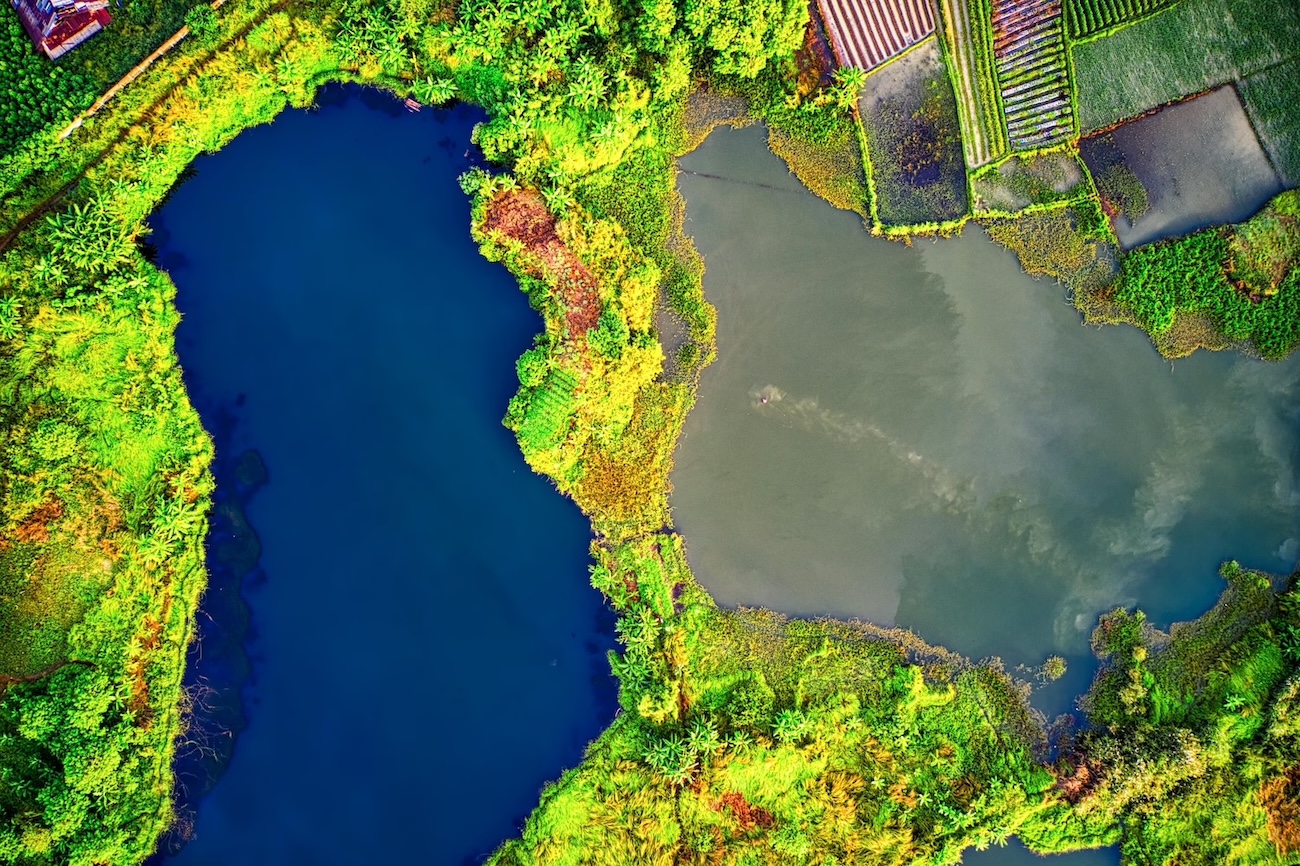
🌊 Flood Detection and Management
SAR's ability to detect water-covered surfaces even under cloud cover makes it ideal for flood monitoring. When rapid response is essential, SAR imagery provides critical insights into:
- Inundated zones and flood extent
- Damage to infrastructure and agriculture
- Changes in water level over time
Annotation Challenge: Differentiating water from wet soil or low-reflectivity surfaces requires nuanced labeling. Boundaries may be blurred, especially in urban areas or delta regions.
Real-World Application: The Sen4Floods project combines annotated SAR data with AI to create flood maps in near-real-time, supporting disaster response teams globally.
🌳 Forest Monitoring and Illegal Logging Detection
L-band SAR can penetrate forest canopies, revealing biomass density, forest health, and signs of illegal deforestation. With time-series analysis, even gradual canopy changes become visible to trained models.
Annotation Challenge: Forest types often appear visually similar in SAR imagery. Annotating temporal data to reflect change—rather than static features—is crucial.
Real-World Application: Organizations like Global Forest Watch leverage SAR data to track forest loss in remote and cloudy areas like the Congo Basin and Amazon.
🏙️ Urban Expansion and Informal Settlements
SAR is indispensable for tracking urban growth, identifying new constructions, and mapping slums or refugee camps in regions lacking updated cadastral maps.
Annotation Challenge: Buildings may cast radar shadows or cause layover effects, making geometry irregular. Multiple SAR passes and polarization channels often need to be interpreted together for accurate annotation.
Use Case: Urban planners use SAR to monitor unauthorized construction or infrastructure development in fast-growing cities where optical data is blocked by smog or cloud cover.
🛤️ Infrastructure and Ground Subsidence Monitoring
SAR interferometry (InSAR) can detect ground displacement on the order of millimeters—perfect for spotting risks to railways, bridges, or dams.
Annotation Challenge: Changes may be gradual and invisible in single-frame imagery. Annotators must label displacement across time-lapse images and relate patterns to known geophysical activity.
Use Case: The Daresbury Hartree Centre uses annotated SAR datasets to build AI models that flag structural vulnerabilities in critical UK infrastructure.
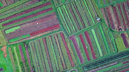
🛰️ Agricultural Monitoring and Soil Moisture Estimation
SAR is increasingly used to assess crop health, tillage practices, and soil moisture, especially in regions where optical methods fail due to cloud coverage.
Annotation Challenge: Differentiating between crop types, growth stages, and moisture levels from backscatter data can be counterintuitive. Seasonality must also be factored in during annotation.
Example: SAR-based crop mapping tools are helping farmers and governments improve yield prediction and water management, especially in monsoon-heavy regions of Asia.
🌋 Volcano and Earthquake Impact Analysis
SAR is sensitive to surface deformation caused by tectonic movements or volcanic uplift. Annotating these subtle patterns helps in early warning systems and post-disaster assessment.
Annotation Challenge: Requires temporal annotation over multi-year intervals. SAR images must be aligned precisely, and noise filtered effectively to trace movement accurately.
Real-World Example: The NASA OPERA Project uses SAR time-series imagery to detect terrain deformation caused by earthquakes, landslides, and volcanic activity.
🔒 Defense, Security, and Border Monitoring
In areas with restricted access or high risk, SAR allows intelligence teams to monitor troop movements, vehicle deployments, or changes in structures.
Annotation Challenge: High noise levels and camouflage tactics can mask objects. Labeling must be consistent, detailed, and often multi-temporal to capture suspicious activity patterns.
Real-World Application: Governments and defense contractors use annotated SAR to create AI models that can flag anomalies in surveillance zones with minimal human oversight.
Best Practices for Annotating SAR Imagery with Precision 🧠
Getting SAR annotation right demands a specialized approach. Here are some proven strategies:
1. Preprocessing and Speckle Reduction
Apply speckle filtering (e.g., Lee, Frost, Gamma-MAP) before annotation to improve clarity. While this doesn’t eliminate all noise, it provides a more consistent surface for annotation without compromising data integrity.
Tip: Never use overly aggressive filters—preserving backscatter details is essential for downstream model accuracy.
2. Use Multi-Modal References
Whenever possible, align SAR images with co-registered optical imagery, GIS layers, or DEMs. This hybrid approach helps annotators understand what the SAR features represent in the real world.
Example: Annotating flooded buildings becomes more accurate when paired with pre-flood optical images and elevation data to detect depressions.
3. Develop Domain-Specific Annotation Guidelines
Create detailed SOPs that are tailored to SAR data. Include:
- Label interpretation examples (e.g., water vs. wet soil)
- Frequency-specific differences
- Handling geometric distortions
- Guidelines for multi-temporal imagery
This ensures annotation consistency, especially when using distributed teams or crowdsourcing platforms.
4. Train Annotators with SAR Literacy
Annotation teams should be trained not only in labeling tools but also in interpreting SAR data. Understanding how radar interacts with terrain and materials improves annotation precision and confidence.
Recommended resource: ESA SAR Education Portal
5. Integrate Human-in-the-Loop QA Systems
Use a tiered review system involving both trained annotators and SAR domain experts. Cross-validation helps flag ambiguous labels and refine the dataset iteratively.
6. Leverage Weak Supervision and Active Learning
Instead of labeling every image from scratch, use model-assisted annotation or active learning workflows. Start with a small, high-quality dataset, then iteratively label samples where model confidence is low.
This dramatically reduces manual workload and improves dataset efficiency over time.
The Role of Temporal SAR Annotation in Change Detection
SAR's unique capability to capture consistent time series opens doors for annotating temporal events, such as:
- Progressive flooding
- Deforestation over months
- Land subsidence
- Urban sprawl
These use cases require frame-to-frame continuity, where annotations must reflect not just a snapshot, but an evolving pattern. Annotating SAR time series is thus both more labor-intensive and more valuable.
Best practices here include:
- Using sequence-aware labeling tools
- Tracking object permanence (e.g., persistent water vs. temporary pooling)
- Structuring annotations as spatio-temporal graphs
Common Pitfalls in SAR Annotation Projects 🚫
Even with best intentions, SAR annotation projects can go wrong. Here's what to avoid:
Misinterpreting Backscatter
Annotators often confuse high-intensity regions as high-importance features. For instance, a metal shed might shine brighter than a flooded field, leading to mislabeled data.
Inconsistent Labeling Across Frequencies
Annotations applied blindly across X-band and L-band SAR images will likely fail. Each band reflects different surface structures and penetrates to varying depths.
Ignoring Polarization
VV and HV images reveal different aspects of the same scene. Failing to annotate accordingly can lead to poor generalization in AI models.
Overlooking Contextual Cues
Focusing too narrowly on local textures can lead to missed insights. Broader geographic context—rivers, elevation, surrounding land use—can change label interpretations significantly.
Building Better Datasets for SAR AI Models
Creating a robust SAR dataset isn't just about labeling—it’s about dataset design. Here’s how to future-proof your annotation efforts:
Ensure Balanced Class Distribution
SAR scenes often contain sparse instances of key classes (e.g., flooded buildings or newly constructed roads). Oversample or synthetically augment these underrepresented categories to prevent model bias.
Annotate for Generalization
Include scenes from different seasons, geographies, and sensor types (e.g., Sentinel-1, TerraSAR-X) to improve model robustness across contexts.
Embed Metadata
Store sensor metadata, acquisition date, orbit track, and weather conditions alongside annotations. This allows downstream AI pipelines to make context-aware predictions.
Real-World Annotation Projects Leveraging SAR 🛰️
1. Sen4Floods by ESA
This project used multi-temporal Sentinel-1 data and AI models trained on expertly annotated flood masks to support emergency response teams worldwide.
2. Daresbury Radar AI for Infrastructure
The UK’s Hartree Centre applied SAR-based AI to monitor ground motion around key infrastructure, relying heavily on precise annotation of subsidence events.
3. NASA’s OPERA Project
NASA’s OPERA project is working on a global SAR-based surface dynamics catalog. Annotation efforts include tracking floods, landslides, and surface deformation using long-term SAR time series.
These initiatives reflect the critical importance of quality annotations in turning SAR into an actionable AI asset.
What the Future Holds for SAR Annotation
The evolution of SAR sensors—higher resolution, new frequencies, and even onboard AI—will open new annotation frontiers. Key trends include:
- SAR + ML Fusion Models: Combining radar with optical and hyperspectral data will require cross-modal annotation schemas.
- Synthetic Data Generation: As real data remains limited, simulated SAR images may be used to bootstrap training datasets.
- Cloud-Based SAR Annotation Platforms: Expect integrated tools where satellite tasking, labeling, and AI training are all part of a single pipeline.
These advancements will only be valuable if supported by sound annotation practices and human expertise.
Let’s Bring It Down to Earth: Your Next Move 🌍
If you're working with SAR data—or planning to—you already know it’s not plug-and-play. The complexity is high, but so is the potential. Whether you're building flood detection models, monitoring infrastructure, or developing environmental AI, getting the annotation right is your foundation for success.
Need help scaling or improving your SAR annotation pipeline?
At DataVLab, we specialize in crafting high-quality SAR annotation workflows tailored to your use case—whether it's disaster response, climate modeling, or satellite analytics. Our experienced annotators, SAR-aware workflows, and model-integrated feedback loops ensure that your dataset becomes an asset, not a liability.
👉 Let’s explore your project—reach out today and let’s build AI that sees what others can’t.