
Agriculture Data Annotation Services for Farming AI, Crop Monitoring, and Field Analytics

Agriculture Data Annotation Services
Built for teams shipping agritech AI who need reliable labeled documents. You get segmentation masks and tracking, stable label guidelines, and QA you can audit, without slowing your roadmap. Agriculture Data Annotation Services is delivered with secure workflows and consistent reporting from pilot to production.
Consistent annotation of crops, soil patterns, livestock, field structures, and aerial imagery.
Support for yield prediction, field analytics, pest detection, and precision agriculture models.
Quality control adapted to large agricultural datasets and varied environmental conditions.
Agriculture and farming increasingly rely on computer vision and AI to improve yield prediction, automate field monitoring, detect crop stress, and optimize resource use.
Models trained on accurately labeled farming data can identify crop conditions, analyze soil and vegetation patterns, classify machinery, monitor livestock, detect pests and diseases, and support precision irrigation. DataVLab provides agriculture data annotation services for agritech companies, drone analytics platforms, environmental monitoring systems, precision agriculture tools, and AI research teams.
Our annotators follow structured guidelines adapted to crop species, growth stages, field structure, multispectral signatures, vegetation classes, and agronomic workflows. We support segmentation, plant counting, disease detection, soil condition annotation, livestock tracking, machinery identification, crop row detection, and multispectral analytics. Quality control includes multi stage review, growth stage validation, spectral interpretation checks, and consistency verification across large AOIs.
How DataVLab Supports Agriculture and Farming AI
Structured annotation workflows aligned with crop analytics and farming automation.

Crop Segmentation and Growth Stage Labeling
Polygon and pixel level annotation
We segment crop regions and identify growth stages for yield forecasting.
Disease and Pest Detection
Annotating stress signals
We label lesions, discoloration, pest traces, and disease patterns.
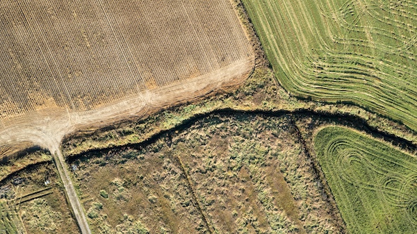
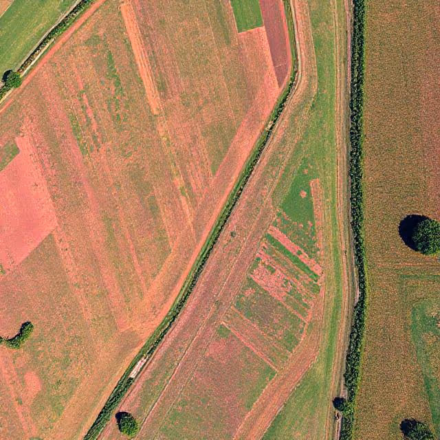
Drone and Satellite Field Annotation
Supporting multispectral analytics
We annotate NDVI based crop conditions and field zoning.
Livestock Tracking
Bounding boxes and keypoints
We track cattle, poultry, and other livestock for welfare monitoring.
Machinery Annotation
Supporting farm automation
We annotate tractors, sprayers, and equipment.
Soil and Field Condition Labeling
Terrain and moisture analysis
We label soil patches, erosion indicators, and water stress patterns.
Discover How Our Process Works

Defining Project
Sampling & Calibration
Annotation
Review & Assurance
Delivery
Explore Industry Applications


We provide solutions to different industries, ensuring high-quality annotations tailored to your specific needs.
We provide high-quality annotation services to improve your AI's performances

Annotation & Labeling for AI
Unlock the full potential of your AI application with our expert data labeling tech. We ensure high-quality annotations that accelerate your project timelines.
Agritech Data Annotation Services
High accuracy annotation for agritech applications including precision farming, field robotics, multispectral analytics, yield prediction, and environmental monitoring.
Plant Annotation Services
High precision plant level annotation for leaf segmentation, disease detection, phenotyping, growth analysis, and scientific agriculture datasets.
Drone Image Annotation
High accuracy annotation of drone captured images for inspection, construction, agriculture, security, and environmental applications.
Aerial Image Annotation
High quality annotation of aerial photography for mapping, inspection, agriculture, construction, and environmental analysis.
FAQs
Here are some common questions we receive from our clients to assist you.
What is agriculture data annotation and what does it cover?
Agriculture data annotation labels visual and sensor data from agricultural environments to train AI systems for crop monitoring, yield estimation, pest and disease detection, autonomous farming equipment, and precision agriculture applications. It includes labeling crop types, plant health status, growth stages, pests, diseases, weeds, and soil conditions from drone imagery, satellite imagery, ground-level cameras, and multispectral sensor data. Agriculture AI annotation requires annotators and reviewers with agronomic knowledge because the relevant classes (specific pest species, disease symptoms, growth stages) require domain expertise to identify correctly.
Why does agriculture annotation require agronomic domain expertise?
Agronomic expertise is required because the visual differences between healthy and diseased crops, between pest damage and nutritional deficiency, and between different weed species are subtle and require domain knowledge to correctly identify. A trained annotator can distinguish bacterial blight from fungal leaf spot in a soybean field, identify aphid infestations from overhead drone imagery, or correctly classify wheat growth stage from a field camera. Without this expertise, annotation produces incorrect labels that teach the model the wrong visual patterns, directly reducing its agricultural utility. DataVLab works with agronomists and agricultural scientists for annotation review in agriculture projects.
What types of agricultural data do you annotate?
Agriculture AI annotation uses several data types. RGB drone imagery from UAVs captures field conditions at high spatial resolution for crop counting, weed mapping, and canopy analysis. Multispectral and hyperspectral imagery captures plant stress, chlorophyll content, and soil properties invisible to standard cameras. Satellite imagery provides large-scale field mapping for yield estimation and crop type classification. Ground-level camera imagery captures individual plant condition for disease and pest detection. LiDAR point clouds capture 3D plant structure for biomass estimation and harvest planning. Annotation requirements vary substantially by sensor type: multispectral annotation requires understanding of spectral indices like NDVI, while LiDAR annotation requires 3D spatial analysis skills.
What are the unique challenges in annotating drone and satellite imagery for agriculture?
Drone and satellite imagery annotation presents unique challenges absent from standard camera annotation. Variable altitude creates objects at wildly different scales in the same dataset: a field annotated from 30 meters altitude looks completely different from the same field annotated from 120 meters. Geographic coordinate systems require annotations to be spatially accurate in the real world, not just visually accurate in the image. Seasonal and lighting variation means the same crop type looks dramatically different across the growing season and in different light conditions. For satellite imagery, cloud cover and atmospheric effects require annotators to make inferences about partially obscured land cover.
What are the main use cases for agriculture AI annotation?
Agriculture AI annotation is used across a wide range of precision agriculture applications. Crop health monitoring: identifying plant stress, disease, and nutritional deficiency from aerial and ground imagery. Weed detection: distinguishing weeds from crops for targeted herbicide application that reduces chemical use. Yield estimation: labeling fruit counts, canopy density, and maturity indicators for harvest planning. Pest detection: identifying insect pests and their damage patterns from close-range imagery. Autonomous equipment navigation: labeling crop rows, field boundaries, and obstacles for autonomous tractor and harvester guidance. Soil and land use analysis: classifying land cover types, soil erosion indicators, and drainage patterns from satellite imagery.
What agriculture annotation capabilities does DataVLab provide?
DataVLab provides agriculture data annotation for drone imagery, satellite imagery, ground-level camera imagery, and multispectral sensor data. We work with agricultural AI companies, precision agriculture platforms, agtech startups, research institutions, and farming organizations that need labeled agricultural datasets. Our annotation network includes agronomists and agricultural scientists who provide domain expertise for tasks requiring specialist knowledge. For European agricultural AI programs, EU-based annotation teams are available for projects with sovereignty or data residency requirements. We cover all major European crop types, growing regions, and agricultural contexts.


Custom service offering
Up to 10x Faster
Accelerate your AI training with high-speed annotation workflows that outperform traditional processes.
AI-Assisted
Seamless integration of manual expertise and automated precision for superior annotation quality.
Advanced QA
Tailor-made quality control protocols to ensure error-free annotations on a per-project basis.
Highly-specialized
Work with industry-trained annotators who bring domain-specific knowledge to every dataset.
Ethical Outsourcing
Fair working conditions and transparent processes to ensure responsible and high-quality data labeling.
Proven Expertise
A track record of success across multiple industries, delivering reliable and effective AI training data.
Scalable Solutions
Tailored workflows designed to scale with your project’s needs, from small datasets to enterprise-level AI models.
Global Team
A worldwide network of skilled annotators and AI specialists dedicated to precision and excellence.
Potential Today
Blog & Resources
Explore our latest articles and insights on Data Annotation


We are here to assist in providing high-quality data annotation services and improve your AI's performances