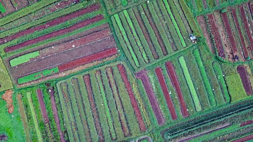
A crop classification dataset is a collection of satellite, drone, or aerial images annotated with crop type labels. These labels identify what is growing in each field, enabling AI models to differentiate between wheat, corn, soybeans, rice, vegetables, orchards, vineyards, and other agricultural categories. Crop classification is important because it helps governments, farmers, and agribusinesses understand production trends, anticipate food supply changes, and optimize agricultural practices.
The rise of Earth observation systems and affordable multispectral satellites has significantly expanded access to agricultural imagery. Organizations now have the ability to monitor millions of hectares consistently and in near real time. Research from the Food Systems Research Network at Stanford University highlights how crop classification supports global food security by enhancing forecasting and land management. High quality datasets make these large scale analyses possible by providing the labeled examples needed to train robust AI models.
Crop classification datasets are used for many tasks, including crop type mapping, crop rotation analysis, yield estimation, field boundary extraction, and vegetation health assessment. Each task requires specific annotation structures and curated imagery to ensure accurate modeling.
Why Crop Classification Matters
Supporting global food security
Accurate crop classification helps governments and agencies assess the supply of key staples. Early insights into crop conditions reduce uncertainty and support stable pricing across global food markets. Remote sensing makes large scale food production monitoring possible without intensive manual inspections.
Enabling precision agriculture
Farmers use crop classification to tailor fertilizer, irrigation, and planting strategies. Knowing the crop type and growth stage helps agronomists adjust interventions to improve yield and reduce resource waste. Precision agriculture improves sustainability by aligning inputs with real crop needs.
Monitoring crop rotation and land use
Monitoring what crops are grown over time helps detect patterns that impact soil fertility and environmental sustainability. Crop rotation affects nutrient cycles, pest dynamics, and long term productivity. Accurate classification helps farmers adopt healthier planting strategies.
Enhancing agricultural insurance
Insurance companies rely on crop maps and classification datasets to assess risk in agricultural regions. These datasets support claim verification, drought impact analysis, and regional risk modeling. Automated crop classification reduces fraud risk and improves claim handling efficiency.
Strengthening environmental conservation
Crop classification plays a role in monitoring deforestation, land conversion, and water consumption. Agricultural expansion can significantly alter ecosystems, and classification data helps researchers quantify these changes. Studies from the World Resources Institute emphasise how land use monitoring supports sustainable natural resource management.
Crop classification therefore affects everything from farm level decisions to global food policy.
How Crop Classification AI Works
Spectral signature analysis
Different crops reflect light differently across spectral bands. AI models learn the spectral signatures of each crop type by analyzing multispectral or hyperspectral imagery. These signatures vary based on crop structure, leaf shape, pigmentation, and moisture content.
Temporal modeling of growth cycles
Crop appearance changes dramatically across the growing season. Models incorporate time series images to track phenological stages, allowing them to differentiate crops based on seasonal growth patterns. This temporal dimension greatly enhances classification accuracy.
Field boundary segmentation
Before crops can be classified, models often extract field boundaries using segmentation. Accurate boundaries ensure that pixels are assigned to the correct field and crop.
Classification of multispectral pixels
Once boundaries are defined, classification models analyze the aggregated spectral information within each field to determine the crop type. Models may assign a single label per field or create pixel level crop maps for large heterogeneous areas.
Model post processing
Post processing smooths classification outputs and corrects inconsistencies. Spatial filters, rule based adjustments, and morphological operations improve overall map quality and reduce noise.
This workflow requires carefully curated datasets that capture diverse growing conditions and agricultural practices.
NDVI and Vegetation Indices in Crop Classification
Normalized Difference Vegetation Index (NDVI) is one of the most widely used predictors in crop classification. NDVI measures vegetation vigor based on the reflectance of red and near infrared light.
NDVI as a crop health indicator
Healthy crops reflect more near infrared light and less visible red light. NDVI quantifies this relationship and provides a reliable measure of plant health. Seasonal NDVI patterns vary by crop type, and models can leverage these patterns for classification.
Multi temporal NDVI analysis
NDVI is most powerful when observed across time. Seasonal NDVI curves highlight how each crop species develops from planting to maturity. AI systems use these curves as signatures to distinguish crop types.
Integration with multispectral data
NDVI complements other vegetation indices such as EVI, SAVI, and NDRE. Together, these metrics offer a deeper understanding of canopy structure and chlorophyll content. Insights from the Global Agriculture Monitoring Initiative (GEOGLAM) show that combining NDVI and multispectral data improves agricultural monitoring accuracy.
NDVI serves as a crucial feature in many crop classification datasets because it captures plant biology across space and time.
Geospatial Inputs for Crop Classification
Crop classification datasets often incorporate multiple geospatial data sources. These inputs enrich the dataset and allow AI models to interpret complex agricultural environments.
Multispectral satellite imagery
Multispectral satellites such as Landsat, Sentinel 2, and commercial providers offer the spectral depth required for crop classification. Different bands help distinguish crop types based on reflectance properties.
Radar data
Synthetic Aperture Radar (SAR) imagery penetrates clouds and provides structural information. SAR enhances crop classification during cloudy seasons or regions with frequent rainfall.
Drone based imagery
Drones capture high resolution images that complement satellite data and help with local field analysis. These images support precise boundary extraction and fine grained classification.
Soil and climate layers
Crop growth depends heavily on soil composition, precipitation patterns, and temperature. Environmental layers enrich models by adding contextual factors.
Field survey data
Ground truth observations from agronomists help validate remote sensing predictions. Field level data increases dataset reliability and supports supervised model training.
Crop classification performance improves significantly when datasets integrate diverse and complementary geospatial inputs.

Annotation for Crop Classification Datasets
Field boundary annotation
Annotators draw polygons around agricultural fields, ensuring that each field is clearly defined. Accurate boundaries are essential for assigning the correct crop labels.
Crop type labeling
Each field polygon receives a crop label based on field records, surveys, or visual interpretation. Consistent labeling requires strict guidelines and domain expertise.
Pixel level crop masks
Some projects require segmentation masks to classify individual pixels. This approach is useful for mixed or fragmented fields where different crops grow in close proximity.
Temporal annotation
Annotators ensure that field labels apply consistently across multi date imagery. Temporal consistency is crucial for accurate modeling of seasonal crop patterns.
Validation and quality checks
Quality assurance processes include cross referencing field data, reviewing polygons, and validating labels against auxiliary datasets. Annotation errors can propagate through the model and reduce overall accuracy.
Annotation is the main bottleneck in crop classification dataset creation because it requires domain expertise and precise geospatial workflows.
Challenges in Building Crop Classification Datasets
Seasonal variation
Crops look different early in the growing season versus near harvest. Datasets must include multi seasonal imagery to avoid ambiguity.
Similarity across crop species
Some crops have similar spectral signatures during certain growth stages. Early season crops often require temporal data to differentiate accurately.
Mixed and fragmented fields
Small farms may plant multiple crops in one field or maintain irregular boundaries. These factors complicate pixel level classification.
Cloud cover and atmospheric noise
Clouds obscure farmland, making it difficult to capture consistent imagery throughout the season. Radar imagery can help fill these gaps.
Regional variability
Crop varieties differ across continents. A model trained on European wheat may not generalize to Asian wheat. Datasets must reflect regional agricultural diversity.
Label availability
Ground truth labels may not exist for large regions. Incomplete field data creates labeling gaps that require manual interpretation or supplemental surveys.
Overcoming these challenges requires careful dataset design, robust annotation strategies, and diverse imagery sources.
Applications of Crop Classification
Precision farming
Farmers use crop maps to optimize irrigation, fertilization, and pesticide application. Accurate crop type information enhances decision making at field level.
Food supply forecasting
Governments and food agencies assess production trends using crop classification models. Early insights support supply chain planning and market stabilization.
Agricultural insurance and risk analysis
Insurers depend on accurate crop maps to assess risk exposure. Crop classification datasets help verify claims and detect anomalies after climate events.
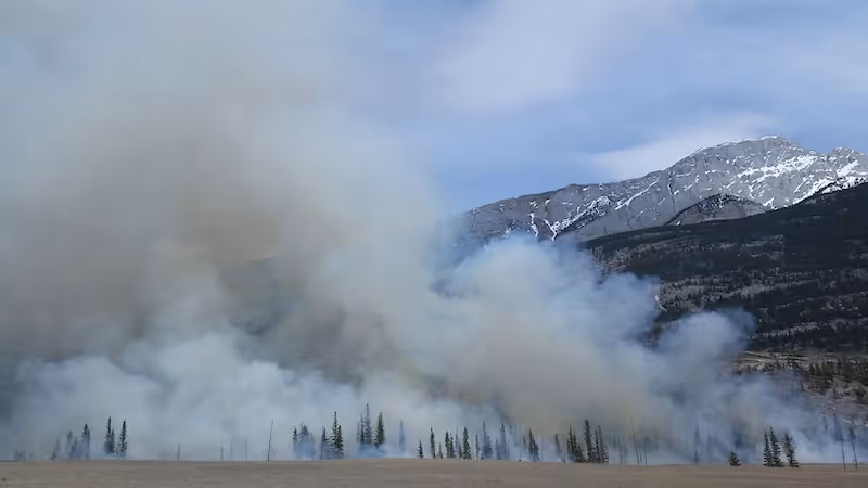
Environmental conservation
Mapping agricultural expansion helps conservation groups identify areas at risk of deforestation or habitat loss or wildfire. Crop classification supports sustainable land management.
Market intelligence
Commodity traders monitor crop conditions using remote sensing. Predicting yield trends offers competitive insights in global markets. The Institute for Agriculture and Trade Policy provides research illustrating the economic value of remote crop monitoring.
Crop classification datasets serve a broad ecosystem of stakeholders who depend on actionable agricultural intelligence.
Solar Panel Detection and Agricultural Land Use
Crop classification datasets often intersect with solar panel detection datasets. Renewable energy installations increasingly appear on farmland or near agricultural zones.
Mapping solar infrastructure in rural regions
Detecting solar panels helps track the expansion of renewable energy. These maps identify interactions between energy production and agricultural land availability.
Assessing farmland conversion
Solar farms may replace agricultural land. Crop classification datasets help quantify how much farmland is converted to renewable energy installations.
Modeling energy agricultural interactions
Understanding the co-location of solar farms and crops helps planners evaluate land use tradeoffs. This integrated approach improves long term sustainability planning.
Solar panel detection is therefore an important complementary dataset in modern environmental and agricultural analysis.
Future Directions in Crop Classification and Agricultural AI
Fusion of multisensor data
Combining optical, radar, hyperspectral, and thermal data enhances model reliability and fills observational gaps caused by cloud cover.
Self supervised learning
Self supervised models will reduce dependency on labeled data by learning from large volumes of unlabeled satellite imagery. This dramatically lowers dataset creation costs.
Fine grained classification
Future models will identify crop varieties, disease stages, and nutrient deficiencies at high resolution. These fine grained insights support precision agriculture.
Near real time agricultural monitoring
Advances in on orbit processing and cloud infrastructure will allow faster data delivery. Farmers will receive insights within hours rather than days.
Global scale yield forecasting
AI driven yield models integrating climate variables, field boundaries, and time series imagery will support predictive agriculture at national and global levels.
The future of crop classification lies in deeper automation, richer datasets, and integrated agricultural intelligence systems.
Conclusion
Crop classification datasets provide the essential foundation for agricultural AI systems that support global food security, precision agriculture, environmental monitoring, and supply chain planning. By integrating multispectral imagery, NDVI time series, field boundary annotation, and ground truth labels, these datasets enable accurate classification across diverse farming systems. As agriculture continues to face climate challenges and demand for food increases, organizations that invest in robust dataset creation and geospatial AI capabilities will be better positioned to manage risk, improve productivity, and support sustainable land use.
If your team needs expertly annotated crop classification datasets, NDVI segmentation, or large scale agricultural labeling, contact DataVLab.
We help build high quality geospatial datasets for agriculture, environment, and remote sensing AI.