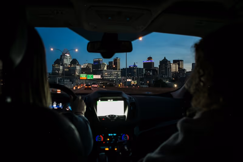
Why Lane Detection Matters in Autonomous Driving 🛣️
Lane detection is not just another perception task—it’s the backbone of safe autonomous driving. AVs must consistently interpret their position on the road, anticipate lane changes, navigate intersections, and stay centered. This all begins with annotated data.
Every lane marking helps the AV answer a critical question: Where can I drive?
Errors in lane perception can lead to:\
- Drifting into adjacent lanes
- Missing exits
- Misinterpreting intersections
- Unsafe autonomous behaviors in shared environments
To prevent this, AV developers need annotated datasets that represent real-world conditions: straight roads, sharp curves, tunnels, rain-soaked highways, or construction-diverted lanes.
The quality of the AI model is tightly bound to the quality of the annotated data.
The Complexity Behind Lane Annotations
Lane annotation is deceptively complex. On the surface, it may seem like a simple task—draw a few lines along the road and move on. But in practice, it’s one of the most technically challenging and context-dependent annotation tasks in the autonomous vehicle (AV) domain.
Here’s why lane annotation is so demanding:
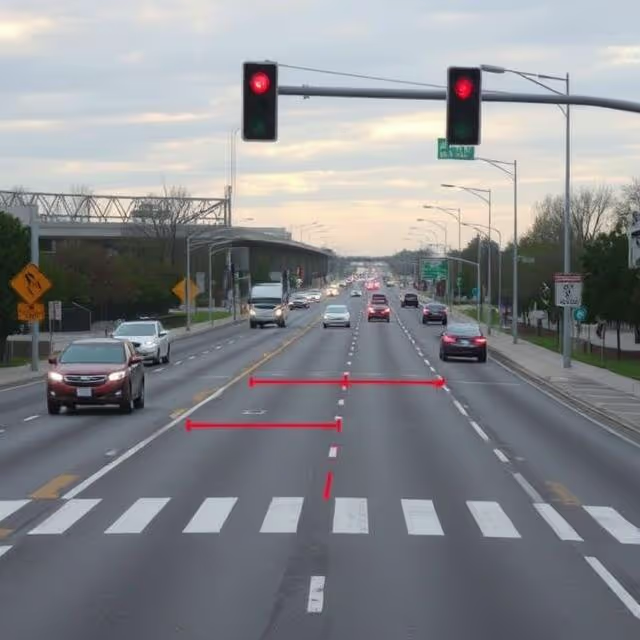
🌀 Lanes Aren’t Static or Uniform
Unlike discrete objects like traffic signs or vehicles, lane lines are fluid, continuous, and often highly irregular. A single lane can:
- Curve, branch, or fade over a sequence of frames
- Vary in style—solid, dashed, double lines, painted arrows, merge indicators
- Change color depending on the road type and region (e.g., white in Europe, yellow in North America for opposing traffic lanes)
This variability makes it hard to apply static labeling templates. Annotators must evaluate every segment contextually.
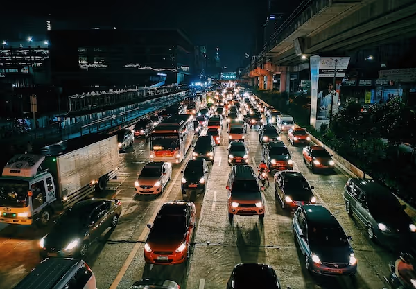
🌫️ Environmental Variability
Lane markings are frequently obscured by:
- Weather conditions: Rain, snow, and fog can erase visibility
- Lighting issues: Glare, overexposure, and underexposure affect clarity, especially during dawn or dusk
- Wear and tear: Faded paint, road work disruptions, and old markings that were never removed
In such conditions, human annotators often need to infer lane boundaries, not simply label what they see. This introduces subjectivity and increases the risk of inconsistent labels.
🚗 Occlusions and Interference
Lane lines are often partially or completely hidden by:
- Large vehicles (e.g., trucks, buses)
- Road debris or temporary cones
- Pedestrians or cyclists crossing the path
- Shadows cast by buildings, overpasses, or trees
Annotators must extrapolate or use temporal cues (previous and next frames) to infer the lane’s trajectory.
🔁 Temporal Consistency Requirements
A key differentiator in lane annotation is that it must be temporally stable—meaning that a lane should appear continuous and consistent across multiple frames of a video sequence.
Even a slight misalignment can break the continuity of a lane, causing AV perception models to misinterpret a straight path as a curve or fail to identify an upcoming merge.
Maintaining temporal coherence requires:
- Annotating sequences, not isolated images
- Implementing interpolation and trajectory smoothing
- Assigning persistent lane IDs across time
This level of rigor isn’t required in object detection and makes lane annotation uniquely demanding.
🌍 International Road Rules and Markings
Lane configurations vary widely between regions and countries:
- Left vs. right-hand traffic (e.g., UK vs. USA)
- Local rules on bus lanes, bicycle paths, reversible lanes
- Different lane markings to denote priority, danger zones, or crosswalks
An annotation team working on international datasets must be trained on these differences. Otherwise, models may learn unsafe or illegal behavior when deployed globally.
🧭 Road Geometry and Elevation Changes
Complex 3D road geometries, such as:
- Bridges, tunnels, and overpasses
- Curving ramps and spiral exits
- Split-level roads
...make 2D annotation even more error-prone. Without an understanding of elevation, camera distortion, and vanishing points, annotators may misplace or misclassify lanes.
That’s where sensor fusion—especially LiDAR and IMU—can bridge the gap.
Strategic Labeling Approaches for Lane Datasets
Successful annotation isn’t about labeling faster—it’s about labeling smarter. That starts with designing a structured annotation protocol. Here’s what leading teams do:
✅ Define a Clear Taxonomy
Establish standard lane types across your project. Common classes include:
- Left driving lane
- Right driving lane
- Centerline
- Turning lane
- Bicycle lane
- Shoulder marking
- Crosswalk lines (if needed for lane context)
A good taxonomy should align with traffic laws in your deployment region(s), while remaining consistent across your dataset.
🧠 Incorporate Semantic Context
Lane markings rarely exist in isolation. Smart annotations account for:
- Nearby vehicles
- Road boundaries
- Intersections
- Signs and arrows
- Stop lines and traffic lights
This semantic layering helps AI understand when a dashed line indicates a turn or a merge, not just a “lane boundary.”
📽️ Focus on Temporal Continuity
Lane annotations across video frames should be temporally consistent. Key strategies include:
- Annotating in clips (not single frames)
- Using interpolation tools
- Applying per-lane identifiers (e.g., lane_1, lane_2) to track continuity
Temporal annotation is crucial for video-based models like 3D CNNs and Recurrent Neural Networks (RNNs) used in AVs.
🌐 Align with Sensor Geometry
If you’re working with LiDAR or GPS-aligned cameras, make sure your annotations respect calibration parameters. Misaligned labels can lead to distorted projections in sensor fusion pipelines.
Common Challenges in Lane Annotation Projects
Even with a robust plan, lane annotation teams often run into the same bottlenecks:
🌧️ Visibility & Weather Conditions
Rain, fog, snow, and night-time conditions obscure lane lines. Annotators must often guess based on limited visual cues, which introduces human bias.
Solution: Use temporal sequences and road context to reinforce weak visual signals.
🧍 Subjectivity in Human Annotation
Even trained annotators may disagree on where a dashed line starts or how to label broken or faded lines.
Solution: Create a detailed annotation guideline with example edge cases and visual references.
⛔ Occlusions from Vehicles or Infrastructure
Lane lines can be blocked by large trucks, pedestrians, or construction elements.
Solution: Annotate based on prior and subsequent frames using interpolation and common-sense inference.
🔁 Frame Misalignment
When using keyframe-based labeling, poor interpolation or skipped frames can cause “lane jumps” that confuse models.
Solution: Implement QA systems that flag abrupt changes in lane geometry.
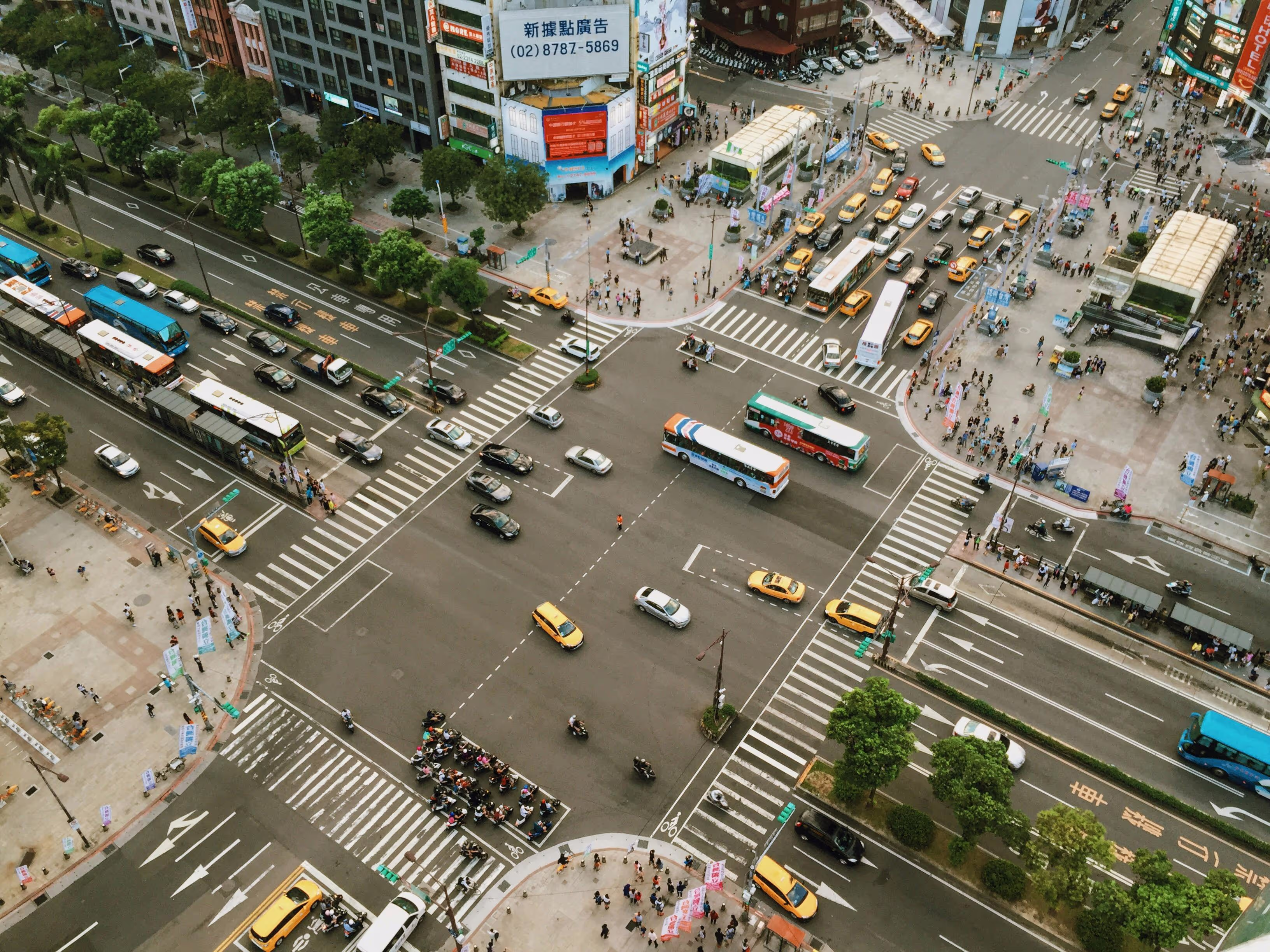
🧩 Diverse Road Designs
Roundabouts, five-way intersections, and reversible lanes add annotation ambiguity.
Solution: Expand your taxonomy and context rules to support complex layouts.
What Makes a Lane Annotation Dataset Truly Robust?
High-quality datasets aren’t just about volume—they’re about coverage and realism. A robust lane dataset should:
- Include various road types: highways, suburban streets, city roads, tunnels, and alleys
- Show diverse weather and lighting: sunny, overcast, foggy, night-time, rainy
- Feature different countries and cultures: left-hand vs. right-hand traffic, multilingual signage
- Include edge cases: road work, traffic diversions, lane shifts
- Be labeled with consistent QA standards
- Support 3D geometry and temporal continuity
📚 Notable public lane datasets include:
- TuSimple Lane Benchmark
- CULane
- ApolloScape Lane Segmentation
- LLAMAS Dataset
- nuScenes (with road geometry metadata)
Sensor Fusion: Enhancing Lane Annotation Accuracy
To tackle the inherent limitations of monocular cameras, modern autonomous vehicle platforms rely on sensor fusion—the integration of multiple sensory inputs like LiDAR, radar, IMU, and GPS. This multi-modal approach significantly improves lane detection and annotation reliability.
Here’s how different sensor types contribute to higher annotation quality:
🧱 LiDAR: Mapping the Road Plane with Precision
LiDAR (Light Detection and Ranging) provides a 3D point cloud representation of the environment. For lane detection:
- It helps define elevation changes, slopes, and road surface contours
- It distinguishes between the flat driving surface and raised curbs or barriers
- It provides dense spatial data, allowing lane boundaries to be confirmed even when visual cues are missing
For example, even if a lane marking is invisible in a rainy video frame, the curvature and surface discontinuity from LiDAR can help annotators reconstruct the likely boundary.
🛰️ GPS and IMU: Anchoring Annotations to Real-World Coordinates
GPS (Global Positioning System) and IMU (Inertial Measurement Unit) sensors track the AV’s location, velocity, orientation, and acceleration in space. When integrated:
- Lane annotations can be geospatially aligned to global maps (e.g., HD maps)
- Annotators can trace lane markings consistently even if the camera perspective shifts
- Annotated lanes can be reused for multiple trips, improving labeling efficiency and consistency
Moreover, GPS data helps differentiate static lane geometry (e.g., permanent paint) from dynamic road features (e.g., temporary diversions), which is critical in urban environments.
🌦️ Radar: All-Weather Support for Annotation Consistency
Radar is less impacted by fog, dust, or heavy rain than cameras or LiDAR. While radar doesn’t directly detect lane markings, it complements annotations by:
- Identifying drivable surfaces in poor weather
- Confirming lane continuity based on the motion of other vehicles
- Supporting multi-modal cross-checks, where annotators verify whether the radar-detected drivable region aligns with the visually inferred lane
Radar helps minimize false positives in lane changes or merges caused by visual occlusions.
🧠 Semantic Map Overlays and HD Map Integration
In advanced pipelines, sensor fusion isn’t limited to raw sensor data—it also includes semantic maps and HD maps with pre-defined lane graphs. Annotators can overlay these on video to:
- Verify that annotations match the official map data
- Identify anomalies (e.g., construction zone changes)
- Automatically suggest lane labels based on geolocation
When done right, this hybrid annotation process reduces cognitive load for annotators and increases geometric accuracy.
🔄 Calibration and Synchronization Challenges
Despite its benefits, sensor fusion also introduces complexity:
- Sensors must be perfectly calibrated and time-synced
- Misalignment between LiDAR and camera frames can distort label placement
- Annotators must be trained on multi-modal visualization tools to make sense of fused data
Annotation tools must support toggling between 2D, 3D, and map views, enabling humans to annotate confidently across all perspectives.
Manual vs. Semi-Automated Lane Annotation at Scale
Pure manual annotation doesn’t scale when you're dealing with thousands of kilometers of driving footage. Here’s how teams are speeding up workflows without losing quality:
🔄 Model-Assisted Pre-Annotation
Use weakly trained models to pre-label data. Human annotators then correct mistakes and validate results. Tools like Scale AI, SuperAnnotate, or CVAT support such workflows.
🏃♀️ Keyframe Interpolation
Instead of labeling each frame, annotators mark keyframes and let software interpolate in between.
Risk: If not properly reviewed, interpolation errors can creep into the dataset.
🤝 Crowdsourced-Hybrid Models
Some projects use crowdsourced workers to annotate basic lane shapes, then have trained QA teams refine them.
Tip: Always define fallback rules when workers disagree.
Quality Assurance: A Must-Have, Not a Bonus
Quality control is crucial, especially for safety-critical applications. High-performing AV companies implement multi-tier QA systems, including:
✔️ Tiered Reviews
- First pass by primary annotator
- Second pass by peer reviewer
- Final pass by domain expert or QA lead
📊 Consistency Scoring
Automated scripts check for label consistency across frames, lane continuity, and shape smoothness.
🎥 3D & Temporal Visualization
Instead of reviewing annotations frame by frame, reviewers use 3D viewers to examine lane trajectories in context.
🧪 Synthetic Edge-Case Testing
Inject synthetic anomalies to test model sensitivity to annotation noise.
Ethics, Inclusion, and Annotation Fairness ⚠️
Autonomous Driving doesn’t exist in a vacuum—it drives through human environments. Ethical annotation practices are vital:
- ✅ Ensure privacy protection in datasets (blur faces and plates)
- ✅ Label developing countries and underrepresented geographies, not just California and Europe
- ✅ Avoid excluding non-standard road environments (unpaved roads, crowded markets)
- ✅ Respect local laws on lane interpretation and data collection consent
Unethical or biased datasets lead to unsafe AI behaviors—and potential regulatory backlash.
Staying Up to Speed with AV Standards
AV development is fast-moving. Your lane annotation protocol should evolve alongside standards. Keep an eye on:
- SAE Levels of Driving Automation
- IEEE AV Standards Committee
- Government regulations on data privacy and AV roadworthiness
- Public benchmarks like Argoverse and Waymo Open Dataset
Standards help teams align their annotations with real-world deployment requirements and interoperability goals.
Let’s Build Something the Roads Can Trust 🚗
Lane detection annotation may not make headlines—but it makes autonomous vehicles safer. It teaches cars when to turn, how to merge, and where to stop. Whether your fleet drives city streets, mountain passes, or international highways, accurate and thoughtful lane annotation is essential.
At the end of the day, building great AVs means building great data pipelines. And lane data is where the road begins.
Ready to Tackle Lane Annotation with Confidence?
If your AV project needs bulletproof lane datasets, don’t go it alone. At DataVLab, we bring advanced workflows, trained teams, and QA-first annotation strategies to every project. Whether you're scaling up, starting out, or cleaning legacy datasets—let’s collaborate.
👉 Contact us today to build lane datasets that keep your autonomous vehicles on track, literally and figuratively.