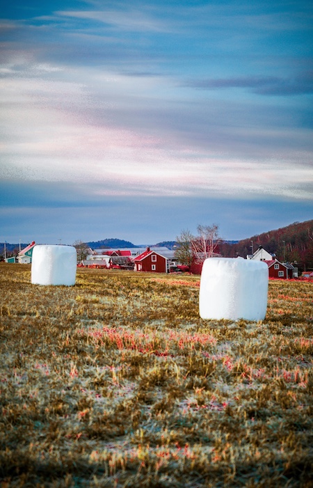
Why Crop Detection Matters in Modern Agriculture
Crop detection is fundamental to agricultural AI because it enables automated mapping of active fields, planted areas, crop boundaries and early vegetation emergence. Governments, agritech companies, insurers and large food producers depend on detection models to understand planting patterns, assess production risk and monitor compliance with agricultural programs. The United States Geological Survey provides extensive land cover datasets showing how crop detection supports national scale mapping and monitoring systems. Accurate detection datasets ensure AI models can recognize crops across varied environments, seasons and sensor types.
What Crop Detection Models Learn
Crop detection models learn to identify the presence or absence of crops, distinguish them from non crop vegetation and recognize spatial structures associated with agricultural fields. These systems interpret patterns such as canopy density, vegetation indices, row orientation and field geometry. With well annotated data, models can detect crop areas even when images include weeds, soil patches or partial occlusions. Research published in Nature Plants has shown how early season detection contributes to yield prediction and agronomic forecasting. Reliable annotations directly affect the model’s ability to interpret fine grained spatial signals.
Distinguishing Crop vs Non Crop Areas
The most basic task in crop detection involves separating crops from background elements such as soil, grass, water or infrastructure. Models learn this distinction by analyzing spectral, textural and geometric features. Clear annotations that mark crop regions precisely help models achieve high accuracy across fields and regions. Poorly defined boundaries lead to confusion between vegetation types.
Recognizing Field Structure
Field geometry plays an important role in detection. Row crops exhibit organized patterns, while broadcast seeded crops present more diffuse arrangements. Models trained on diverse field structures can adapt to different farming practices. Including multiple geographies and crop systems in the dataset prevents overfitting and strengthens generalization.
Designing a Taxonomy for Crop Detection
A taxonomy for crop detection does not require extensive classes, but it must clearly define what counts as “crop” versus “non crop.” Detection datasets may also include categories for partial vegetation, weeds or bare soil depending on project goals. Clear definitions reduce annotator ambiguity and improve dataset quality.
Defining “Crop” Boundaries
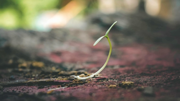
Crop boundaries should follow visible vegetation edges where possible. Annotators must know how to treat transitional areas where soil and emerging plants overlap. For young crops, boundary precision becomes especially important because early stage plants are small and partially occluded. Consistent boundary definitions help maintain coherence across large datasets.
Including Supporting Classes
Some crop detection datasets include supporting labels such as “weed vegetation,” “bare soil” or “residue.” These additional classes help models distinguish crops from visually similar elements. Supporting classes are particularly useful for models intended to operate during early growth stages or in mixed landscapes.
Seasonal and Phenological Categories
If the project includes multi seasonal analysis, taxonomies may incorporate categories such as “emerged,” “vegetative,” “flowering” or “mature.” These categories help models interpret vegetation stages and adapt to seasonal variability. Including these labels expands the dataset’s usefulness across broader agricultural applications.
Image Sources for Crop Detection Datasets
Crop detection datasets can be built from various imaging sources depending on resolution, budget and application scope. Each imaging modality introduces unique traits that influence annotation strategy and model design.
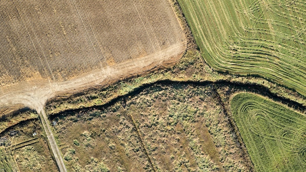
Satellite Imagery for Large Scale Mapping
Satellite data provides wide area coverage, ideal for regional or national crop detection. Multispectral imagery from platforms such as Sentinel or Landsat contains spectral bands that help distinguish crops from other vegetation. The European Commission’s JRC MARS program demonstrates how satellite based crop monitoring supports agricultural policy and food security. Satellite images offer regular temporal updates, enabling detection across planting seasons.
Drone Imagery for Precision Detection
Drones offer high resolution images that capture detailed field patterns. They are useful for detecting crops in complex or heterogeneous environments where satellites may miss fine details. Drone flights also support custom imaging schedules, giving developers flexibility during data collection. High spatial resolution simplifies detection but increases annotation workload due to the level of detail present.
Ground and Machinery Mounted Sensors
Ground imagery collected by tractors, sensors or field cameras helps detect early emergence and small plant structures. These close range views capture subtle differences between crops and weeds. They also provide detailed insights into row shapes and planting irregularities. Integrating ground images with aerial and satellite data increases dataset diversity and enhances model robustness.
Preprocessing Before Annotation
Preprocessing prepares images for annotation by standardizing formats, correcting distortions and ensuring consistent representation of vegetation. Preprocessing steps vary depending on the imaging modality, but the goal remains the same: improve clarity and ensure uniformity across the dataset.
Aligning Multispectral and RGB Bands
Satellite and drone images often include multiple spectral bands. Aligning these bands ensures consistent spatial correspondence across channels. Proper alignment prevents annotation errors resulting from mismatched geometry or band offsets. Band alignment is a critical preprocessing step for multispectral crop detection.
Removing Clouds, Shadows and Artifacts
Clouds, shadows and atmospheric distortions reduce visibility and complicate annotation. Preprocessing tools can mask or remove unwanted areas, allowing annotators to focus on usable imagery. When not removed, these artifacts must be labeled consistently to avoid misleading the model.
Normalizing Resolution
Images from different sensors may vary widely in resolution. Normalizing resolution ensures that vegetation appears at comparable scales across the dataset. Normalization simplifies annotation and makes training data more uniform.
Annotation Methods for Crop Detection
The annotation method depends on the detection task and imaging source. Different methods offer different levels of precision and effort.
Pixel Level Semantic Segmentation
Semantic segmentation is the most common method in crop detection datasets, assigning each pixel to “crop” or “non crop.” This method provides fine detail and supports high precision detection systems. Pixel level segmentation is essential for early stage detection and applications requiring spatial accuracy.
Polygon Annotation for Field Boundaries
Polygon annotation outlines crop fields at a coarse resolution. This method is ideal for satellite imagery where fields are clearly visible. Polygons help models detect field boundaries, classify agricultural parcels and generate geospatial crop maps. Polygon annotation requires consistent rules for boundary placement to ensure dataset coherence.
Patch Based Annotation
Patch annotation divides images into fixed size segments labeled with crop presence or absence. This method reduces annotation complexity and accelerates dataset construction. Patch based labels work well for models that analyze image tiles or grid based inputs.

Creating Annotation Guidelines
Annotation guidelines ensure that large teams label images consistently, especially when working with varied geographies or vegetation patterns. Clear guidelines reduce confusion and improve dataset reliability.
Clarifying Edge Cases
Edge cases include areas containing sparse vegetation, mixed crop and weed patches or transitioning soil zones. Guidelines must specify how to label these cases. Without clear rules, annotators may interpret boundaries inconsistently, reducing dataset cohesion.
Establishing Protocols for Young Crops
Young crops present detection challenges due to small size and low contrast. Guidelines must describe how to annotate seedlings, partial rows or faint emergence signals. High resolution reference images help annotators make accurate decisions.
Defining Non Crop Classes
Annotators must know how to treat roads, water bodies, grasslands and natural vegetation. Defining these categories prevents confusion between crops and non agricultural vegetation. Consistent non crop labeling strengthens model generalization.
Quality Control for Crop Detection Datasets
Quality control ensures that annotations meet the required precision for agricultural applications. Because detection often supports geospatial analysis, errors can propagate into downstream systems.
Two Stage Review
A two stage review helps catch inconsistencies and ensure spatial accuracy. First reviewers check label consistency, while second level reviewers confirm boundary integrity and vegetation representation. This structured review process reduces errors in large datasets.
Expert Agronomist Validation
Agronomists review difficult cases, such as distinguishing crop from visually similar vegetation or interpreting low contrast areas. CABI provides extensive agricultural reference materials that improve annotation accuracy. Expert validation ensures biological correctness, especially in multi crop environments.
Automated Consistency Checks
Automated tools can flag anomalies such as irregular polygons, mislabeled patches or artifacts. These tools assist reviewers and improve efficiency. However, human oversight remains essential for scientific accuracy.
Challenges in Crop Detection Annotation
Crop detection introduces challenges related to vegetation variability, environmental noise and imaging inconsistencies. Understanding these challenges helps design better datasets.
Seasonal and Geographic Variability
Crop appearance changes dramatically across seasons, climates and farming systems. A crop detection dataset must include diverse samples to prevent overfitting. Without diversity, models may fail when deployed in new regions.
Shadows, Soil Color and Lighting
Shadows from clouds, trees or equipment distort vegetation visibility. Soil color varies with moisture, texture and region, influencing the contrast between crops and background. Annotators must handle these sources of variability consistently.
Overlapping Vegetation
Fields may contain weeds, grasses or volunteer crops that complicate detection. Accurate labeling requires distinguishing target crops from competing vegetation. High resolution imagery improves clarity, but guidelines remain essential.
Scaling Crop Detection Datasets
Large scale agricultural projects require efficient annotation workflows, version control and quality management.
Pre Labeling and AI Assisted Annotation
Pre labeling accelerates annotation by generating initial predictions. Annotators correct these predictions, significantly reducing workload. AI assisted annotation works particularly well for segmentation tasks on drone and satellite imagery.
Efficient Data Management
Large detection datasets require careful organization. Version control, metadata tracking and geospatial indexing streamline dataset management. Structured data pipelines support long term growth and maintenance.
Continuous Dataset Expansion
Seasonal changes and new geographies require ongoing dataset updates. Continuous expansion ensures that detection models remain accurate over time. Regular retraining keeps models aligned with real world vegetation patterns.
How Crop Detection Models Use Annotated Data
Annotated datasets serve as the foundation for detection models powering mapping, monitoring and field management tools.
Training and Validation
Models learn to distinguish crops based on annotated pixels, polygons or patches. Balanced datasets ensure fair representation across conditions. Validation sets help calibrate performance and prevent overfitting.
Deployment and Field Performance
Field deployments require models to handle unpredictable conditions. Robust datasets prepare models to interpret real world imagery. Ongoing evaluation ensures continued performance post deployment.
Integration with Precision Agriculture Platforms
Crop detection systems feed into mapping tools, insurance models, farm management software and compliance systems. Accurate datasets enable reliable crop mapping across regions and seasons.
Supporting Your Next Agricultural Dataset
If you are building a crop detection dataset or developing field level AI systems, we can help you structure, annotate and validate your data with reliable agricultural workflows. Our teams specialize in high resolution segmentation, polygon marking and multi stage quality control adapted to farms, satellites and drones. If you want support for your next dataset, feel free to reach out anytime.