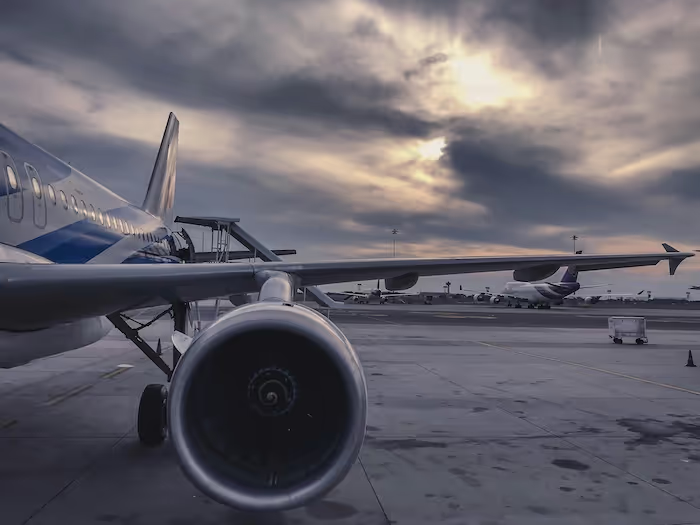
Why UAV Detection Has Become a Critical Need
The growth of drones across recreational, commercial and industrial use cases has increased risks to aviation, infrastructure and public safety. Unauthorized UAVs can interrupt airport operations, threaten aircraft, compromise private facilities or violate restricted zones. The European Space Agency has highlighted how increasing UAV density complicates airspace safety management, especially near sensitive areas. UAV detection systems help identify drones early, track their trajectories and alert operators before risks escalate. Computer vision adds accuracy and scalability, enabling round-the-clock monitoring across wide areas.
The Role of Computer Vision in UAV Detection
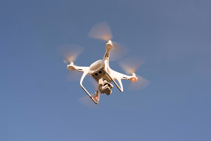
Computer vision systems analyze video from ground cameras, infrared sensors or aerial platforms to detect UAVs based on shape, size, motion patterns and thermal signatures. The European Union Aviation Safety Agency’s civil drone guidance emphasizes the need for reliable model-based detection as airspace becomes more crowded. Computer vision helps identify UAVs even when radio frequency monitoring is insufficient or unavailable. Models learn to differentiate between drones, birds, aircraft and ground objects. Vision-based detection provides a high-resolution complement to RF and radar methods.
Visual Pattern Recognition
Computer vision detects UAVs by analyzing edges, contours and geometric features. Algorithms learn to recognize rotor configurations, silhouette shapes and multi-rotor structures. Pattern recognition helps identify UAV types in varied lighting and weather conditions.
Motion-Based Detection
UAVs produce characteristic motion signatures based on flight dynamics. Vision models analyze object trajectories and acceleration patterns. These cues help distinguish drones from birds or debris, especially when visual clarity is limited.
Multi-Scale Object Detection
Because UAVs vary in size, detection systems must operate at multiple scales. Computer vision models detect both large commercial drones and small hobby-class UAVs. Multi-scale detection improves reliability across diverse scenes.
Data Collection for UAV Detection
UAV detection requires extensive datasets representing multiple environments, altitudes and conditions. Collecting data involves capturing imagery of drones flying in controlled zones. National Air Traffic Services notes that controlled data collection helps calibrate detection boundaries and operational thresholds. Diverse conditions such as urban backgrounds, open fields, forests or industrial zones strengthen model generalization. Recording UAV flights at different distances, speeds and angles ensures thorough representation of real-world encounters.
Multi-Weather Data Collection
UAV detection must work under bright sun, fog, rain, snow or low light. Capturing images in multiple weather scenarios helps models detect drones reliably across environmental noise.
Urban and Rural Environments
UAV backgrounds vary significantly between cities and open areas. Buildings, reflections and moving vehicles complicate detection in urban zones. Rural zones feature trees, fields and wildlife. Data collection must cover both for robust performance.
Aerial and Ground-Based Imaging
Some datasets capture UAVs from ground cameras, while others use aerial drones for multi-angle detection. Combined perspectives improve detection accuracy and help models understand UAV behavior more holistically.
How UAV Detection Models Work
UAV detection models use machine learning to analyze features that indicate drone presence. They learn from annotated datasets to identify small, fast-moving objects accurately.
Convolutional Neural Networks for Detection
CNNs extract visual features such as edges, textures and shapes. These models are effective at detecting UAVs in cluttered environments. CNNs analyze image patches to identify object presence and classify UAV types.
Optical Flow and Motion Tracking
Optical flow models analyze movement across frames. UAVs exhibit distinct motion trajectories compared to birds or random objects. Tracking motion helps reduce false positives and improves temporal consistency.
Thermal and Infrared Detection
Some UAV detection systems use thermal imaging, especially in low visibility. Thermal signatures differ between drones and natural objects. Models trained on thermal data provide reliable detection at night or in fog.
Annotating Datasets for UAV Detection
High-quality annotation is critical for training effective UAV detection systems. Annotators label drone positions, shapes and motion paths across thousands of images.
Bounding Box Annotation
Bounding boxes indicate UAV locations. Precise boxes help models learn object boundaries and improve detection accuracy. Boxes must align with drone shape, even when small or partially obscured.
Polygon Annotation
Polygon labeling captures irregular UAV outlines and improves detection in cluttered scenes. Polygons represent real object boundaries more accurately than boxes, especially for small drones.
Sequence Annotation
UAV detection requires understanding motion, so annotators label drone positions across multiple frames. Sequence labels help models learn temporal patterns and continuity.
Preprocessing UAV Imagery
Preprocessing improves dataset quality and reduces noise. UAV imagery includes significant environmental variability that must be normalized.
Noise Reduction
Distant drones appear as small, noisy objects. Smoothing filters reduce sensor noise and help models interpret edges and shapes more effectively.
Contrast Enhancement
Contrast adjustment improves drone visibility against bright skies or dark backgrounds. Enhanced contrast supports more accurate detection.
Temporal Alignment
Frames must be aligned across sequences to support motion modeling. Temporal synchronization ensures accurate tracking and behavior analysis.
Challenges in UAV Detection
Detecting UAVs is difficult due to environmental noise, object size and movement variability. NOAA highlights the significant impact of weather changes on aerial imagery clarity, affecting UAV detection reliability.
Small Object Detection
Drones appear small in camera feeds, often just a few pixels wide. Small object detection requires high-resolution sensors and specialized model architectures.
Background Complexity
Urban backgrounds contain buildings, lights, reflections and moving vehicles. Models must handle clutter and avoid false positives from similar shapes.
Bird Versus UAV Differentiation
Birds often resemble drones in silhouette and motion patterns. Models must analyze fine details to differentiate between them accurately.
UAV Classification and Identification
Beyond detection, some systems classify drone models or identify potential threats. Classification requires detailed shape analysis and robust training data.
Rotor Configuration Classification
Quadcopters, hexacopters and fixed-wing drones have distinct shapes. Models learn these differences to classify drone types. Classification improves incident response by identifying risk level.
Behavior-Based Assessment
Behavior analysis helps identify abnormal or suspicious UAV activity. Motion patterns such as hovering near restricted zones indicate elevated risk.
Real-Time UAV Tracking
UAV detection systems must track drones continuously. Tracking algorithms predict motion, update object positions and assess risk dynamically.
Kalman Filter Tracking
Kalman filters help smooth tracking and predict UAV movement. These models handle noise and estimate future positions reliably.
Multi-Object Tracking
Airspace may contain multiple drones or wildlife. Multi-object tracking ensures each UAV is monitored independently.
Predictive Trajectory Analysis
Predictive models anticipate UAV flight paths. Early trajectory prediction helps initiate timely response protocols and avoid escalation.
Sensor Fusion for UAV Detection
Sensor fusion integrates camera feeds, radar signals and RF detection. DARPA documents several UAV programs using multi-sensor fusion to increase reliability in contested environments.
RF + Vision Fusion
RF detection identifies UAV command links, while vision provides visual confirmation. Combined systems reduce false positives and strengthen identification accuracy.
Radar + Vision Fusion
Radar detects fast-moving objects at long range. Vision confirms object type and refines location. Fusion improves detection across all visibility conditions.
Acoustic + Vision Fusion
Some UAVs generate distinct acoustic signatures. Combining sound with vision improves detection when drones approach at low altitudes.
Real-World UAV Detection Applications
UAV detection supports multiple sectors requiring active airspace protection.
Airport Protection
Airports monitor runways, terminal zones and approach paths to prevent drone interference. Vision-based systems help detect unauthorized drones early and initiate runway protection measures.
Border and Critical Infrastructure Security
Government agencies deploy UAV detection around restricted installations and energy sites. Vision systems monitor vulnerable areas and track unauthorized aerial activity.
Industrial and Commercial Environments
Companies use UAV detection to protect warehouses, factories and logistics hubs from unwanted surveillance or operational disruptions.

Integrating UAV Detection into Security Workflows
Effective integration ensures that UAV detection tools deliver actionable insights.
Integration with Incident Response
Security teams require precise alerts, location data and classification results. Integration improves response coordination and minimizes ambiguity.
Integration with Airspace Management Systems
AI detection feeds support airspace management tools used by airports and government agencies. Integration strengthens situational awareness and compliance monitoring.
Integration with Automated Warning Systems
Automated alarms help initiate protective measures. These systems notify personnel when drones approach restricted zones, improving response time.
Supporting Your UAV Detection and Monitoring Projects
If you are developing UAV detection systems or building annotated datasets for drone monitoring, we can help you design high quality annotation workflows, collect diverse imagery and integrate model-ready datasets. Our teams specialize in UAV detection, tracking and classification datasets for critical airspace applications. If you want support with your next project, feel free to reach out anytime.