Why UAV Inspection Is Transforming Infrastructure Management
Replacing Manual and Ground-Level Surveys
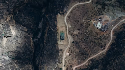
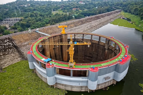
Traditional infrastructure inspection relies on ground teams, scaffolding, and rope-access technicians reaching structures that are difficult, dangerous, or time-consuming to access. UAV platforms change this by deploying sensors at altitude, capturing imagery and data from positions that would otherwise be impractical. This shift has accelerated in utilities, wind energy, civil infrastructure, and industrial facilities, where inspection backlogs directly affect safety compliance and asset availability.
Enabling Continuous Condition Monitoring
Where manual inspection produces periodic snapshots, UAV programs can generate frequent data collection cycles. Operators deploy fleets on scheduled routes, creating datasets that show how defects develop over time. This temporal continuity changes the inspection workflow from reactive maintenance to predictive monitoring, identifying components approaching failure before that failure causes operational disruption.
Reducing Exposure of Personnel to Hazardous Environments
Inspecting energized transmission lines, offshore platforms, confined spaces, and elevated structures carries significant safety risk. UAVs remove personnel from these environments entirely for data collection tasks while delivering higher spatial resolution than visual inspection from a distance. The safety argument has been a major driver of regulatory approval for beyond-visual-line-of-sight operations in utility corridors.
AI Techniques Used in UAV Infrastructure Inspection
Object Detection for Component Identification
Inspection models must first locate the components they are assessing, distinguishing insulators, hardware, blades, or structural elements from background clutter and environmental noise. Object detection architectures trained on annotated aerial imagery provide the localization capability that downstream defect classifiers depend on. Detection quality determines the coverage and reliability of the entire inspection pipeline.
Semantic Segmentation for Surface Analysis
Surface-level defects such as corrosion, cracking, erosion, and material loss require pixel-level analysis rather than bounding box detection. Semantic segmentation models label individual pixels with defect categories, producing spatial maps that show the extent and distribution of damage across a component surface. This output supports quantitative severity assessment and tracking of defect progression across inspection cycles.
Anomaly Detection for Novel Defect Types
Infrastructure components develop failure modes that were not anticipated when training datasets were created. Anomaly detection models learn a baseline representation of healthy asset states and flag deviations from that baseline without requiring labeled examples of every defect type. This approach is valuable in early deployment phases when labeled defect data is limited and in detecting unusual failure modes that appear infrequently.
Change Detection Across Time-Series Imagery
Comparing inspection imagery collected at different dates reveals how components change between visits. Change detection models identify regions where surface condition, geometry, or material properties have shifted, directing human reviewers to areas requiring detailed assessment rather than requiring review of all collected data. This workflow scales inspection programs to the data volumes that regular UAV operations produce.
Annotation Challenges in Aerial Infrastructure Datasets
Altitude-Dependent Scale Variation
UAV imagery is collected at varying altitudes depending on regulatory constraints, platform capabilities, and operational requirements. This produces datasets where the apparent size of components and defects varies across images. Annotation guidelines must specify how to label features at different scales and models must be trained to generalise across this variation.
Illumination and Shadow Effects
Outdoor inspection missions are subject to changing sun angle, cloud cover, and seasonal variation in illumination. Shadows can mask defect features or simulate surface damage that does not exist. Annotators must distinguish genuine defects from shadow artifacts and datasets should include examples collected across a range of illumination conditions to build model robustness.
Specialist Domain Knowledge Requirements
Identifying stress fractures on a wind turbine blade, tracking corrosion on transmission hardware, or detecting delamination on a solar panel surface requires annotators with domain knowledge specific to the asset type. Generalist annotation pools produce unreliable ground truth for technical inspection tasks. Effective dataset development requires annotators with engineering or technical background in the specific infrastructure category.
Long-Range and Thermal Sensor Data Integration
Advanced inspection platforms combine RGB imagery with thermal, multispectral, or LiDAR sensors. Annotation must address each modality and maintain consistency between them. Thermal hotspot annotation, for example, requires understanding of the physical processes that produce thermal signatures rather than simply marking bright regions in the image.
Dataset Design for Infrastructure AI
Defect Taxonomy Development
Effective inspection datasets begin with a defect taxonomy that defines every category the model needs to detect, specifies visual criteria for each category, and establishes severity levels that connect model outputs to maintenance decision thresholds. Taxonomy development requires collaboration between domain engineers and annotation teams to ensure that categories reflect operational relevance rather than visual convenience.
Coverage of Asset Variants and Conditions
Infrastructure assets vary in design, age, material, and operational history. A dataset built from a single asset type or installation environment will not generalise to the broader fleet. Dataset design must deliberately include asset variants, environmental contexts, and operational histories that represent the range of deployment conditions the model will encounter.
Handling Class Imbalance in Defect Data
Healthy asset states vastly outnumber defect cases in naturally collected inspection imagery. Datasets with severe class imbalance produce models that are biased toward predicting healthy states and miss genuine defects. Strategies including targeted defect collection, synthetic augmentation, and weighted training losses are used to address imbalance without compromising the statistical validity of performance metrics.
For related reading, see our guides on data annotation vs data labeling, types of data annotation and data annotation pricing.
Working With DataVLab on Infrastructure Inspection Datasets
DataVLab provides annotation services for UAV and aerial inspection AI, including defect segmentation, component detection, and multi-sensor alignment for utilities, wind energy, civil infrastructure, and industrial facilities. Our domain-matched annotation teams follow structured guidelines and multi-stage quality review to produce inspection datasets that meet the accuracy requirements of safety-critical applications. If your team is developing or scaling an infrastructure inspection AI program, contact DataVLab to discuss dataset requirements.