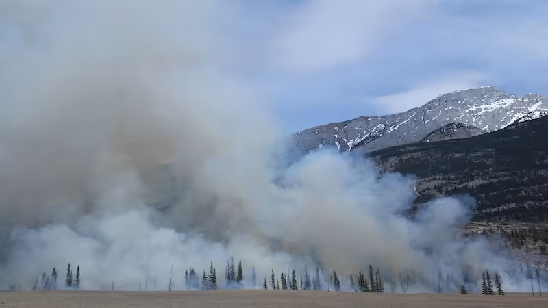
A forest fire detection dataset is a collection of satellite, aerial, or drone images that have been annotated to highlight fire-related features. These features may include active fire fronts, smoke, hotspots, burned vegetation, and areas at risk. The purpose of the dataset is to train machine learning models to recognize early signs of wildfires or track their progression over time. Because environmental conditions vary dramatically across seasons and regions, the dataset must include diverse samples to ensure that the models generalize effectively.
Demand for high quality forest fire datasets has grown significantly as global wildfire activity has increased. Research by the National Aeronautics and Space Administration (NASA) shows that satellite based fire monitoring plays a crucial role in detecting wildfires in remote areas, where ground reports can be delayed or inconsistent. These systems depend on robust datasets to interpret complex environmental signals and produce accurate predictions.
Forest fire datasets support three main categories of AI systems: early detection, spread forecasting, and post fire assessment. Each category requires its own annotation strategy, model approach, and dataset structure.
Why Forest Fire Detection Matters
Increasing wildfire frequency
Climate change, drought, heat waves, and land management practices have driven an increase in wildfire frequency and severity. Early detection is essential for minimizing damage and protecting communities. Wildfire trends documented by the World Meteorological Organization underline the importance of timely data in fire mitigation efforts.
Remote area monitoring
Many regions affected by wildfires are difficult to monitor using ground patrols. Satellite imagery provides broad, continuous coverage that helps authorities identify new fires, even in isolated landscapes.
Rapid response and resource allocation
Fire agencies need accurate geospatial information to deploy resources effectively. AI powered detection systems deliver insights faster than manual interpretation, enabling quicker response times that can limit fire spread.
Post fire analysis and recovery
After a wildfire, satellite image segmentation and classification models help assess burned areas, measure vegetation loss, and evaluate ecosystem recovery. This information is vital for ecological restoration and long term land planning.
Climate modeling and research
Wildfire data contributes to climate models that assess carbon emissions, land surface changes, and long term environmental impact. Machine learning enhances the accuracy of these models by providing comprehensive fire detection data.
Forest fire detection datasets offer powerful tools to support fire management, environmental conservation, and climate research at global scale.
How Forest Fire Detection Using AI Works
Hotspot detection
Hotspot detection uses thermal and infrared satellite bands to identify areas of unusually high temperature. These signatures often indicate active fires or smoldering areas. AI models learn to distinguish between true hotspots and false signals such as industrial heat sources.
Smoke plume detection
Smoke is often visible in optical imagery long before flames appear. Smoke detection models rely on texture, color, spectral patterns, and movement cues to identify plume formation. Smoke detection is challenging because clouds and haze can have similar visual properties.
Fire boundary mapping
Fire boundary models rely on segmentation to outline burned areas and active fire fronts. These models help assess fire growth, direction, and intensity. Satellite time series data supports continuous tracking of fire evolution.
Change detection analysis
Change detection models compare images from different timestamps to detect sudden transitions such as vegetation loss or thermal anomalies. They are effective for identifying new fire events.
Risk prediction
Risk prediction models analyze crop and vegetation density, soil moisture, temperature, and historical fire patterns. By combining environmental variables, they forecast areas at high risk of ignition.
These systems rely on large, well annotated datasets that capture the diversity and complexity of fire related imagery across seasons, elevations, climate zones, and sensor types.
Components of a Forest Fire Detection Dataset
Multispectral and thermal imagery
Forest fire datasets often incorporate multispectral bands such as near infrared and shortwave infrared. These bands help detect heat signatures and differentiate fire from other features. Thermal data enhances accuracy by capturing temperature variations invisible in optical imagery.
High resolution optical data
High resolution optical images show smoke, flame edges, road networks, and vegetation structure. They support segmentation and boundary extraction tasks. Datasets may include imagery from satellites, drones, or aerial surveys.
Geolocation metadata
Datasets include latitude, longitude, timestamps, and sensor metadata. This information is essential for tracking fire progression and integrating model outputs into geographic information systems.
Weather and environmental variables
Some datasets include temperature, humidity, wind speed, soil moisture, and vegetation indices. These layers enrich model predictions by incorporating the environmental context that drives fire behavior.
Historical fire records
Historical fire datasets help models learn seasonal patterns and understand long term fire behavior. These datasets may include fire reports, burned area polygons, or land use history.
By combining these components, a forest fire dataset provides a deep and holistic representation of environmental changes associated with wildfire activity.

Annotation Strategies for Forest Fire Detection
Binary fire masks
Annotators label pixels as fire or non fire. This simple annotation is useful for hotspot or active fire detection but lacks detail for more complex tasks.
Multi class segmentation
Multi class masks label smoke, flames, burned areas, and vegetation separately. This detailed annotation supports advanced segmentation and boundary extraction models.
Bounding boxes for smoke or hotspots
Bounding boxes provide a coarse but scalable way to annotate smoke plumes or thermal anomalies. They help detection models locate relevant regions quickly.
Polygon annotation for burned areas
Polygons help delineate burned regions clearly. These annotations are useful for post fire assessments and for calculating damage extent.
Temporal labeling for time series
Annotators label sequences of images to capture fire growth over time. Temporal labeling is particularly important for forecasting models that rely on sequential data.
Environmental class labeling
Some datasets include annotation for flammable vegetation types such as dry grass, brush, or conifer forests. These labels support risk prediction and modeling fire behavior.
Annotation quality plays a critical role in model accuracy and generalization. Even small inconsistencies can lead to significant errors in fire detection.
Public Forest Fire Detection Datasets
Although many forest fire datasets are private, several public datasets support research and model development.
MODIS Fire Products
NASA’s MODIS Fire Products provide daily global fire detection data using thermal anomalies. These datasets are widely used for coarse scale fire monitoring.
VIIRS Active Fire Dataset
The VIIRS dataset offers improved spatial resolution and is useful for near real time fire detection. It is frequently used in environmental AI research and operational monitoring systems.
Sentinel 2 Burned Area Products
The European Commission’s Copernicus Program provides detailed burned area maps through Sentinel 2 imagery. These datasets are useful for segmentation tasks requiring higher spatial resolution.
Drone based datasets
Some research groups produce smaller, high resolution datasets captured from drones. These datasets contain very fine details and help model localized fire behavior.
Regional wildfire datasets
Countries prone to wildfire events often maintain national datasets. These include fire perimeters, historical burn scars, and fire progression maps. Analysts use them to assess long term fire patterns.
The Group on Earth Observations (GEO) catalogs many of these global datasets and promotes open collaborative research.
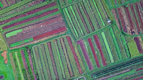
Solar Panel Detection Datasets and Environmental AI
While forest fire datasets focus on fire monitoring and prevention, solar panel detection datasets support renewable energy deployment. These datasets contain annotated rooftop panels or solar farms captured from satellite or aerial imagery.
Identifying solar infrastructure
Solar panel datasets help energy companies inventory existing installations and identify potential sites for expansion. They rely on segmentation or detection to extract rooftop panel areas.
Monitoring renewable energy growth
Mapping solar infrastructure helps track progress toward sustainable energy targets. Government agencies and utility companies rely on accurate spatial data to plan grid upgrades.
Integration with wildfire risk analysis
Solar farms located in arid regions may be exposed to wildfire risk. By combining solar panel detection with fire risk mapping, organizations can model the vulnerability of renewable energy assets.
Environmental AI systems increasingly integrate multiple datasets to produce more comprehensive environmental assessments.
Challenges in Building Forest Fire Detection Datasets
Cloud cover and atmospheric noise
Clouds obscure fire signatures and complicate the interpretation of multispectral signals. Atmospheric haze may resemble smoke, leading to false positives.
Visual ambiguity
Smoke and clouds can appear similar in optical imagery. Shadows may be mistaken for burned areas. These issues require high quality annotation and robust model training.
Variability across regions
Forest structure, soil type, topography, and vegetation density vary across different regions. Models trained on one area may struggle in another, making dataset diversity essential.
Temporal dynamics
Fires evolve rapidly, and satellite revisit times may miss critical moments. Data gaps complicate time series analysis and forecasting.
Resolution constraints
Coarse resolution imagery may not capture small fires or early ignition indicators. Combining multiple sensors can help mitigate this limitation.
These challenges highlight why building a robust forest fire detection dataset requires expertise in both remote sensing and annotation.
Environmental Applications Beyond Fire Detection
Flood detection
Segmentation and classification models can identify flooded regions after heavy rainfall. Flood mapping helps emergency teams coordinate response.
Land use change analysis
Land use datasets support long term environmental planning. AI models detect urban expansion, deforestation, and agricultural transformation.
Water resource monitoring
Remote sensing data helps assess lake levels, river flows, and groundwater availability. These indicators are important for drought management.
Air quality monitoring
AI models analyze satellite based aerosol measurements to monitor pollution levels. Air quality datasets support environmental regulations and public health guidance.
Ecosystem protection
Habitat mapping supports biodiversity conservation. Environmental organizations use segmentation to monitor protected areas and evaluate conservation strategies.
Environmental AI relies on diverse datasets that reflect the complexity of ecosystems and climate processes.
Future Directions for Environmental AI Datasets
Higher resolution Earth observation
Future satellites will capture even finer spatial and spectral details. This improves the precision of fire detection and environmental monitoring.
Near real time processing
Advances in on orbit computing will enable satellites to process imagery before downlinking. This reduces latency in fire detection.
Multimodal dataset integration
Environmental models will combine optical, thermal, radar, meteorological, and ecological datasets for richer analysis.
Self supervised learning
Self supervised techniques reduce dependency on annotated data. Models learn patterns directly from large volumes of unlabeled imagery.
AI driven anomaly detection
Future systems will detect unexpected environmental events automatically. This enhances resilience and preparedness.
The future of environmental AI depends on developing high quality datasets that capture complex environmental dynamics at scale.
Conclusion
Forest fire detection datasets are fundamental building blocks of environmental AI. They enable early detection of wildfires, support rapid response, and provide critical insights for long term ecosystem recovery. By combining multispectral imagery, thermal data, environmental variables, and high quality annotation, these datasets help build reliable models that operate across diverse landscapes and conditions. As climate related risks continue to grow, organizations that invest in robust dataset creation and geospatial AI capabilities will be better equipped to monitor and protect the environment.