The Climate Crisis: Urgency Meets Opportunity
Climate change is no longer a distant threat—it's a present-day emergency. Global temperatures are rising, glaciers are melting, and extreme weather events are becoming more frequent. According to the Intergovernmental Panel on Climate Change (IPCC), we must halve global emissions by 2030 and achieve net zero by 2050 to avoid catastrophic consequences.
Enter artificial intelligence. AI isn’t just a buzzword—it’s a game-changer in how we monitor, predict, and act upon environmental trends. But while AI tools offer promise, their accuracy and effectiveness depend entirely on the quality of the data they ingest.
Where AI Is Making a Real Impact on Climate 🌐
Let’s explore the major domains where AI is being actively deployed in the climate fight.
Smart Energy Management
AI systems can forecast electricity demand, balance grid loads, and automate energy-saving decisions in real time.
- Energy grids: Companies like Google DeepMind are using AI to optimize the energy efficiency of data centers, reducing power consumption by up to 40%.
- Renewables forecasting: AI predicts wind and solar output with impressive accuracy, reducing reliance on fossil fuel backups.
- Smart buildings: AI helps buildings dynamically adjust lighting, heating, and cooling to reduce carbon footprints.
🧠 Read more on this in IEA’s report on digitalization and energy.
Climate Modeling and Prediction
AI accelerates climate modeling by quickly analyzing massive amounts of meteorological and oceanographic data.
- Weather predictions: Neural networks outperform traditional physics-based models in forecasting extreme events like hurricanes or droughts.
- Climate risk mapping: AI identifies areas most vulnerable to sea-level rise or heatwaves, helping planners adapt infrastructure accordingly.
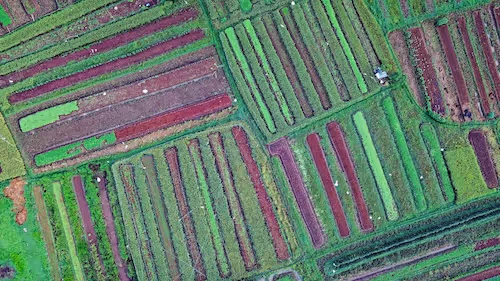
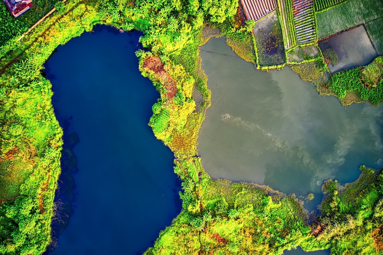
Satellite Imagery & Environmental Monitoring
Computer vision models analyze remote sensing data to track changes in the earth’s surface, forests, oceans, and atmosphere.
- Deforestation detection: Tools like Global Forest Watch use AI to alert organizations of illegal logging in real-time.
- Methane leaks and air pollution: AI is trained to spot emission hotspots from satellite or drone imagery.
- Agriculture monitoring: Climate-smart farming leverages AI to optimize water usage and crop yields under changing weather conditions.
Carbon Accounting & ESG Reporting
AI is streamlining carbon footprint analysis and enabling more transparent climate disclosures.
- Emission tracking: Algorithms estimate CO₂ output across industrial operations, transportation, and supply chains.
- ESG automation: AI scans reports and datasets to score companies on environmental performance, aiding green investors and regulators.
AI Is Only as Smart as Its Data 📊
While AI holds immense promise, the effectiveness of any model—be it for tree cover classification or emission prediction—hinges on one critical factor: data quality.
High-quality datasets are:
- Accurate: Free of label errors, inconsistencies, or duplicates.
- Relevant: Aligned with the specific use case (e.g., distinguishing between cloud cover vs. smoke in satellite images).
- Timely: Reflect current conditions, not outdated environments.
- Balanced: Representative across geographies, weather patterns, or sensor types.
When data is noisy or incomplete, the consequences can be costly—mislabeling methane leaks or missing early signs of drought may delay interventions that save lives and ecosystems.
A Case in Point: Satellite Imagery
Consider a model trained to identify deforestation. If the training data includes mislabeled cloud shadows as "tree loss," false alarms may be triggered. On the flip side, real illegal logging could go unnoticed if canopy density variations aren’t well-annotated.
That’s why teams working with satellite data often invest heavily in preprocessing, annotation consistency, and domain expert review.
Real-World Applications in Action 🌎
AI’s role in fighting climate change is not theoretical—it's already making a measurable difference across industries and continents. These applications prove that when paired with high-quality data, AI can become a powerful force for sustainability.
AI for Reforestation and Carbon Sequestration
Forests play a crucial role in absorbing atmospheric carbon dioxide, but accurately quantifying their impact has long been a challenge. That’s where AI steps in.
🌳 Pachama uses a blend of LiDAR data, satellite imagery, and AI algorithms to verify reforestation projects. This ensures carbon credits issued in voluntary carbon markets are based on real, verifiable data—not inflated promises. The AI models analyze biomass density, canopy cover, and growth rates, flagging any inconsistencies or deforestation events.
🔎 Rainforest Connection, another innovator, uses solar-powered listening devices in forests combined with AI audio analysis to detect illegal logging activity in real time. Trained models can identify chainsaw sounds, vehicle noises, or even suspicious silence, enabling proactive interventions.
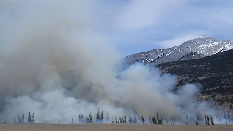
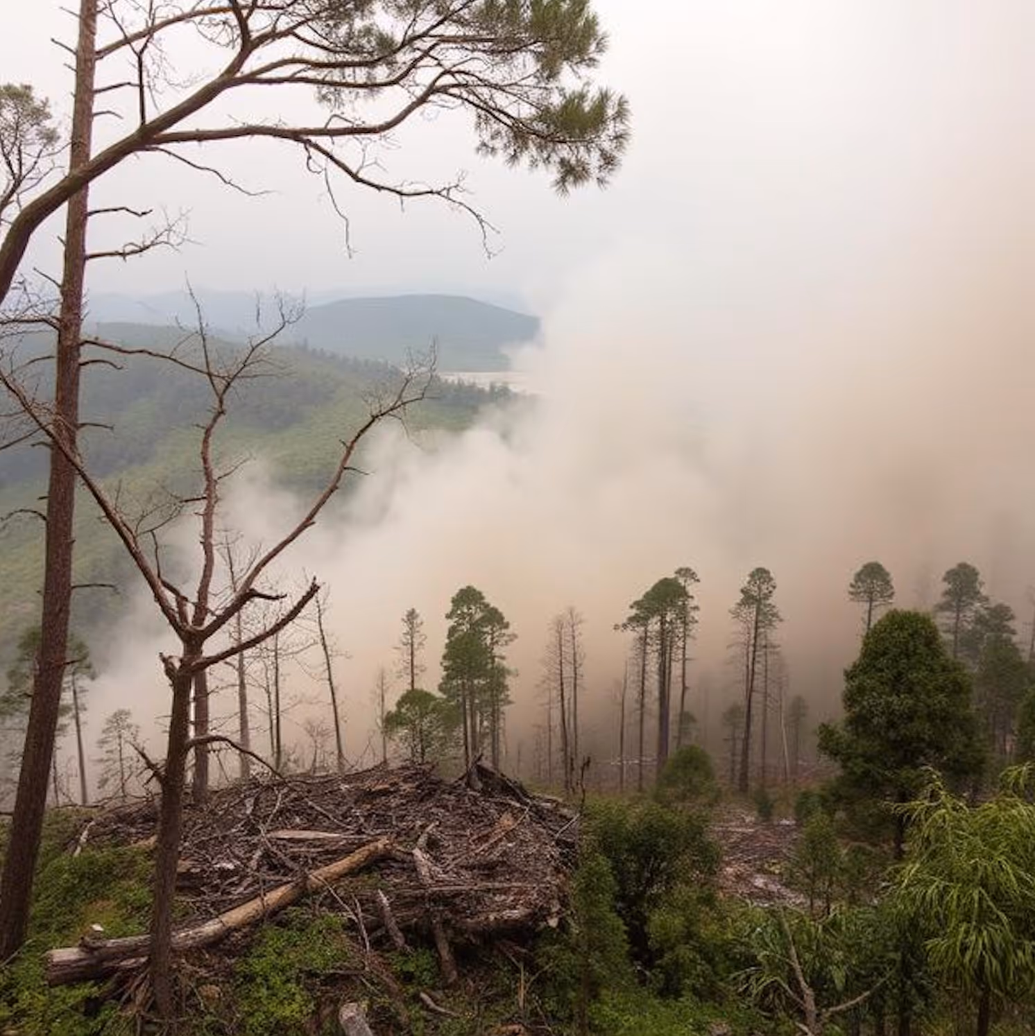
Disaster Response and Early Warning Systems
Climate-induced disasters like floods, wildfires, and hurricanes are becoming more frequent and intense. AI is helping responders act faster and prepare better.
🌊 In Bangladesh, IBM’s The Weather Company developed flood prediction models powered by machine learning. These models process data from satellite altimeters, river sensors, and precipitation forecasts to anticipate flash floods up to five days in advance. The same concept is being tested for landslides in Nepal and Indonesia.
🔥 Wildfire detection tools, such as those developed by Descartes Labs, use convolutional neural networks (CNNs) trained on satellite thermal imagery to detect fire outbreaks within minutes of ignition—even before local authorities are aware. These systems monitor changes in temperature, color, and smoke patterns.
🏙️ AI-enhanced drone systems are also being deployed to assess post-disaster damage. In Turkey’s 2023 earthquake response, AI-aided drones surveyed rubble fields to identify heat signatures and possible survivors faster than traditional ground teams.
Urban Climate Adaptation
Cities are particularly vulnerable to climate impacts due to population density, impermeable surfaces, and infrastructure strain. AI is helping urban planners build climate-resilient cities.
🌡️ Los Angeles partnered with NASA JPL to deploy AI models that map “urban heat islands” using high-resolution infrared imagery. These maps guide where to plant trees, apply reflective pavement coatings, or create cooling centers.
🌧️ In Copenhagen, a smart drainage system uses AI to predict heavy rainfall and redirect stormwater to underground reservoirs or green spaces. This proactive adaptation helps prevent urban flooding—a risk increasing with climate change.
🚴 Singapore’s Smart Nation initiative integrates environmental sensors, AI, and urban design to optimize shade coverage, bike lane placement, and energy-efficient construction zones—transforming heat-prone streets into walkable, livable spaces.
Agriculture and Food Security
AI is transforming how we grow food in a climate-uncertain world.
🚜 Precision agriculture tools use AI to analyze multispectral satellite imagery, weather data, and soil sensors to guide farmers on when to plant, irrigate, or harvest. For instance, Microsoft’s AI for Earth supports projects that improve water efficiency and predict crop yields in Africa and India.
🌾 AI-driven pest detection systems, like those developed by PlantVillage, analyze farmer-submitted images to identify disease symptoms in crops like cassava or maize. These tools enable early intervention and reduce yield losses due to climate-induced pest migrations.
By bringing together geospatial, agricultural, and meteorological data, AI helps ensure food security even in the face of volatile weather.
Data Collection: Where Does Climate AI Get Its Information?
AI cannot solve what it cannot see. The success of climate-related AI applications depends on feeding them rich, diverse, and clean data. Fortunately, today’s climate tech ecosystem provides a growing arsenal of data sources—many of them open access and real-time.
Satellite Imagery
Satellites remain the backbone of climate data, offering global, continuous, and multi-spectral views of our planet.
🛰️ Programs like the Copernicus Sentinel missions (by the European Space Agency) and NASA’s Landsat offer free satellite datasets with high temporal resolution. These datasets capture vegetation cover, urban sprawl, ocean temperatures, ice melt, and more.
- Sentinel-2 provides 10-meter optical resolution—ideal for tracking agriculture and land use.
- Landsat 8 offers thermal and near-infrared bands, crucial for detecting wildfires, droughts, and urban heat zones.
AI models often rely on these images to classify terrain, detect anomalies, or assess trends. These images must be preprocessed (e.g., cloud masking, normalization) and manually annotated to serve as training data for vision-based models.
Remote Sensors and IoT Devices
On the ground and in the oceans, smart sensors feed real-time environmental data into AI systems.
🌧️ Rain gauges, soil moisture sensors, air quality monitors, and thermal cameras are deployed in cities, farms, forests, and coasts. These devices generate time-series data critical for short-term prediction tasks like rainfall or pollution spikes.
🌊 Buoy networks, such as those maintained by the National Data Buoy Center (NDBC), provide oceanographic data: wave height, wind speed, sea surface temperature, and salinity. These variables influence everything from coral reef health to hurricane formation.
💨 Airborne sensors, like drones equipped with LiDAR or hyperspectral cameras, are used in wildfire risk modeling, biodiversity assessment, and terrain mapping. These technologies provide hyperlocal data that satellites might miss—such as plant stress before it’s visible to the human eye.
Public Climate Datasets and Research Platforms
AI developers increasingly rely on large, curated public datasets to train and benchmark models.
📚 Some key platforms include:
- NOAA Climate Data Online (CDO): Historical temperature, rainfall, and storm data across the U.S.
- OpenAQ: A global repository of real-time and historical air quality data.
- Google Earth Engine: A massive cloud-based platform for environmental data processing and visualization.
- Radiant MLHub: An open repository of labeled geospatial training data tailored for machine learning.
These datasets often require preprocessing—interpolation, standardization, and cleansing—to be ready for AI modeling.
Government and NGO Contributions
Many governments and nonprofits are joining the open data movement, releasing climate-relevant datasets.
📂 The World Bank’s Climate Data API provides economic and climate resilience indicators across countries.
🏛️ National agencies like India’s IMD, Japan’s JMA, and Brazil’s INPE publish region-specific datasets covering weather, deforestation, and natural disasters. Cross-national collaboration is growing, but dataset interoperability remains a challenge.
🧭 NGOs like WRI and CDP are also critical players—compiling emissions, ESG disclosures, and impact data that power carbon accounting and sustainability scoring tools.
Challenges: When AI Goes Wrong
Garbage In, Garbage Out
If models are trained on inconsistent, sparse, or poorly labeled data, the predictions will reflect those weaknesses—sometimes with serious real-world consequences.
- Overfitting in extreme weather modeling
- False positives in emission detection
- Undetected land degradation due to outdated imagery
Bias in Data
Climate datasets often overrepresent certain regions (e.g., North America or Europe) while underrepresenting the Global South. This can lead to skewed predictions and reinforce climate injustice.
🌍 Building globally representative datasets is not just a technical task—it’s an ethical imperative.
Labeling Complexity
In environmental datasets, the lines between classes can be blurry: is that brown patch due to seasonal change or land degradation? Manual labeling often requires ecological expertise.
Why Data Governance and Annotation Standards Matter
Climate AI efforts need strong data governance frameworks:
- Version control for evolving datasets
- Metadata standards to track source, timestamp, and format
- Annotation protocols for consistency in labeling
- Quality assurance through multi-layer review and validation
Organizations like Radiant Earth Foundation are working to establish open standards and improve access to high-quality geospatial training data for climate-focused AI initiatives.
The Human Factor: Collaborative Annotation for Climate AI 👥
Labeling data for climate AI is not always an automated task. It often requires collaboration between:
- Domain experts (ecologists, meteorologists)
- Data annotators trained in visual labeling
- AI scientists who design the training pipelines
- Policy analysts who ensure data ethics and climate justice
Crowdsourcing can help, but without proper training and guidelines, it introduces new risks. That’s why many organizations use a hybrid model: AI pre-labels the data, while humans review and refine the output for maximum accuracy.
The Road Ahead: What the Future Holds for AI and Climate 🌤️
The synergy between AI and climate solutions is only just beginning. Emerging frontiers include:
- AI for carbon capture innovation: Accelerating R&D in direct air capture and biochar optimization.
- Autonomous climate monitoring drones: Self-flying machines that collect and annotate environmental data in real-time.
- Multi-modal learning: Models that combine satellite images, sensor data, and text (e.g., climate reports) to provide holistic insights.
But scaling these innovations depends on more than algorithms—it requires robust, high-quality data pipelines and global collaboration.
Wrapping It All Together
Artificial intelligence is redefining what’s possible in the climate fight—from precision agriculture to automated emissions tracking. But without quality data, even the smartest models fall short.
At the heart of AI’s success lies an often invisible workforce: data engineers, annotators, scientists, and domain experts who ensure that the training data reflects the complex reality of our changing planet.
As we scale AI for good, investing in data quality isn’t just smart—it’s non-negotiable.
Let’s Keep the Momentum Going 🚀
Are you working on climate data, annotation, or AI development? Whether you're a scientist, startup, NGO, or enterprise, we’d love to collaborate. Let’s build climate AI solutions that are as accurate as they are impactful.
👉 Reach out to our team today and explore how high-quality data can elevate your AI project. Together, we can make a measurable difference.
📬 Questions or projects in mind? Contact us