Why Change Detection Matters in Natural Disaster Response ⚠️
Natural disasters are increasingly becoming more destructive and frequent due to climate change, urban expansion, and environmental degradation. In the chaos that follows, decision-makers face immense pressure to act swiftly. But fast action without accurate data can lead to wasted resources—or worse, loss of life.
That's why change detection using satellite imagery has emerged as a transformative tool in emergency response. By highlighting what has changed between two timeframes (typically before and after a disaster), responders gain actionable insights on:
- Where to send rescue teams first
- Which roads are impassable or intact
- How many homes or facilities have been impacted
- What infrastructure needs immediate repair
- Where aid distribution should be prioritized
It Replaces Time-Consuming Ground Surveys
Traditionally, damage assessment required field inspections, which are slow, dangerous, and often incomplete. With satellite change detection and AI annotation:
- Entire regions can be analyzed within hours, not days
- Coverage includes remote or inaccessible zones
- Safety risks to on-ground teams are drastically reduced
Enables Scalable, Systematic Damage Mapping
In disaster scenarios spanning hundreds of kilometers—such as tsunamis, wildfires, or riverine floods—it's humanly impossible to get a full picture manually. Change detection pipelines powered by annotated data can:
- Process and analyze massive image datasets
- Quantify the extent of the damage in numerical terms
- Generate geo-tagged impact heatmaps that aid logistics and planning
Supports Equitable Resource Allocation
By visualizing which neighborhoods or zones are most affected, decision-makers can avoid biased or uneven resource distribution. This is especially crucial when dealing with:
- Vulnerable populations
- Displaced communities
- Areas with poor historical investment
Change detection helps ensure that no one is left behind, guiding efforts in a fair, data-backed manner.
It's Not Just for Today—It's for Tomorrow Too
Change detection doesn't end with emergency relief. It's also used for:
- Post-disaster recovery planning
- Climate resilience modeling
- Insurance risk assessment
- Policy advocacy and infrastructure upgrades
Annotated change maps become long-term assets for sustainable reconstruction and disaster preparedness.
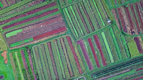
The Role of Image Annotation in Change Detection for Disasters
Image annotation refers to labeling elements in satellite images that have changed between two timeframes. In disaster contexts, this often involves:
- Floodwaters spreading across land
- Entire neighborhoods reduced to rubble
- Burned forest cover after a wildfire
- Landslides altering the terrain
Using change detection annotation, you can train deep learning models to automatically detect these transformations. These models then power tools that allow governments, NGOs, and first responders to assess and act rapidly.
This process underpins platforms like the Copernicus Emergency Management Service (EMS) and disaster-focused initiatives by NASA's Earth Science Division.
Real-World Applications of Change Detection Annotation in Disaster Scenarios 🛰️
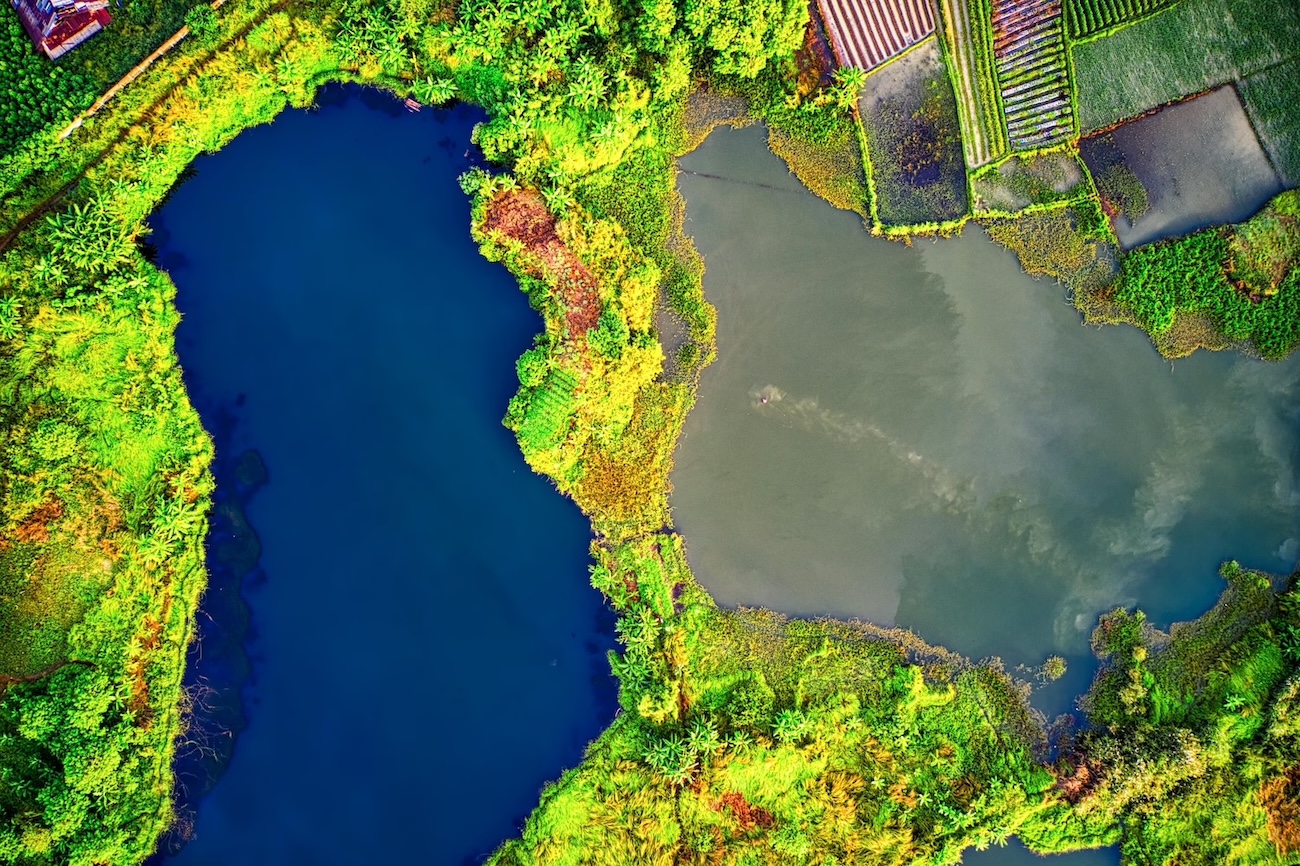
Flood Response and Mapping
Floods are among the most common and devastating natural disasters. Annotated satellite imagery helps:
- Detect water levels spreading over time
- Estimate how many homes or hectares of farmland are affected
- Support relief logistics and evacuation route planning
For example, during the 2022 Pakistan floods, annotated Sentinel-1 imagery helped humanitarian organizations understand the scale of damage and deploy resources more efficiently.
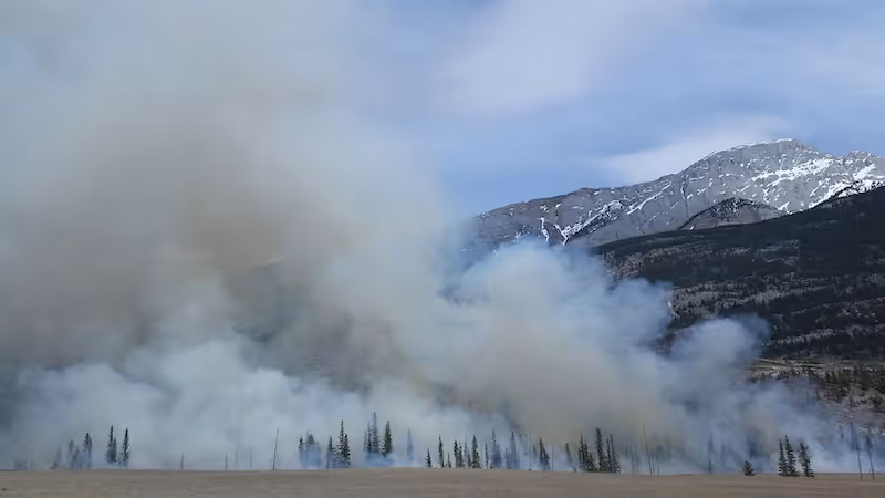
Wildfire Damage Assessment
After a wildfire, it's crucial to know how much land has burned and what assets were lost. Change detection annotation enables:
- Burn severity mapping
- Forest cover loss estimation
- Utility infrastructure impact tracking
Projects like the Global Fire Atlas use such data to train AI models that support firefighting and reforestation planning.
Earthquake and Landslide Detection
Earthquakes and landslides dramatically alter landscapes, often rendering infrastructure useless. Annotated images help models identify:
- Collapsed buildings
- Road discontinuities
- Hillside shifts indicating future risk
This is especially vital in remote areas where sending teams would be dangerous or delayed.
Cyclone and Hurricane Impact Analysis
In the aftermath of tropical storms, annotated change maps aid in:
- Monitoring storm surge impacts
- Mapping wind-damaged zones
- Locating displaced populations
Change detection was pivotal during Hurricane Ian in the U.S., where AI tools helped insurers and government agencies coordinate response.
What Makes Change Detection Annotation So Challenging?
Complex Environmental Dynamics
Natural disasters affect environments in unpredictable ways. For instance, floodwaters might recede quickly, wildfires may skip over areas, and earthquake damage might not be visible from overhead.
To annotate these changes accurately, annotators must often:
- Compare multi-temporal imagery
- Interpret seasonal effects or cloud coverage
- Disambiguate between actual damage and visual artifacts
Spatial Resolution and Image Quality
The quality of satellite imagery varies. Some images offer high resolution (e.g., 30 cm), while others have limitations like cloud cover or poor lighting.
Lower-resolution images make it difficult to:
- Detect small-scale changes
- Identify partial building damage
- Annotate narrow water channels or roads
Thus, annotators must be trained to adjust their expectations based on available data.
Subjectivity in “Change” Definition
What constitutes “change” varies across use cases:
- A flooded road may be a major issue for rescue logistics but irrelevant in a forest monitoring context.
- A partially burned field may or may not be included in a change detection label, depending on the project goals.
To reduce ambiguity, annotation projects require clear, context-specific labeling guidelines, which are often refined with feedback from domain experts.
Multi-Source Data Fusion for Better Annotation Outcomes 🔍
Many disaster response platforms now combine satellite images with other geospatial sources to improve annotation accuracy and model robustness:
- Radar + Optical: Combining Sentinel-1 SAR (radar) with Sentinel-2 optical imagery helps detect changes even through clouds.
- Aerial Imagery: Drones provide high-resolution images where satellites can't.
- Ground Reports: On-the-ground observations help verify and refine annotations.
This multi-source fusion improves the ground truthing process and enriches model training.
Change Detection AI in Action: A Case Study from Southeast Asia 🌧️
In 2021, a coastal province in Southeast Asia experienced massive flooding due to back-to-back typhoons. The local disaster agency partnered with a geospatial AI provider to map flood damage across several villages using change detection AI.
The process:
- Image Collection: Pre- and post-disaster satellite images were collected within a 48-hour window.
- Annotation: Teams annotated flooded roads, submerged buildings, and displaced shoreline boundaries.
- Model Training: A U-Net-based deep learning model was trained using the annotated data.
- Deployment: The model was embedded into a dashboard used by relief coordinators and rescue teams.
Results:
- Damage maps were available within 6 hours of satellite image reception
- Resource deployment time decreased by 35%
- Evacuation planning improved significantly, reducing casualties
This real-world example illustrates the power of annotated change detection in accelerating humanitarian impact.
Who Benefits from Change Detection Annotation?
Emergency Responders and Governments
They gain situational awareness faster, allocate resources more effectively, and reduce response time.
Insurance and Reinsurance Firms
Annotated maps help insurers validate damage claims, model risk zones, and predict future losses.
NGOs and International Organizations
From the Red Cross to the UN, many rely on annotated datasets for post-disaster assessments and funding appeals.
Climate and Environmental Scientists
They use change detection to study patterns, model disaster risk, and improve resilience planning.
Key Strategies for High-Impact Change Detection Projects 🧠
Creating a successful change detection annotation project for natural disaster response goes far beyond drawing polygons on satellite images. It requires a well-thought-out strategy, multi-disciplinary collaboration, and scalable processes. Here's how to make it work:
Build a Grounded Annotation Strategy
Disasters don't follow simple rules—and neither should your annotation schema. Ensure your labeling approach:
- Reflects real-world emergency needs (e.g., separating temporary flooding from permanent water bodies)
- Includes clear definitions of “change” based on use case—urban, forest, agricultural, etc.
- Is validated by domain experts (e.g., civil engineers, emergency managers, geospatial analysts)
Clarity upfront saves time and confusion later when models behave unexpectedly.
Prioritize Pre-Disaster Data Access
One of the most common failures in change detection is missing or outdated pre-disaster imagery. To mitigate this:
- Maintain a curated archive of satellite imagery for at-risk zones
- Collaborate with open-access initiatives like Sentinel Hub and NASA Earthdata
- For critical zones, consider tasking commercial satellites (like Maxar or Planet) in advance of expected events (e.g., hurricane season)
Timely access to pre-disaster baselines dramatically improves annotation quality and model output.
Train Annotators for Disaster-Specific Contexts
Disaster change detection is not the same as labeling cars or buildings in a cityscape. It's complex, subtle, and emotionally sensitive. Annotators need to:
- Learn to differentiate real change from seasonal variations or image artifacts
- Be trained on multi-temporal image comparison techniques
- Understand domain-specific labeling nuances, such as identifying displaced populations vs. damaged structures
You'll also want to put robust quality assurance workflows in place to catch annotation drift or inconsistencies.
Automate Where Possible—But Stay Human-in-the-Loop
AI-assisted annotation tools can pre-highlight likely changes, but don't rely on them blindly. A hybrid approach works best:
- Auto-suggested masks can accelerate workflows
- Manual review and correction preserves data integrity
- Active learning loops allow AI to improve over time by learning from annotator feedback
This human-in-the-loop process ensures both speed and accuracy, especially in high-stakes settings.
Integrate Change Detection into Operational Systems
Annotations shouldn't just live in a dataset—they should power real-world decision-making. This means:
- Ensuring your outputs are compatible with platforms like ArcGIS, QGIS, or custom dashboards used by disaster agencies
- Exporting results in geospatial formats (GeoJSON, shapefiles, TIF overlays)
- Designing APIs or data feeds that allow real-time ingestion of annotated change maps
Actionable integration is the bridge between your AI model and actual lives saved on the ground.
Don't Forget Ethics and Privacy
While satellite images often avoid privacy concerns, disasters can occur in sensitive regions. Make sure to:
- Blur or anonymize data when showing civilian areas in conflict zones
- Restrict access to high-resolution outputs as needed
- Comply with international humanitarian and geospatial data ethics guidelines
Disaster AI should always be built with compassion and responsibility at its core.
Looking Ahead: The Future of AI-Powered Disaster Response
As climate change intensifies, disasters will grow in frequency and unpredictability. The need for real-time, data-driven insights will only increase.
Emerging trends include:
- Automated Annotation: Tools like Labelbox and Encord are experimenting with semi-automated change labeling.
- Crowdsourcing Verification: Platforms like OpenStreetMap allow citizens to confirm AI predictions.
- Federated Learning: Models trained on localized data can adapt to new disaster zones without needing full re-training.
- Edge AI: Drones and mobile units could soon run change detection models on-device for real-time deployment in the field.
What's clear: annotated satellite imagery will continue to be a cornerstone of smarter, faster, and fairer disaster response systems.
Want to Contribute to the Future of Disaster AI? 🚀
Whether you're a researcher, NGO, government agency, or AI startup, high-quality annotated data is your launchpad for impact. At DataVLab, we specialize in delivering precise, scalable annotation for critical missions like disaster response, climate adaptation, and humanitarian mapping.
✨ Let's collaborate on building a more resilient world. Contact us here to get started.