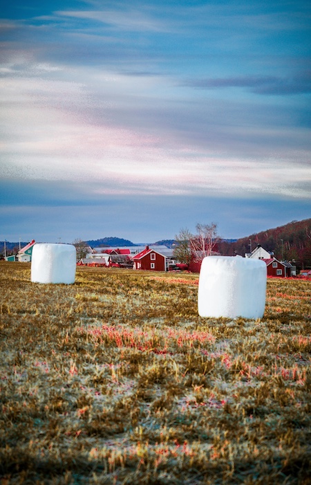
Why Satellite Imagery Matters in Agriculture
Modern agriculture faces a trifecta of pressure: feeding a growing population, preserving the environment, and staying profitable. Farmers can no longer rely solely on manual inspections or localized sensor data. To manage fields efficiently across vast terrains, scalable and precise monitoring tools are essential. That's where satellite imagery becomes a game-changer.
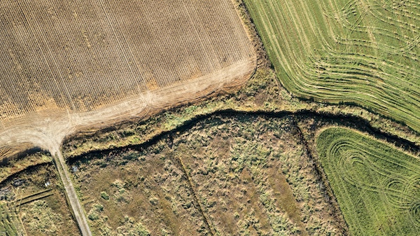
A Bird's-Eye View of Entire Landscapes
Unlike drones or on-the-ground sensors, satellites offer unmatched geographical coverage. With just a few images, farmers or agronomists can monitor thousands of hectares in one shot. This enables regional or even national-scale agricultural analysis, offering governments and cooperatives a consistent way to understand crop patterns and productivity.
Frequent and Consistent Monitoring
Satellites orbiting Earth—like the European Space Agency's Sentinel-2 or commercial satellites from Planet Labs—provide regular image updates (daily to weekly). This time-series data allows stakeholders to:
- Track how crops evolve over time
- Spot early anomalies in growth patterns
- Assess the impact of irrigation cycles or weather events
For farmers managing remote or large farms, this removes the need for costly and time-consuming field visits.
Seeing Beyond the Visible Spectrum 🌈
One of the most powerful aspects of satellite imagery lies in multispectral and hyperspectral imaging. These systems capture light beyond the visible range, such as near-infrared (NIR) and shortwave infrared (SWIR), which are essential for analyzing vegetation health.
Commonly used vegetation indices include:
- NDVI (Normalized Difference Vegetation Index) – Indicates plant vigor and greenness
- EVI (Enhanced Vegetation Index) – Better at minimizing atmospheric interference
- NDWI (Normalized Difference Water Index) – Helps detect water stress
These indices allow agronomists to remotely assess crop condition, even before visual signs of stress appear.
Precision for Planning and Prediction
Satellite imagery feeds into AI-driven crop classification, yield estimation, and forecasting systems. Annotated data from these images helps develop models that answer questions like:
- What crop is being grown and where?
- When should harvesting begin?
- Will we meet yield forecasts this season?
By integrating these insights into planning software or farm management platforms, farmers can make more proactive and profitable decisions.
Scalability for Global Food Security
As climate change causes more unpredictability in weather and crop cycles, globally scalable tools become essential. Annotated satellite data supports not only individual farms but also national governments, NGOs, and food security programs tracking crop health across regions.
Organizations like NASA Harvest and World Food Programme already leverage satellite-powered AI to forecast food crises and manage aid.
The Role of Annotation in Satellite-Based Precision Farming
Annotation is the backbone of machine learning in geospatial contexts. By labeling images to mark crop boundaries, disease patterns, waterlogged areas, or nutrient deficiencies, data scientists train models to detect and predict similar phenomena automatically.
Some practical annotations include:
- 🌱 Identifying different crop types
- 🌾 Labeling fields by growth stage
- 🌀 Highlighting disease or pest stress zones
- 💧 Marking irrigated vs. non-irrigated plots
- 🔥 Detecting burned or damaged areas
Each pixel or polygon drawn on a satellite image feeds the algorithm's ability to generalize across time and space. Without accurate annotations, AI becomes guesswork.
How Annotated Satellite Images Improve Crop Management
So, how exactly does annotated satellite imagery impact precision farming? Let's explore the downstream effects across various aspects of crop management.
Early Detection of Crop Stress 🌡️
Models trained on annotated datasets can recognize patterns of early stress—be it from pests, drought, or nutrient deficiencies—weeks before symptoms are visible to the naked eye. This leads to:
- Timely interventions
- Reduced pesticide or fertilizer usage
- Lower yield loss
According to a NASA Harvest study, early remote sensing alerts improved intervention response time by 20% on average in maize fields.
Accurate Crop Mapping and Classification
By labeling historical satellite images, AI can classify land parcels by crop type. This is crucial for:
- Crop rotation planning
- Market forecasting
- Compliance with government subsidies
It also helps in building national-level crop inventory maps like those used by the USDA's Cropland Data Layer.
Variable Rate Application (VRA) of Inputs 💧💊
Precision farming allows farmers to vary the amount of fertilizer, water, or pesticide based on the specific needs of sub-plots. Annotated imagery helps train models that segment fields into management zones, ensuring:
- Less chemical runoff
- Optimal input use
- Better environmental sustainability
Yield Prediction and Harvest Planning 📈
Models using annotated satellite data can estimate biomass or canopy cover, which directly correlate with yield. This predictive power helps:
- Plan labor and logistics
- Secure fair pricing in contracts
- Reduce post-harvest loss due to overproduction
Monitoring Environmental Impact and Soil Health
Deforestation, soil erosion, waterlogging, and salinity can all be tracked through annotated imagery. This is critical for:
- Ensuring sustainability certifications
- Planning regenerative practices
- Meeting ESG (Environmental, Social, Governance) goals
Challenges of Annotating Satellite Images for Agriculture
While the benefits are clear, annotating satellite imagery comes with its unique challenges.
Image Complexity and Resolution
- Spatial resolution can vary from 10m (Sentinel-2) to sub-meter (commercial providers like PlanetScope).
- Crop boundaries often blend into one another, especially in intercropping systems.
Temporal Variation
One crop may look drastically different across time. Annotating for one stage (e.g., sprouting) may not help the model detect another (e.g., maturing).
Cloud Cover and Shadows ☁️
Obstructions in imagery reduce clarity, forcing annotators to either discard data or guess underlying features—both risky for model accuracy.
Lack of Ground Truth
Validating annotations against on-ground data (like GPS-verified crop types) is expensive and often limited to pilot regions.
Expertise Requirement
Annotators need agricultural context. Mistaking sorghum for maize—or identifying a fungal patch as natural discoloration—can reduce model performance significantly.
Real-World Applications of Annotated Satellite Imagery in Precision Agriculture
Let's take a closer look at how annotated satellite data is used on the ground by farmers, agtech firms, and governments.
Case Study: Monitoring Rice Fields in Southeast Asia 🍚
The IRRI (International Rice Research Institute) uses annotated Sentinel imagery to detect transplanting patterns and crop growth stages in rice fields across Vietnam and the Philippines. This allows:
- Early alerts for failed germination
- Tracking water management effectiveness
- Field-level yield predictions
Case Study: Detecting Locust Infestations in Africa 🦗
Using annotated satellite imagery of prior infestations, FAO's Locust Watch can predict outbreak zones and coordinate rapid response, preventing massive crop losses.
Case Study: Sustainable Farming in the EU 🌍
Under the EU's Common Agricultural Policy (CAP), annotated satellite images help verify if farmers are meeting greening practices (e.g., crop rotation, buffer strips). Automated tools reduce the need for physical inspections.
Combining Satellite Imagery with Other Data Sources
While satellite data provides an invaluable top-down view, it truly shines when combined with ground-level and environmental data streams. Think of satellite imagery as the central nervous system—and other data sources as sensory organs feeding it nuanced input.
Soil Sensors for Ground-Truth Validation 🌱
Soil health directly impacts crop yield, but satellite imagery alone can't always provide deep insights into underground conditions. That's where soil moisture and nutrient sensors come into play. These IoT devices:
- Validate satellite-derived inferences about water stress
- Calibrate models using real-time field data
- Trigger localized alerts (e.g., irrigation or nitrogen deficiency)
By pairing soil data with annotated satellite images, AI systems learn to recognize how specific crop stressors appear in different spectral bands.
Weather Data for Contextual Awareness 🌤️
Weather is one of the biggest variables in farming. A healthy-looking field in a satellite image may be on the brink of stress if high temperatures or rainfall deficits persist. Integrating hyper-local weather data allows models to:
- Account for recent or upcoming heatwaves, frosts, or storms
- Improve yield prediction reliability
- Enhance irrigation scheduling recommendations
APIs like OpenWeatherMap and Tomorrow.io offer scalable access to real-time and forecasted weather data that can be layered on top of satellite insights.
Drone Imagery for Zoomed-In Analysis 🚁
Drones complement satellites by offering ultra-high-resolution imagery (up to 2–5 cm per pixel). This is especially useful when:
- Clouds obscure satellite views
- Fine-grained annotation is needed (e.g., individual plant detection)
- High-risk zones need localized monitoring (e.g., pest outbreaks)
In AI pipelines, drone imagery can be used to pre-train or fine-tune models originally developed with coarser satellite data, improving overall model generalizability.
Farmer-Contributed Data 📱
Mobile apps allow farmers to annotate their own plots, report pest sightings, or verify AI predictions on the ground. This crowdsourced validation creates a feedback loop that:
- Refines label accuracy
- Highlights misclassified crops or anomalies
- Builds local trust in remote sensing systems
Platforms like Plantix and AgriSense already leverage user input to validate and enhance geospatial datasets.
Government and Census Data for Land Use Context 🧾
Linking annotated satellite data with cadastral records, land ownership maps, or subsidy program data enhances the interpretability of geospatial models. For instance:
- Overlaying annotated crop types with land ownership can verify subsidy claims
- Comparing satellite-inferred yield with reported harvests can detect fraud or errors
- Integrating census data can support broader agrarian policy decisions
Creating an Integrated Decision-Making Platform
Agtech companies and agricultural researchers are now building integrated data fusion platforms that layer:
- Satellite feeds
- Drone scans
- Sensor data
- Ground reports
- External APIs (weather, market prices, land zoning)
By using annotated satellite imagery as the core input and enriching it with these data layers, they can generate field-level insights with regional context—empowering more intelligent, adaptive, and sustainable crop management strategies.
Building High-Quality Datasets: Best Practices for Annotators
Ensuring annotation quality is crucial to training effective models. Here's how the best teams operate when annotating satellite imagery:
- Contextual overlays: Using NDVI, EVI, and moisture indices alongside RGB to aid visual interpretation
- Version control: Keeping track of dataset iterations and feedback loops
- Collaboration with agronomists: Especially for rare or localized crops
- Label consistency audits: To avoid variation across annotators
- Edge case flagging: Documenting anomalies like cloud blur or mixed cropping for separate handling
Several open-access resources such as the Spacenet Dataset and Radiant MLHub provide annotated satellite imagery for training and benchmarking.
The Future of Crop Management Through Annotated Satellite Imagery
As AI advances, annotated satellite imagery will become the default lens through which farmers, agronomists, and policymakers manage food systems.
Trends to watch:
- Self-supervised learning: Reducing the need for manual annotations
- Crowdsourced labeling platforms: Letting local farmers contribute and validate annotations
- Real-time labeling pipelines: Integrating satellite and drone feeds into active AI pipelines
- Climate adaptation: Using annotations to train models that predict resilience under different climate scenarios
Ultimately, the goal isn't just monitoring—but optimizing the full farming lifecycle, from seed to harvest, sustainably and efficiently.
Ready to Power Up Your Precision Agriculture Strategy? 🚀
Whether you're an agtech startup, research organization, or agricultural cooperative, annotated satellite imagery can give you a serious competitive edge. Don't just collect data—turn it into insight.
If you're looking to:
- Build or scale AI for crop monitoring
- Improve yield predictions and input planning
- Reduce waste and improve sustainability metrics
Let's talk. Our annotation experts at DataVLab can help you label your geospatial data with precision, speed, and domain-specific expertise.
👉 Book a free consultation today and start building smarter agricultural models from space.