3D reconstruction datasets provide the spatial information needed for models to interpret depth, structure and geometry across scenes or objects. These datasets include multi-view images, calibrated camera poses, depth maps, point clouds and surface meshes. Research from the University of Washington Reality Lab shows that reconstruction quality strongly depends on accurate calibration and well-structured ground truth. Because 3D reconstruction underpins robotics navigation, AR scene mapping, digital twin creation and NeRF-style algorithms, dataset precision directly affects downstream performance. Building high-quality 3D datasets requires a deep understanding of geometry, alignment and sensor fusion.
DataVLab’s 3D annotation services can structure point clouds, depth maps, and geometry-aware labels for reconstruction datasets.
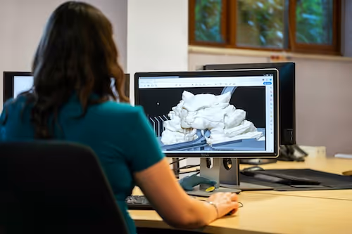
Why 3D Reconstruction Is Essential for Modern Vision Systems
3D reconstruction supports tasks such as SLAM, object scanning, environment modeling and robotic manipulation. Models must understand how surfaces align, how depth changes with viewpoint and how scenes deform over time. These capabilities rely heavily on geometric supervision from well-curated datasets. Studies from the Imperial College London 3D Vision Group highlight that reconstruction datasets significantly improve mapping accuracy in robotics and AR navigation. Without structured multi-view and depth data, models struggle to infer stable 3D structure.
Supporting robotics navigation and mapping
Robots require dense geometric understanding to navigate safely. Reconstruction datasets train systems to infer scene depth, obstacle structure and spatial layout. Good 3D supervision improves mapping reliability. Consistent geometry enhances route planning. Accurate datasets allow robots to operate safely in complex environments.
Enabling AR and VR scene understanding
AR devices integrate digital content into real environments. 3D reconstruction datasets help models estimate surfaces, walls, or furniture layouts. Accurate mapping supports stable overlays. Scene understanding enhances user immersion. Good datasets improve AR anchoring quality.
Building digital twins and simulation models
3D reconstruction datasets support generating realistic digital twins of environments or industrial spaces. These twins inform simulation, planning and inspection. Strong geometric data improves simulation fidelity. Accurate 3D ground truth accelerates industrial workflows. Structured reconstruction supports high-value digital applications.
Capturing Multi-View and Depth Data for Reconstruction
Dataset quality begins with capturing high-resolution views from multiple calibrated cameras. These views allow the model to triangulate and infer spatial structure. Capture setups must avoid noise that distorts geometric interpretation.
Using synchronized multi-camera rigs
Multi-camera rigs ensure simultaneous capture of different viewpoints. Synchronization prevents temporal misalignment across frames. Multiple angles help resolve occlusions and depth ambiguities. Good coverage enhances structural inference. Rig quality directly impacts dataset stability.
Integrating depth sensors
Depth sensors provide ground truth for surface distances. Fusion of RGB and depth strengthens reconstruction resolution. Depth cues help annotate occluded or textureless regions. Clean depth data improves surface accuracy. Proper sensor placement reduces noise.
Ensuring lighting and exposure consistency
Stable illumination prevents shadows that distort depth estimation. Good lighting reduces surface ambiguity. Consistent exposure improves color-depth alignment. Stable capture conditions support accurate fusion. Clean data strengthens geometric reliability.
Calibrating Cameras and Establishing Ground Truth Geometry
Camera calibration defines how images correspond to 3D space. Good calibration ensures consistency across views and supports reliable reconstruction.
Calibrating intrinsic parameters
Intrinsic calibration estimates focal length, distortion coefficients and principal points. Accurate intrinsics reduce projection errors. Calibration consistency improves triangulation. Good intrinsics stabilize depth maps. Clear documentation supports reproducibility.
Calibrating extrinsic parameters
Extrinsic calibration defines camera positions and orientations. Tight extrinsic accuracy reduces geometric drift. Stable extrinsics improve surface reconstruction. Good spatial alignment strengthens dataset quality. Accurate calibration supports multi-view consistency.
Verifying calibration accuracy
Calibration must be validated using test patterns or checkerboards. Validation ensures the camera model maps correctly to real-world coordinates. Clean calibration prevents structural artifacts. Verification improves long-term consistency. Reliable calibration enhances modeling performance.
Annotating Depth Maps, Point Clouds and Surfaces
3D reconstruction datasets often include depth maps or raw point clouds. These annotations provide models with the geometric cues required to infer shape and structure.
Cleaning and filtering depth maps
Depth maps require filtering to remove noise, holes or invalid pixels. Annotators must apply consistent filtering techniques. Clean depth inputs improve 3D alignment. Noise reduction enhances mesh quality. Proper filtering strengthens model training signals.
Structuring point cloud annotations
Point clouds represent spatial samples of surfaces. Annotators must ensure consistent scaling, orientation and alignment. Point cloud consistency supports surface reconstruction. Clean structuring improves geometric reliability. Structured formats simplify processing.
Annotating surface normals
Surface normals describe orientation of surfaces at each point. Annotators may compute or validate these normals. Normals improve shading, alignment and reconstruction. High-quality normals support NeRF-style rendering. Normal accuracy enhances dataset richness.
.svg)
Building High-Quality Meshes and Volumetric Representations
Meshes and volumetric structures such as voxels or signed distance fields (SDFs) support detailed 3D modeling. These representations provide explicit surface geometry that models use for training.
Generating watertight meshes
Watertight meshes avoid holes that hinder reconstruction. Annotators must check for gaps and fix inconsistencies. Watertightness improves volumetric modeling. Stable surfaces enhance simulation fidelity. Clean meshes support strong training signals.
Labeling mesh components
Some datasets require labeling mesh regions such as walls, furniture or object parts. Region annotation improves scene understanding. Structured labeling helps segment environments. Clear mesh labels enrich modeling detail. Granularity enhances recognition tasks.
Creating voxel or SDF volumes
Volumetric formats encode geometry on a grid or as a distance field. Annotators must ensure consistency across resolution and scale. Volumetric alignment supports neural rendering. Structured volumes improve model interpretability. Clean volumetrics strengthen dataset coherence.
Ensuring Scene Alignment and Multi-View Consistency
Scene alignment ensures that all views and geometric representations refer to the same coordinate space. Consistency across modalities is critical for model training.
Aligning RGB, depth and point clouds
All data modalities must reference the same origin and scale. Annotators must verify alignment through visual overlap. Good alignment supports accurate fusion. Clean overlay reduces reconstruction errors. Consistency enhances dataset realism.
Maintaining temporal stability
Scenes may contain dynamic elements. Annotators must ensure temporal alignment across frames. Stability prevents reconstruction drift. Good sequencing supports robust modeling. Temporal consistency improves downstream accuracy.
Checking for alignment drift
Over time, small calibration errors can accumulate. Annotators must run drift checks to detect deviation. Drift correction preserves spatial consistency. Reliable alignment ensures dataset quality. Strong validation workflows prevent structural noise.
Handling Occlusion, Reflective Surfaces and Challenging Scenes
Real-world environments introduce challenges that complicate 3D reconstruction. Good datasets must account for these conditions to support robust modeling.
Managing occluded regions
Occlusions obscure surfaces behind objects. Annotators must avoid inventing geometry for hidden areas. Proper occlusion labeling preserves realism. Structured handling reduces artifacts. Clean occlusion rules support robust reconstruction.
Addressing reflective or transparent surfaces
Reflective surfaces confuse depth sensors. Annotators must mark unreliable depth regions. Consistent labeling prevents geometric noise. Transparency-aware annotation improves dataset usability. Good handling improves reliability.
Capturing cluttered or irregular environments
Complex scenes challenge reconstruction systems. Annotators must ensure consistent labeling even in clutter. These cases strengthen model robustness. Clutter-rich data improves generalization. Complex scenes enhance dataset value.
Quality Control for 3D Reconstruction Datasets
Quality control ensures geometry, alignment, depth maps and calibration remain accurate. QC pipelines detect errors early and maintain structural integrity.
Reviewing geometric accuracy
Reviewers must verify surface correctness by comparing predicted and ground truth geometry. High accuracy improves modeling. Good review practices catch alignment drift. Thorough checks strengthen dataset reliability. Precise geometry supports training success.
Validating point cloud density
Point cloud density affects reconstruction smoothness. QC teams must ensure uniform sampling. Proper density improves surface fidelity. Balanced point clouds strengthen modeling. Consistent density enhances downstream tasks.
Running automated consistency checks
Automated tools detect holes, duplicate points or calibration inconsistencies. Automation scales QA efficiently. These checks complement manual inspection. Automated validation improves dataset scalability. Combined workflows keep data reliable.
Integrating Reconstruction Data Into Vision and Robotics Pipelines
3D reconstruction datasets must be integrated smoothly into training and evaluation workflows. Structured integration improves real-world model performance.
Preparing evaluation benchmarks
Evaluation sets must include varied environments and geometry types. Balanced benchmarks reveal model weaknesses. Strong evaluation supports continuous improvement. Reliable testing enhances deployment. Comprehensive benchmarks strengthen training loops.
Aligning datasets with SLAM or NeRF pipelines
SLAM and neural rendering systems expect specific formats. Annotators must ensure compliance with these conventions. Proper alignment improves interoperability. Structured formatting reduces friction. Good integration supports advanced modeling.
Supporting dataset expansion and updates
As environments or capture methods evolve, datasets must grow. Annotators must maintain consistent geometric rules. Stable expansion supports long-term model refinement. Up-to-date datasets enhance generalization. Structured updates improve dataset longevity.