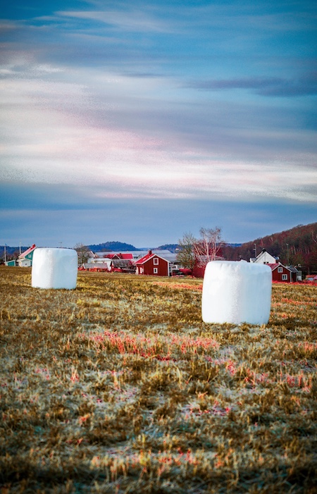
Why Soil Moisture Matters for Smart Agriculture 🌦️
Soil moisture plays a pivotal role in plant health, yield forecasting, and irrigation scheduling. Unlike surface vegetation indices such as NDVI, soil moisture data reveals what lies beneath — offering insight into root-zone hydration, drought stress, and water retention.
In a world facing erratic climate events and growing demand for food, remote sensing platforms (e.g., Sentinel-1, SMAP, MODIS) deliver scalable, consistent, and timely moisture data over vast agricultural areas. When this data is annotated and used to train machine learning models, it empowers farmers with predictive analytics and automated systems for irrigation, crop choice, and field intervention.
“Soil moisture is often called the 'invisible variable’—yet it’s the key to unlocking water-smart Agriculture.”
Remote Sensing + AI: A Powerful Duo for Monitoring Soil Moisture 📡🤖
Remote sensing technology has evolved from a passive observer to an active enabler of intelligent agriculture. Combined with artificial intelligence (AI), it forms the backbone of modern soil moisture monitoring systems — offering precision, scale, and speed that traditional ground-based methods simply can’t match.
How Remote Sensing Contributes
Satellites like Sentinel-1, SMAP (Soil Moisture Active Passive), and MODIS deliver large-scale images of Earth's surface. These satellites provide crucial metrics such as:
- Surface reflectance (from multispectral sensors)
- Backscatter coefficients (from synthetic aperture radar)
- Brightness temperature (from passive microwave radiometers)
These measurements are transformed into volumetric soil moisture estimates through radiative transfer models, empirical equations, or machine learning models trained on field data.
However, raw data isn’t always actionable. This is where AI and annotation come in.
Where AI Makes the Difference
AI bridges the gap between sensor data and decision-making by analyzing vast geospatial datasets and learning moisture patterns under different conditions. Annotated maps serve as the training ground for these models, allowing them to:
- Predict soil moisture in unseen areas (using spatial interpolation and geostatistics)
- Fill temporal gaps (when data is unavailable due to cloud cover or satellite downtime)
- Model non-linear relationships (between soil type, vegetation cover, and moisture retention)
- Detect abnormal moisture events (e.g., unexpected dryness or saturation)
For instance, a convolutional neural network (CNN) trained on annotated soil moisture rasters can classify regions into irrigation zones, highlight drainage problems, or recommend planting dates — all from space.
Combining Multiple Data Layers
The real strength of remote sensing and AI lies in data fusion. Soil moisture alone doesn’t tell the full story. But when combined with:
- NDVI and vegetation indices
- Elevation and slope models (DEM)
- Weather data (rainfall, evapotranspiration)
- Soil type and land cover layers
…it forms a rich, multidimensional dataset that AI can use to infer soil behavior more holistically.
This layered approach enables site-specific recommendations for farmers — tailoring actions down to the parcel level. It also enables national-level decision support systems used by agriculture ministries and NGOs for planning and resilience.
Unlocking Timely, Targeted Interventions
By analyzing soil moisture trends in near real-time, AI systems can:
- Alert farmers before crops enter water stress
- Identify where irrigation is being wasted
- Schedule fertilization more effectively
- Predict pest outbreaks linked to moisture conditions
This kind of proactive decision-making is not only cost-effective but also critical in drought-prone or flood-vulnerable regions. As more regions digitize their agricultural systems, annotated soil moisture data becomes the bedrock for these intelligent interventions.
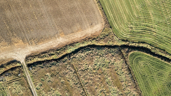
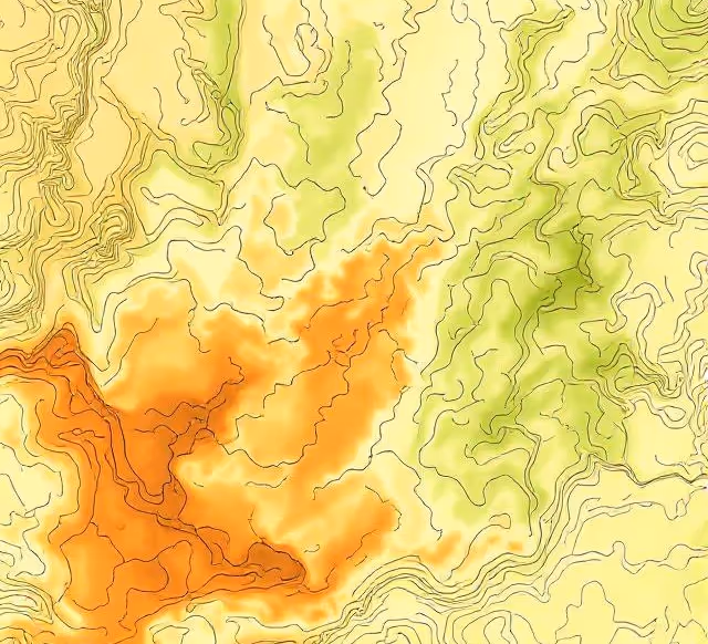
What Are Soil Moisture Maps and How Are They Generated?
Soil moisture maps typically represent volumetric water content across different soil depths. These maps are generated using a mix of active and passive sensors mounted on satellites, drones, or aircraft. Common techniques include:
- Synthetic Aperture Radar (SAR) for surface moisture
- Microwave Radiometry for subsurface estimates
- Thermal Infrared Sensing for moisture inference from surface temperature
Platforms like NASA’s SMAP or ESA’s Sentinel-1 provide large-scale, open-source soil moisture datasets that can be preprocessed and annotated for AI models. These datasets often come as raster images (GeoTIFFs) or time-series layers, requiring expert interpretation and labeling.
The Role of Annotation in Training Soil Moisture AI Models
To train AI models that can forecast, classify, or segment moisture levels accurately, annotated datasets are essential. Annotating soil moisture maps involves:
- Zoning areas by moisture intensity (e.g., low, medium, high)
- Labeling anomalies (e.g., extreme dryness, flooded zones)
- Linking with agronomic ground truth (soil sampling, yield data)
- Aligning with auxiliary data (e.g., slope, crop type)
For instance, if you’re training a CNN to detect drought onset from SAR images, your dataset needs pixel-level segmentation masks or bounding boxes indicating affected zones — generated through careful annotation.
Moreover, pairing this data with temporal variables (e.g., 7-day trends) allows for spatiotemporal modeling, a crucial capability for seasonal agriculture planning.
Real-World Use Cases: Soil Moisture Annotations in Action 🚜
Let’s explore how annotated soil moisture data is improving outcomes across real-world agricultural systems:
Precision Irrigation Systems
Startups like CropX and Prospera are building soil intelligence systems that ingest moisture maps and recommend irrigation actions. Annotated moisture zones train AI to detect under-irrigated fields, optimizing water usage and reducing waste.
Drought Prediction and Mitigation
By combining Sentinel data with labeled drought zones, organizations like CGIAR have created early-warning systems that alert farmers and governments weeks in advance — saving crops and lives.
Crop Yield Forecasting
Agricultural analytics platforms integrate annotated moisture layers with NDVI, precipitation, and crop calendars to improve harvest predictions. Annotated data helps refine predictive models that are used by insurers, banks, and ministries.
Agri-Insurance and Risk Assessment
Insurance companies rely on historical and real-time annotated maps to validate claims and adjust premiums. Models trained on such datasets enable semi-automated damage assessments after droughts or floods.
Key Challenges in Annotating Soil Moisture Data ⚠️
Despite its importance, annotating soil moisture data presents several unique challenges:
1. Noisy or Low-Resolution Inputs
Soil moisture satellite data often suffers from coarse spatial resolution (e.g., 9 km/pixel in SMAP), making precise segmentation difficult. Annotators must work with downsampled or interpolated data, sometimes introducing label uncertainty.
2. Lack of Ground Truth
Unlike visual image annotation, validating soil moisture data requires ground sampling — a costly and logistically complex task. This makes it harder to verify annotations, especially at scale.
3. Temporal Drift and Data Gaps
Remote sensing images may have cloud cover, revisit delays, or sensor errors. Creating consistent labels across time requires interpolation, smoothing, or synthetic data — each with their own trade-offs.
4. Complex Geospatial Formats
Geotiff, NetCDF, and HDF5 files often require specialized GIS knowledge and tools. Annotators must handle projection systems, coordinate grids, and multi-band data, complicating workflows.
Best Practices for Annotating Soil Moisture Maps ✔️
If you’re building a project around AI-enhanced agriculture, here’s how to ensure your soil moisture annotation pipeline is robust and effective:
Integrate Ground Truth and Remote Sensing
Use IoT soil probes or manual sampling to enrich labels, enabling supervised learning at higher accuracy.
Use Stratified Labeling Zones
Instead of binary labels (wet/dry), create multi-tiered zones (e.g., extreme dry, dry, moderate, wet, saturated) that reflect agronomic thresholds. This enhances model generalization across diverse regions.
Align with Crop Calendars and Weather Data
Incorporate layers such as crop stage, evapotranspiration, or rainfall when labeling, so models learn contextual behavior of moisture dynamics.
Leverage Temporal Context
Annotate sequences instead of isolated images. Time-series labels capture evolving patterns and allow for RNNs or transformers to model them effectively.
Collaborate with Agronomists
Farmers, soil scientists, and agronomists bring contextual expertise. Their involvement ensures that annotations are not just technically accurate but agriculturally meaningful.
Scaling Up: How to Manage Large-Scale Annotation Projects 📈
When moving beyond small pilots to national or global-scale monitoring, annotation strategy becomes critical.
- Automate preprocessing: Use scripts to normalize soil moisture rasters, mask out non-agricultural areas, and crop by region.
- Build annotation templates: Design consistent label schemes and visual references to minimize inter-annotator variability.
- Use geospatial AI platforms: Tools like Labelbox, Roboflow, or CloudFactory support geospatial formats and bulk annotation workflows.
- Audit and review: Regularly validate annotations through QA processes, using visual overlays and sampling.
The Bigger Picture: Annotated Moisture Data for Food Security and Climate Resilience 🌍🌾
While the value of soil moisture annotation is evident at the farm level, its real power shines when viewed through a global lens. Annotated remote sensing data on soil moisture is shaping everything from food security policy to climate resilience strategies.
Fighting Drought and Famine
In regions where rainfed agriculture is dominant — such as Sub-Saharan Africa, South Asia, and parts of Latin America — the ability to detect declining soil moisture weeks before it impacts crops can be lifesaving.
Organizations like the Famine Early Warning Systems Network (FEWS NET) use satellite data, paired with on-the-ground insights and AI predictions, to issue alerts and guide relief efforts. High-quality annotated soil moisture maps feed directly into these systems, increasing their accuracy and timeliness.
Powering Sustainable Development Goals (SDGs)
Accurate soil moisture data supports several United Nations Sustainable Development Goals, including:
- SDG 2: Zero Hunger — through better crop productivity and food availability
- SDG 6: Clean Water and Sanitation — by improving irrigation efficiency
- SDG 13: Climate Action — by enabling adaptation to climate-induced weather shifts
Governments and NGOs use this information to allocate resources, draft agricultural policies, and manage transboundary water systems more equitably.
Supporting Carbon and Climate Models
Soil moisture is a key parameter in global carbon flux and hydrological models. AI models trained on annotated data help simulate soil–atmosphere interactions, enhancing predictions for:
- Carbon sequestration potential
- Runoff and erosion risk
- Soil degradation and desertification trends
This allows researchers and policymakers to make informed decisions about land use, conservation planning, and ecosystem restoration.
Enhancing Climate Insurance and Finance
Insurtech companies and weather-indexed insurance providers are using soil moisture annotations to:
- Set premiums and validate claims
- Track agricultural risk across time and space
- Assess the impact of climate variability on crop performance
Such data-driven models can unlock parametric insurance for smallholder farmers who traditionally lack access to safety nets — directly impacting poverty alleviation and economic resilience.
Enabling Next-Generation AgTech Startups
AgTech innovators increasingly build platforms that offer:
- Field-level soil moisture analytics
- Automated irrigation control
- Yield optimization recommendations
These tools depend on clean, labeled datasets to function accurately. By building with annotated soil moisture maps from the start, startups reduce model error, improve usability, and scale faster across regions and crop types.
What’s Ahead: Annotating for the Next Generation of AgTech 🚀
As AI models grow more sophisticated, the demands for richer and more structured annotations will increase:
- 3D Soil Moisture Modeling: Annotating for depth layers, not just surface values
- Multimodal Integration: Pairing soil moisture with drone imagery, rainfall radar, or hyperspectral scans
- Active Learning Loops: Using model predictions to guide what gets annotated next
- Crowdsourced Validation: Engaging farmers through mobile apps to validate AI-generated labels
These innovations depend on a strong foundation of well-annotated data. The future of precision agriculture is only as accurate as the labels that guide it.
Let’s Build the Future of Soil Intelligence Together 🌱
Whether you’re an AI engineer, a researcher, or an agriculture innovator, annotated soil moisture data is the foundation of smarter, more resilient agriculture. Now is the time to invest in the right strategies, tools, and partnerships to bring this vision to life.
✨ Want to elevate your agricultural AI dataset with expert annotations?
Let’s talk — whether you need domain-specific expertise, scalable workforce solutions, or a partner to help you deploy soil-aware models at scale. Reach out today and let’s put intelligence into every acre.
📌 Related: Case Study: Annotating Drone Imagery for Corn Field Health to Enhance Crop Monitoring Accuracy
📬 Questions or projects in mind? Contact us