Why Real-Time Annotation for Drone Footage Matters
Traditional Image Annotation workflows are designed around batch processing. However, drones are constantly capturing new frames—sometimes thousands per hour—and for applications like search-and-rescue, wildfire tracking, or real-time surveillance, speed isn’t a luxury; it's a necessity.
Real-time annotation bridges the gap between data capture and AI inference, allowing:
- Faster model retraining and adaptation
- Immediate feedback loops for edge-based AI
- On-the-fly validation of mission-critical events
- Significant reduction in human-in-the-loop review time
But how do you turn raw video streams from fast-moving drones into actionable, structured data in near real time?
Core Challenges in Real-Time Drone Annotation
Designing an annotation pipeline that handles real-time drone footage is a technical and operational feat. Here’s what makes it so complex:
High Frame Rates, Limited Bandwidth
Drones often capture HD or 4K video at 30+ frames per second. Sending that much data to a remote server, annotating it, and sending it back for analysis or decision-making introduces significant latency—especially in rural or disconnected environments.
Hardware Constraints at the Edge
Most drones or edge processing units (like Jetson Orin or Raspberry Pi CM4) have limited compute capacity. Running object detection, tracking, and annotation tasks simultaneously can overload these systems quickly.
Data Noise and Environmental Variability
From shadows and sun glare to camera shakes and poor lighting, drone footage is messy. Real-time annotation pipelines need to cope with constantly shifting visual conditions.
Human-in-the-Loop Limitations
Real-time implies automation—but annotation is traditionally human-driven. Balancing accuracy with automation, especially in safety-critical tasks, is a delicate trade-off.
Building Blocks of a Real-Time Drone Annotation Pipeline 🧩
Let’s break down the key components of a functional pipeline.
1. Drone-Camera Integration Layer
This is where footage is captured. High-resolution cameras (e.g., RGB, thermal, or multispectral) stream video or images at a fixed frequency.
Modern drones like the DJI Matrice 300 RTK or Parrot Anafi AI support SDKs to tap into live streams and trigger real-time data offloading.
2. Onboard Preprocessing (Optional)
Basic frame sampling, resizing, and noise reduction can happen directly on the drone—saving bandwidth before sending frames for annotation.
Lightweight models such as YOLO-Nano or MobileNet SSD can be used here for first-pass detections or prioritization.
3. Edge or Cloud-Based Inference
Frames are passed to AI models trained on relevant aerial datasets. These models might detect:
- Vehicles, buildings, roads
- Crop health zones
- Emergency situations (fire, smoke, flooding)
- Human activity in restricted areas
If running at the edge, tools like NVIDIA DeepStream, TensorRT, or OpenVINO offer real-time acceleration.
4. Frame Buffering and Smart Sampling
Not all frames need to be annotated. Buffering systems with smart sampling logic (e.g., sample one frame every X seconds unless motion detected) can reduce load.
Event-based triggers like "change in object count" or "presence of anomaly" can dynamically decide what gets annotated.
5. Automated Annotation Layer
This is the core of your pipeline. Pretrained models or semi-automated labeling algorithms generate bounding boxes, segmentation masks, or keypoints. These are not always perfect—but serve as high-quality first drafts.
6. Human Validation (if needed)
In critical tasks—military, emergency response, or insurance—you’ll want a real-time dashboard or interface for rapid human review. Tools like CVAT or Encord offer review modes optimized for streaming data.
7. Storage and Label Synchronization
Each annotated frame (and its metadata) is synced with cloud databases. Labels are versioned, indexed, and stored alongside the original footage in platforms like AWS S3, GCP Cloud Storage, or Azure Blob Storage.
Key Strategies for Real-Time Success 🚀
Building real-time annotation pipelines that actually work in the field requires a careful mix of architecture, automation, and resource-awareness. Below is an expanded guide to strategies that can drastically improve performance and scalability.
Streamline the Right Data—Not All Data
Not every frame from a drone needs to be labeled. A 4K drone capturing at 30 FPS will generate more data than most systems can reasonably annotate in real time.
- Solution: Apply event-based filtering or semantic triggers. For instance, only forward frames for annotation when motion is detected, anomalies appear, or when GPS coordinates enter a zone of interest.
- Example: In wildlife tracking, only send frames where a large animal is detected—ignoring empty landscapes.
Use Incremental Annotation Rather Than Full Frame Labeling
Instead of annotating entire frames from scratch, leverage object trackers (like Deep SORT, FairMOT, or BoT-SORT) to carry annotations across multiple frames with minimal computational cost.
- This saves annotation time by only labeling new or changing instances.
- Reduces human input needs significantly during live surveillance.
Combine Weak Supervision with Confidence Scoring
Rather than rely solely on deterministic model outputs or human validation, introduce weak supervision layers like:
- Ensemble model voting
- Historical comparison
- Contextual rules (e.g., “cars don’t appear in rivers”)
Pair this with confidence scoring, routing uncertain annotations to human reviewers and letting high-confidence predictions pass automatically.
Push Lightweight Inference to the Edge
When using edge devices (e.g., Jetson, Coral TPU, or NVIDIA Xavier), deploy tiny, optimized models for first-pass detection. This allows:
- Local prioritization: flag only “important” frames
- Bandwidth savings: only upload annotated or cropped sections
- Reduced latency for closed-loop systems (e.g., a drone changing route based on what it sees)
Utilize Annotation Hotkeys or AI-Assisted GUIs for Reviewers
Human-in-the-loop doesn’t have to mean slow. By offering real-time GUIs tailored for drone streams, with AI-suggested labels and one-click validation, human reviewers can validate or correct frames in milliseconds.
Some platforms even support speech-to-annotation workflows or gaze tracking to speed up human inputs.
Maintain Feedback Loops for Online Model Adaptation
Unlike static datasets, real-time annotation enables continuous learning. Pipelines can feed corrected annotations into a versioned training queue to:
- Retrain models nightly or weekly
- Adapt to new environments, lighting, or object types
- Alert for model drift when real-world inputs deviate from training data
Design for Annotation Interoperability
Annotation outputs should be immediately usable by downstream processes. Use standard formats like COCO JSON, YOLO TXT, or Pascal VOC XML—and design pipelines that output in all of them when necessary. This avoids time lost to data cleaning or conversion.
Real-World Applications of Real-Time Drone Annotation 🌍
Drone-based AI applications are exploding in industries that need fast decisions from aerial views. Below are detailed examples where real-time annotation pipelines are not just helpful—they’re transformative.
Disaster Response and Humanitarian Aid 🆘
When an earthquake, flood, or wildfire hits, every second counts. Drones help responders locate survivors, assess damage, and deliver aid.
- Annotation Need: Detect damaged infrastructure, stranded people, fire hotspots, water levels
- Real-Time Benefit: Helps route emergency teams faster and prioritize resources dynamically
- Use Case: After Hurricane Ian, drones were deployed in Florida to annotate damaged areas and coordinate utility repair crews in real time
Agriculture and Crop Health 🌾
Drones can detect early signs of drought stress, pest infestation, or nutrient deficiency through RGB and multispectral imaging.
- Annotation Need: Segment fields by condition, detect missing plants, classify crop types
- Real-Time Benefit: Farmers can act immediately—adjusting irrigation, applying fertilizer, or deploying drones with pesticide payloads
- Example: Companies like Pix4D integrate real-time AI pipelines to help farmers annotate fields as they fly
Security and Perimeter Surveillance 🛡️
Airborne monitoring of facilities, borders, or critical infrastructure is increasingly being automated with drone swarms or patrols.
- Annotation Need: Detect intruders, unauthorized vehicles, trespassing or loitering behavior
- Real-Time Benefit: Immediate alerts for physical security teams, triggering follow-up drones or alarms
- Use Case: Oil & gas companies use drone fleets with real-time annotation to monitor pipelines across remote deserts and jungles
Construction and Site Management 🚧
Modern construction companies use drones to map site progress, count materials, and ensure safety compliance.
- Annotation Need: Count vehicles, detect helmet compliance, measure earthwork volume
- Real-Time Benefit: Avoid delays, reduce safety violations, and streamline subcontractor payments
- Example: Propeller Aero offers tools for real-time drone surveying with automatic annotation of terrain changes
Environmental Monitoring 🌲
From glacier tracking to deforestation detection, drones allow scientists and researchers to cover large areas quickly.
- Annotation Need: Detect forest loss, count tree stands, monitor shoreline erosion
- Real-Time Benefit: Enables immediate documentation and alerts, essential for conservation or climate intervention strategies
- Use Case: In the Amazon, drones fitted with AI and annotation tools are used to flag illegal logging in real time
Traffic Monitoring and Urban Planning 🚦
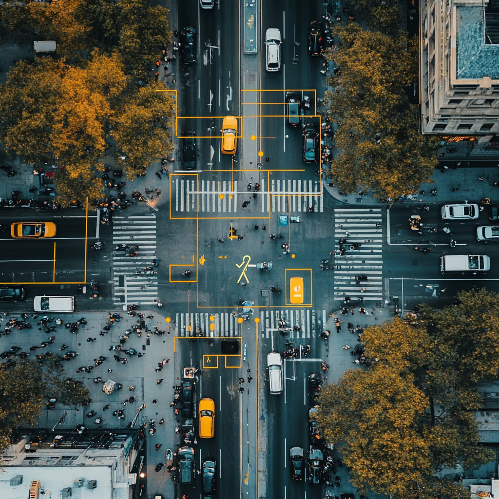
City planners and DOT agencies use drone footage to understand traffic flow, pedestrian movement, and bottlenecks.
- Annotation Need: Detect congestion, illegal parking, pedestrian-vehicle interaction
- Real-Time Benefit: Cities can adjust light timing, reroute buses, or dispatch traffic enforcement within minutes
- Example: Numina uses AI with street-mounted sensors, but drone-based equivalents are emerging for more agile urban analysis
Military Reconnaissance and Tactical Analysis 🪖
In combat or intelligence scenarios, drone feeds are annotated in real time for object identification, route mapping, and threat detection.
- Annotation Need: Vehicle classification, troop movement, weapon identification, activity heat maps
- Real-Time Benefit: Life-or-death decisions depend on accurate, up-to-the-minute insights
- Example: NATO member states have explored drone annotation workflows to streamline intelligence across command centers in seconds
Pitfalls to Watch Out For ⚠️
Even well-designed pipelines can fail without attention to these common mistakes.
Overloading the Edge
Pushing too much compute onto the drone or its companion device can crash systems mid-flight. Always benchmark models under actual hardware constraints.
Latency Blind Spots
If the total latency from capture to annotation exceeds a few seconds, the “real-time” benefit evaporates. Optimize the slowest part of your pipeline—not just the AI.
Ignoring Annotation Drift
AI models often change how they interpret scenes over time. Make sure your auto-annotation is regularly validated and corrected to avoid training bias.
Storage Overhead
Drone footage is huge. If annotation frames and metadata aren’t compressed or archived intelligently, you’ll burn through cloud costs quickly.
Scaling for Long-Term Use 📈
If you’re aiming for commercial, multi-drone deployments, scalability is key.
Auto-Sync With Training Pipelines
Design your annotation outputs to flow directly into your model training stack (e.g., TensorFlow, PyTorch). This avoids delays and formatting mismatches.
Modular, Containerized Services
Use Docker or Kubernetes to containerize each pipeline element: preprocessing, detection, annotation, review, storage. This makes upgrades easier without halting operations.
Monitoring and Alerting
Real-time dashboards should track:
- Inference latency
- Frame drop rates
- Annotation throughput
- Model accuracy drift
Tools like Prometheus + Grafana can help.
The Future of Drone Annotation Is Streaming
We’re entering an era where AI will need to react to real-world changes in milliseconds. In this landscape, annotated drone data becomes not just a training resource—but an active input into autonomous decision-making.
With the rise of event-driven architectures, edge-cloud hybrid pipelines, and AI copilots, real-time annotation isn’t a nice-to-have—it’s a critical enabler.
As drones take flight over fields, forests, cities, and coasts, the infrastructure to label their vision must keep pace. Building real-time pipelines now is how you future-proof your AI stack.
Your Next Step 🚀
If you’re building AI for drones—or working with aerial data in any form—your annotation strategy will define your model’s ceiling.
Don’t let lag or labeling bottlenecks hold you back.
👉 Need expert guidance on building your annotation pipeline? Whether you’re flying one drone or managing fleets across regions, reach out to DataVLab and let us help you scale your AI vision.
Let’s annotate the future—frame by frame.
📌 Related: Drone Surveillance and Object Detection: How to Annotate Aerial Images for AI


