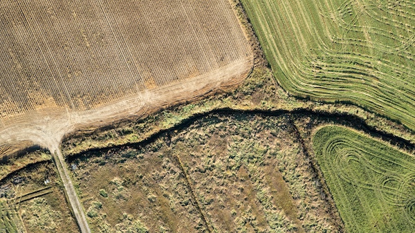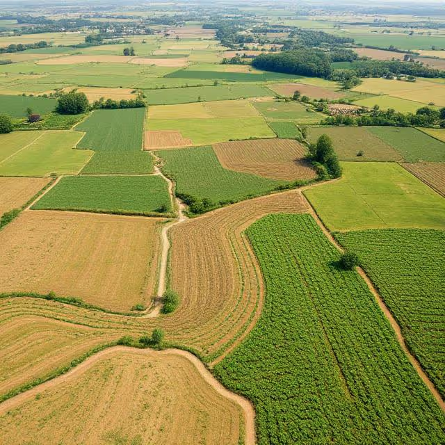
Why Drone Imagery Needs a Solid AI Pipeline
High-resolution aerial data captured by drones holds immense potential. But raw images alone aren't enough to generate actionable insights. AI transforms this data into structured, decision-ready outputs. For this transformation to succeed at scale and speed, a robust pipeline is essential.
Key benefits of a drone AI pipeline:
- 🧠 Automated decision-making through pattern recognition
- 🕒 Faster analysis compared to manual inspection
- 📈 Improved data consistency over time
- 🌐 Scalability across large geographical areas
- 🔁 Feedback loops to continuously improve performance
Use cases span Agriculture, forestry, construction, energy, disaster response, and environmental monitoring. But these industries often face the same core challenges: fragmented workflows, poor generalization of AI models, and lack of integration between capture and analysis.
Mapping the AI Pipeline for Drone-Based Field Analysis
Let’s walk through each phase of a successful AI pipeline for drone imagery, emphasizing best practices and practical insights.
1. Mission Planning and Data Collection 🚀
The foundation of any effective AI pipeline starts in the field—or rather, in the air.
Drone Flight Planning Essentials
- Coverage strategy: Choose between grid, waypoint, or orbit paths depending on the use case.
- Altitude control: Balance image resolution with field-of-view.
- Overlap and sidelap: Ensure sufficient coverage for stitching and object continuity.
- Time of day & lighting: Minimize shadows and glare by flying at optimal times.
Using tools like DroneDeploy or Pix4Dcapture can automate many of these steps, but flight intelligence should be matched with your AI model’s data needs.
Sensor Choices That Matter
Beyond standard RGB cameras, multispectral, thermal, and LiDAR sensors expand what AI can detect:
- Multispectral: Vegetation health, chlorophyll levels
- Thermal: Heat loss, water stress
- LiDAR: Structural depth, terrain mapping
Selecting the right sensor stack aligns your aerial data with specific AI objectives.
2. Data Preprocessing: Cleaning Up the Sky 👨🔬
Before AI can process anything, raw imagery must be standardized.
Key preprocessing stages:
- Orthomosaic creation: Stitch overlapping images into a georeferenced whole
- Geotag alignment: Sync imagery with GPS coordinates for spatial analysis
- Resolution normalization: Ensure consistent pixel dimensions
- Image enhancement: Remove blur, adjust contrast, and apply sharpening filters
- Noise removal: Filter out irrelevant or distorted frames due to wind, motion, or low light
For large volumes, leverage cloud-based pipelines (e.g. AWS Lambda, Google Cloud Functions) to preprocess images in parallel.
3. AI Model Selection and Training 🧠
With clean data in hand, the next step is choosing the right models.
Common Model Types:
- Object Detection: Identify and locate objects (e.g., weeds, vehicles, cracks)
- Semantic Segmentation: Classify each pixel (e.g., crop vs. soil vs. water)
- Change Detection: Analyze time-series imagery for trends or anomalies
- Classification: Label entire scenes (e.g., healthy vs. stressed fields)
Model Architecture Considerations
Choose models that balance accuracy, speed, and deployment cost:
- YOLOv8, Faster R-CNN (for real-time object detection)
- U-Net, DeepLabV3+ (for semantic segmentation)
- Swin Transformer or SAM (for cutting-edge performance on high-res drone images)
Training these models requires annotated data that reflects real-world conditions, angles, and seasonal variations. Mix public datasets (e.g. Roboflow, Agrivision) with proprietary annotated drone captures for optimal results.
4. Augmenting Training with Field Variations 🌦️
Drone imagery varies wildly—weather, time, crop stage, terrain. AI models must generalize.
Apply targeted data augmentation:
- Brightness/contrast changes
- Rotation and scaling
- Gaussian blur or noise injection
- Synthetic shadows or occlusions
- Mosaic or cutmix for object density variety
Use domain adaptation techniques or fine-tuning to adapt pre-trained models to local regions or unique terrains.
5. Model Evaluation: Precision at Altitude 🎯
How do you know your AI model is ready for the field?
Evaluation metrics:
- mAP (Mean Average Precision): For detection models
- IoU (Intersection over Union): For segmentation
- F1-Score: Balancing precision and recall
- Accuracy and AUC: For classification
- Confusion matrices: To detect class imbalance or bias
Cross-validate across seasons, crop types, and lighting conditions. Your model isn’t robust until it handles real-world edge cases.
6. Deploying AI Models for Real-World Use ✈️
Once your model achieves the desired performance in controlled conditions, the real challenge begins: deploying AI into real-world environments where variability is the norm, not the exception.
Edge, Cloud, or Hybrid: Which Architecture Should You Choose?
Your deployment approach will determine how fast, scalable, and cost-effective your solution is.
🔹 Edge AI Deployment
AI models are embedded directly on the drone or an on-site edge device (e.g., NVIDIA Jetson Orin Nano, Luxonis OAK-D). This allows for real-time decision-making without needing constant internet access.
Pros:
- Ultra-low latency
- No reliance on network connectivity
- Enhanced data privacy (nothing is transmitted unless needed)
Challenges:
- Limited processing power
- Power consumption and heat dissipation constraints
- Need for model optimization (e.g., quantization, pruning)
Best for:
- Real-time safety alerts
- Immediate visual feedback during flight
- Remote, bandwidth-limited areas
🔹 Cloud AI Deployment
Drone data is uploaded (via ground station or after flight) to cloud services like AWS, Azure, or GCP where models are hosted and run at scale.
Pros:
- Virtually unlimited computing power
- Easier updates and version control
- Scalable for batch inference and multiple users
Challenges:
- Latency due to upload/download
- Requires stable internet
- Potential regulatory issues with cloud data storage (e.g., GDPR)
Best for:
- Post-flight analysis
- Centralized monitoring dashboards
- Large-scale multi-site operations
🔹 Hybrid Systems
Combine edge and cloud logic: the edge filters or processes initial results, then uploads relevant segments to the cloud for deeper analysis and long-term storage.
Example:
- Drone detects anomalies on-site → flags suspicious zones → uploads only flagged data for advanced cloud processing.
Best for:
- Fieldwork in remote locations
- Reducing cloud costs
- Balancing speed and accuracy
Deployment Pipeline Considerations 🔧
Deploying AI isn't just about getting the model into the field—it’s about making it work under pressure, at scale, with accountability.
Key requirements for field-grade deployment:
- Model versioning: Track which model is running where, with rollback options
- Resource profiling: Match model complexity to available CPU/GPU/RAM
- Fail-safes: If the AI fails, what's the fallback? Manual review? Retry?
- Security layers: TLS encryption, API authentication, secure storage
- Containerization: Use Docker or Kubernetes for scalable deployment
- Telemetry: Collect logs on inference speed, failure rate, and usage
- Battery-awareness: For drone-native AI, ensure AI workloads don't drastically reduce flight time
Platforms like Edge Impulse or AWS Greengrass can help automate deployment, monitoring, and update rollouts in IoT or edge settings.
Monitoring AI in Production 📡
Once deployed, AI systems need ongoing oversight to detect:
- Model drift (performance drop over time)
- Data drift (new conditions not seen in training)
- Hardware degradation (e.g., camera focus issues)
- Environmental impacts (fog, glare, unexpected objects)
Use monitoring dashboards to capture telemetry like:
- Frame processing time
- Prediction confidence levels
- Anomaly rates per day/week
- Operator override frequency
Incorporate alerting systems that notify human operators when AI is unsure, fails, or detects something critical.
7. Visualizing and Delivering Insights 🌐
How will your stakeholders interact with the AI-driven analysis?
Build intuitive dashboards that visualize results clearly:
- Heatmaps of disease spread or resource stress
- Time-lapse comparisons to show change
- Highlight reels of detected anomalies
- Geo-linked annotations directly on the field map
Use frameworks like Mapbox, Kepler.gl, or custom tools built with Leaflet + React to deliver web-based insight layers.
8. Establishing Feedback Loops for Continuous Learning 🔁
Field conditions evolve. So should your AI.
Build a retraining workflow:
- Log misclassifications and false positives
- Let agronomists or field staff verify AI outputs
- Add verified samples to your training data
- Retrain monthly or quarterly with augmented datasets
Integrating human-in-the-loop (HITL) workflows improves trust and performance over time—essential in safety-critical or high-variance environments.
9. Compliance, Ethics, and Data Privacy 🛡️
Drone imagery and AI raise important legal and ethical concerns.
Considerations:
- GDPR or regional privacy laws on imagery of people or private land
- Flight regulations per country (e.g., EASA in Europe, FAA in the U.S.)
- Bias and fairness in model decision-making
- Data retention policies for agricultural or environmental monitoring
Implement opt-in data sharing, anonymize personal elements, and conduct bias audits regularly to maintain trust and legal standing.
Real-World Impact: From Pilot to Production 🚜🌿
Let’s look at how this pipeline delivers value in real-world scenarios:
Agriculture:
- Detect irrigation issues via thermal maps
- Monitor pest outbreaks using object detection
- Predict yield variability through time-series segmentation
Construction and Infrastructure:
- Spot cracks or faults in bridges and buildings
- Monitor equipment usage and vehicle movement
- Track construction progress over time
Environmental Monitoring:
- Analyze vegetation regrowth after wildfires
- Detect illegal deforestation
- Monitor coastline changes and erosion
Each application benefits from faster decisions, early anomaly detection, and cost savings on manual inspection.
What Makes a Pipeline Production-Grade? 🏗️
A research pipeline can generate promising results. But a production-grade AI pipeline must be engineered for consistency, traceability, scale, and business impact.
Here’s what separates a prototype from a robust enterprise-grade system:
🔐 Security and Privacy by Design
- All data in transit and at rest should be encrypted (SSL, AES-256).
- Role-based access control (RBAC) must prevent unauthorized data access.
- Data retention and deletion policies should comply with regulations (GDPR, HIPAA).
- Use pseudonymization or blurring techniques if drones capture identifiable people or vehicles.
⚙️ Modularity and Interoperability
Each step (e.g., preprocessing → inference → visualization) should function independently and support:
- APIs and SDKs for integration
- Configuration files for different use cases
- Plug-and-play modules for various model types or sensor feeds
This makes it easier to scale across industries or update a specific stage without breaking the entire chain.
🧪 Testing, QA, and Validation Built-In
A mature pipeline includes:
- Unit tests for each module
- Data integrity checks (e.g., corrupted frames, missing GPS tags)
- Canary deployments for new model versions
- Performance benchmarking under real-world scenarios
Models should be stress-tested across:
- Weather conditions (clouds, haze, snow)
- Seasonal variations
- Varying altitudes and drone speeds
- Different drone models and camera resolutions
🔁 Continuous Improvement Loops
A key trait of production pipelines is the ability to learn from errors.
- False detections are flagged by users and sent to a retraining dataset
- Periodic fine-tuning of models using newly labeled data
- Monitoring tools detect accuracy dips and trigger retraining recommendations
- Clear labeling guidelines and review mechanisms ensure annotation consistency over time
This aligns with MLOps principles (Machine Learning Operations), where CI/CD pipelines are used not just for code, but for data and models too.
📊 Explainability and Compliance
Your AI can’t be a black box—especially when decisions have economic, safety, or legal consequences.
Make the AI interpretable through:
- Visual overlays on drone imagery (e.g., bounding boxes, heatmaps)
- Confidence scores with thresholds
- Justification summaries: "This area flagged due to texture anomalies resembling X"
In regulated industries, also log:
- Model version used per prediction
- Data inputs and preprocessing steps
- Human overrides or acknowledgments
This creates audit trails for compliance, risk management, and transparency.
🔄 Scalable and Flexible Architecture
As your operations grow:
- Add more drones and sites
- Introduce new AI capabilities (e.g., weed detection, crop classification, construction anomaly detection)
- Serve new user roles (e.g., agronomists, safety officers, compliance teams)
A scalable pipeline must be:
- Cloud-native or hybrid, with autoscaling
- Multi-tenant ready (if serving multiple clients or regions)
- Configurable to run different models for different use cases
Don’t lock your pipeline to a narrow use case—design for adaptability from day one.
🧩 Human-in-the-Loop Compatibility
A field-grade pipeline knows when not to trust itself.
Include a review step when:
- Confidence scores are below a threshold
- A new category is detected for the first time
- An anomaly is spatially or temporally isolated
Crowdsourced or expert annotators can verify AI outputs via built-in dashboards—feeding the feedback loop and preventing compounding errors.
Final Thoughts: The Pipeline Is Your Product
In drone AI, the model is just one cog in a larger machine. Your pipeline is the product—it’s what stakeholders experience daily.
A well-built AI pipeline:
- Turns drones into intelligent observers
- Delivers trustworthy, usable insights
- Scales across geographies and use cases
- Earns user confidence and regulatory approval
Building that pipeline takes more than models and drones. It takes engineering, data rigor, security awareness, and empathy for real-world users. Nail the pipeline—and the sky’s the limit. 🚀
Building the Future of Aerial Intelligence 🌍💡
As drone deployments rise, building robust AI pipelines will define who turns data into impact—and who gets stuck at the image collection phase. Whether you're a precision agriculture startup, a government monitoring agency, or a construction analytics provider, investing in an end-to-end drone AI workflow is no longer optional—it's strategic.
Focus on integration, not just innovation. A sleek model is useless if it can’t operate in the wild. Your AI should fly as smoothly as the drone that carries it.
Want to Level Up Your Drone AI Pipeline?
At DataVLab, we help companies build bulletproof, production-ready AI pipelines tailored to drone imagery and remote sensing data. From dataset creation and annotation to model deployment and retraining workflows, our solutions bridge the gap between aerial data and business outcomes.
👉 Get in touch for a free consultation, or explore our blog for detailed case studies and hands-on guides.
Let’s turn your drone data into real-world insight—efficiently, accurately, and at scale.