Why Annotate Space-Based Imagery?
Earth's orbit is teeming with life—not biological life, but artificial. From functioning satellites to abandoned rocket stages and unidentified debris, the orbital environment is now an arena of intense monitoring. According to the European Space Agency’s (ESA) Space Debris Office, there are over 36,500 debris objects larger than 10 cm being tracked today. With AI becoming instrumental in identifying and tracking these objects, annotated imagery is the foundation that allows models to “see” in space.
Orbital object detection AI requires precise, consistent, and large-scale annotated datasets to:
- Train object recognition models to distinguish between satellites, debris, and artifacts like solar flares or sensor noise.
- Improve prediction accuracy for orbital trajectories and potential collisions.
- Support situational awareness platforms used by agencies and private companies monitoring satellite constellations.
This case study presents how annotated imagery helps achieve these goals—and how teams overcome the unique challenges of working in the void of space.
Real-World Use Case: AI-Powered Orbital Surveillance 🛰️
Imagine a scenario where a commercial satellite operator must constantly monitor its assets to avoid collision with unknown debris. Manual tracking through radar and telescope feeds is time-consuming and error-prone. The company turns to AI—but before launching any model, it needs thousands of annotated space-based images to feed the training pipeline.
The Stakeholders
This project involved a collaboration between:
- A commercial satellite operator based in Europe.
- A remote sensing startup offering AI solutions.
- A data annotation provider with aerospace domain expertise.
- National regulators and defense analysts for validation and testing.
The objective: build an AI model capable of detecting orbital objects in low Earth orbit (LEO) and geostationary orbit (GEO) using optical space imagery collected from Earth-facing telescopes and onboard sensors.
The Data: Space-Based Imagery from Multiple Sources
Data was collected from multiple sources to ensure diversity and realism:
- Optical telescopes (ground-based) capturing streaks of fast-moving objects.
- Onboard satellite cameras capturing stills and video of orbital paths.
- Synthetic datasets generated through physics-based simulations to augment rare events (e.g., near-collisions or decaying objects).
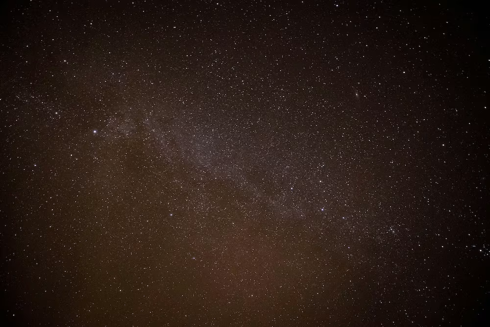
Imagery varied in resolution, angle, lighting, and signal quality. Annotators were tasked with identifying objects in all types of data—from clear night captures with star fields to noisy or low-resolution frames.
💡 Related reading: NASA’s Orbital Debris Program Office provides context on space debris tracking challenges.
Core Annotation Challenges in Orbit
Labeling objects in space isn’t like labeling vehicles on a road. Here are the challenges we faced:
Tiny Objects and Sparse Visibility
Many orbital objects appear as faint dots or streaks, often barely distinguishable from stars or sensor noise. Annotators needed extensive training and reference materials to differentiate targets from false positives.
Varying Velocities and Blur
Depending on relative motion, objects could appear as fast-moving streaks in a single frame or as stationary points across multiple frames. The annotation guidelines had to include:
- Motion patterns across sequences
- Frame-by-frame ID tracking
- Consistency checks over time
Class Ambiguity
Was that object a functioning satellite, a decommissioned fragment, or a solar panel? Without embedded metadata, annotators had to rely on context, visual cues, and simulation cross-validation.
To address this, a “hierarchical class structure” was adopted:
- Known active satellite
- Likely inactive satellite
- Fragment/debris
- Unknown (flagged for expert review)
This classification helped train models to treat uncertainty intelligently rather than discard ambiguous data.
Environmental Noise
Solar flares, cosmic rays, and camera artifacts introduced unpredictable patterns. Annotators had to distinguish:
- True objects
- Reflections
- Optical distortions
- Compression noise (in compressed videos)
A filtering step using AI-assisted pre-labeling helped eliminate false positives before human review.
Building the Annotation Workflow: Accuracy at Scale
To handle this complex task, a multi-layered annotation workflow was adopted:
Data Ingestion and Preprocessing
Raw images were first passed through:
- Noise reduction filters
- Contrast normalization
- Optical flow estimation to highlight motion in videos
Pre-labeled bounding boxes were generated using simple models and clustering heuristics for initial tagging.
Expert-Guided Annotator Training
Annotators received:
- Domain-specific SOPs with real examples of streaks, debris, and false positives.
- Access to a feedback loop with orbital experts and astrophysicists.
- Gamified accuracy scores to boost engagement and reduce fatigue over long sessions.
Annotation was done in batches, and each batch underwent a peer-review QA process with periodic blind audits.
Quality Control and Versioning
Labels were stored with:
- Metadata (source, resolution, timestamp, orbital parameters)
- Confidence scores
- Annotator ID and review status
This allowed rapid regression testing as models evolved and annotation standards shifted.
🛰️ See how FiftyOne helps version, audit, and visualize complex annotation datasets like this one.
Training AI Models for Orbital Object Detection
Once the annotated imagery reached a critical mass, the next phase was to train high-performance models capable of detecting and classifying orbital objects in real-world conditions. Here’s how the annotation pipeline was translated into actionable machine learning insights.
Model Architecture and Strategy
Several AI architectures were evaluated and tested. The most successful ones were:
- YOLOv8 (You Only Look Once v8): Fine-tuned for small object detection using satellite-style preprocessing.
- Vision Transformers (ViT): Particularly useful for long-range dependencies in space imagery, where object patterns are sparse and context-heavy.
- Spatiotemporal models: Used for video feeds to track the motion of objects across multiple frames.
Each model had to balance accuracy, latency, and computational footprint, especially if deployed in edge environments like onboard satellites or ground stations with limited GPU power.
Dataset Augmentation for Space Conditions
Since capturing rare orbital events (like breakups or uncontrolled reentries) was difficult, data augmentation played a critical role. Techniques used included:
- Synthetic streak injection: Artificially adding object trails to empty images to teach models about motion blur.
- Brightness and contrast shifts: Mimicking atmospheric distortion or telescope calibration differences.
- Star field simulation: Adding varying densities of stars to prevent confusion with orbital debris.
These augmentations increased model robustness across diverse sensor feeds and optical settings.
Key Training Techniques
- Tile-Based Inference:
Large, high-resolution images were split into smaller tiles for training. This allowed the detection of micro-objects that would otherwise be missed in full-frame models. - Temporal Consistency Losses:
Especially in video, the model was encouraged to make consistent predictions across frames. This smoothed predictions and reduced false negatives from missed detections during quick object movements. - Class Imbalance Handling:
Some classes (like known active satellites) were overrepresented compared to rarer ones (like fragments or unknown objects). Techniques like focal loss and class-weighting helped balance training and improved minority class performance. - Ensemble Learning:
A voting system between multiple trained models increased reliability in high-risk scenarios—particularly for alerting potential collisions. - Uncertainty Estimation:
The system didn’t just predict what it saw—it also estimated how confident it was. This was crucial for operators making critical decisions based on AI output.
Model Deployment & Evaluation
The trained models were integrated into a real-time monitoring pipeline, which processed live feeds and triggered alerts. Evaluation metrics included:
- Mean Average Precision (mAP) across object classes
- False Positive Rate, especially important to avoid unnecessary maneuvers
- Time-to-detection latency under operational workloads
The project achieved:
- 89% mAP in test conditions with real and synthetic mixed datasets
- Sub-300ms inference time per frame on NVIDIA Jetson modules
- Near-zero false positives in operational conditions after QA-tuned model iterations
This proved that annotated data was not just helpful—it was decisive.
Lessons Learned from the Field 🚀
The annotation and model training journey revealed profound lessons that go far beyond the technical:
Annotation Isn’t Just a Preprocessing Step—It’s Strategy
Many projects treat annotation as a box-checking exercise. But in orbital monitoring, every label carries operational consequences. A misclassified piece of debris might mean a missed warning. A false positive might mean an expensive and unnecessary satellite maneuver. In this case study, annotation became a strategic investment, not just a technical one.
Key takeaway: Your AI is only as smart as your data is thoughtful.
Human-AI Synergy Drives the Best Results
The project benefited significantly from pre-labeling using weak models, which allowed human annotators to focus their attention where it mattered most. But full automation wasn’t feasible.
Annotators flagged rare patterns, debated ambiguous objects, and introduced domain insight no model could replicate. Conversely, AI helped reduce fatigue and highlight missed cases.
This symbiotic feedback loop ensured high recall and precision without overwhelming human resources.
Aerospace Context Demands Domain Experts
Off-the-shelf annotators familiar with general computer vision concepts struggled when first presented with orbital data. Confusion between stars and debris, poor streak estimation, and misjudged motion were common.
Once aerospace-savvy annotators were brought in—and trained with domain-specific SOPs—the quality jumped exponentially.
Lesson: Train your annotators like you’d train your pilots. Precision matters, and context is everything.
Evolving Guidelines Are a Sign of Maturity, Not Failure
Initially, the project launched with a rigid set of annotation rules. But real-world scenarios don’t conform to neat taxonomies. As new edge cases emerged—like debris clusters or deformed satellites—guidelines were revised, sometimes weekly.
Instead of causing chaos, these iterations improved clarity, gave annotators confidence, and adapted the AI system to new realities.
Best practice: Build your annotation playbook as a living document.
Feedback Loops Accelerate Everything
This project thrived on rapid iteration:
- Annotators flagged unknown objects → reviewed by orbital experts → added to training set.
- Model failed to detect a streak → analyzed → new augmentations designed.
- Operators questioned predictions → explained by model uncertainty → refinements made.
This created a continuous loop of learning, labeling, and model improvement—a virtuous cycle that pushed the system toward operational-grade quality.
Broader Impact: Supporting Space Situational Awareness (SSA)
With the rise of megaconstellations like Starlink, Kuiper, and OneWeb, maintaining orbital safety is now a global priority. High-quality annotated datasets are crucial for:
- Collision risk assessments by space agencies and commercial operators.
- Cataloging new objects not yet registered by international bodies.
- Geopolitical monitoring to identify and attribute new spacecraft.
Projects like EU SST and USSPACECOM rely on annotated data pipelines to build SSA dashboards and share alerts in real time.
Annotated imagery isn’t just a training tool—it’s a source of truth that informs public safety, commercial continuity, and global diplomacy in space.
Curious What’s Next? Let’s Talk Orbit Data 🌌
If you're building or training AI models that interact with space imagery, don’t settle for generic datasets. Whether you’re enhancing situational awareness, detecting debris, or managing a satellite fleet, the quality of your annotations will define your edge.
🚀 Ready to accelerate your orbital AI project with precision annotation?
Let’s collaborate and take your mission to the next altitude. Reach out to DataVLab to explore tailored annotation services for your space-based use cases.